
Search
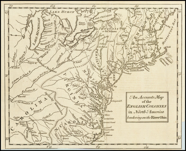
Place/Date:
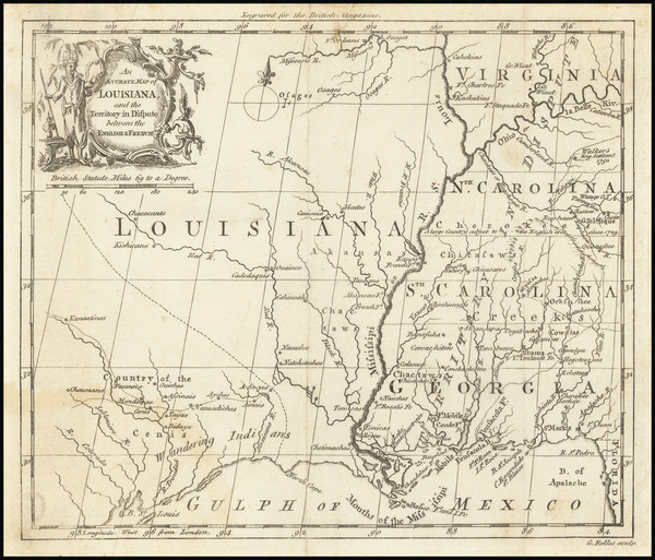
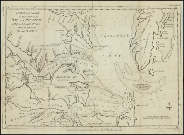
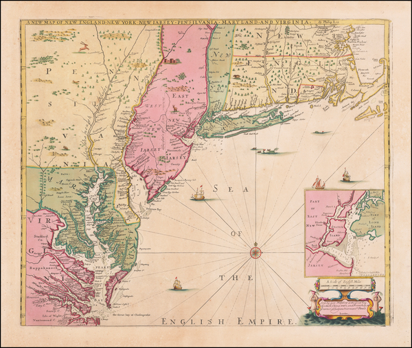
London / 1760
Size:
8.5 x 7.5 inches
Condition:
VG
Stock#:
68964
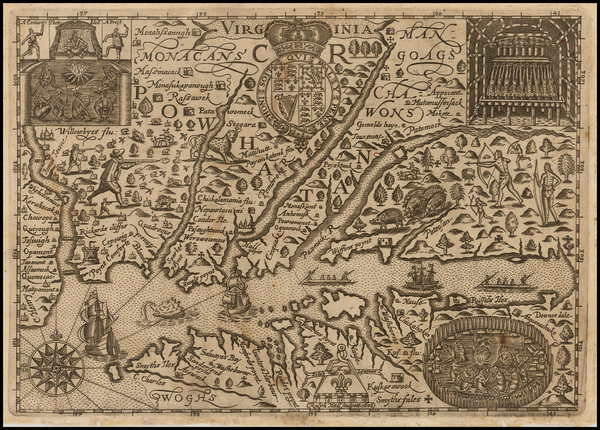
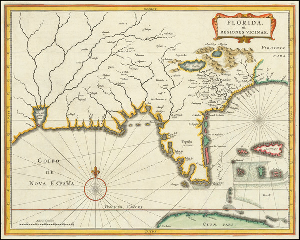
Place/Date:
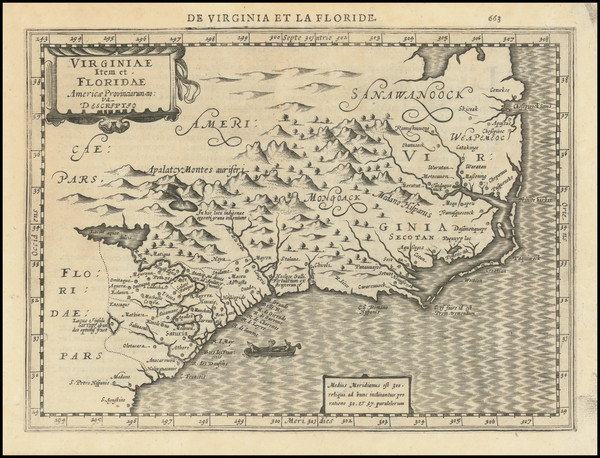
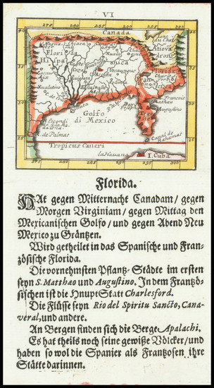
Amsterdam / 1630
Size:
10 x 7.5 inches
Condition:
VG+
Stock#:
95300
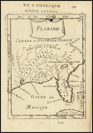
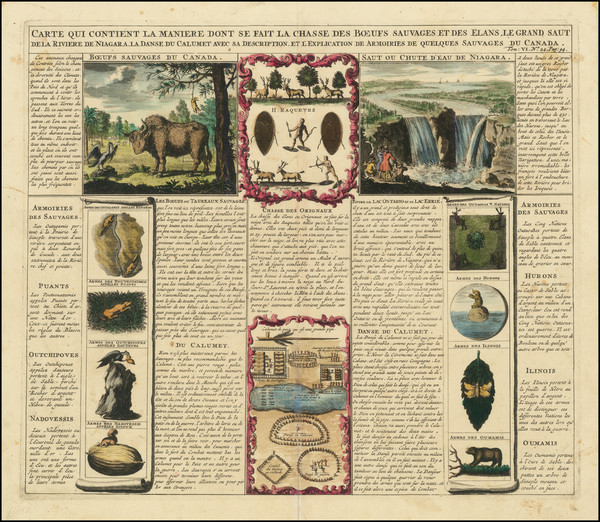
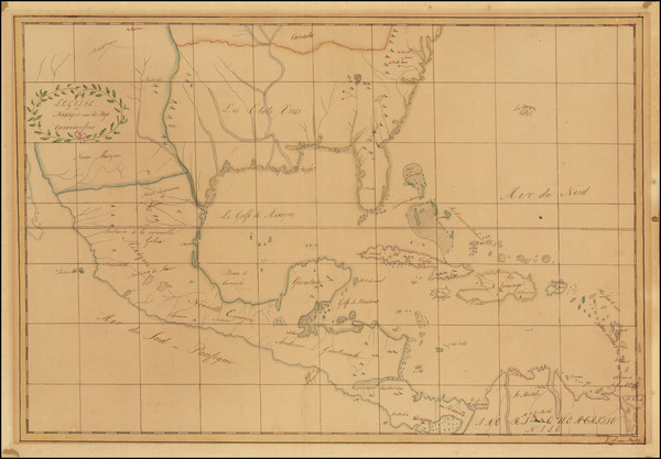
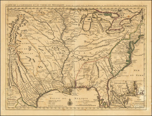
Place/Date:
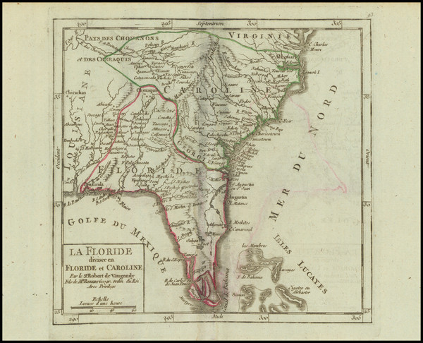
Paris / 1749
Size:
7 x 6.5 inches
Condition:
VG
Stock#:
97356
Place/Date:
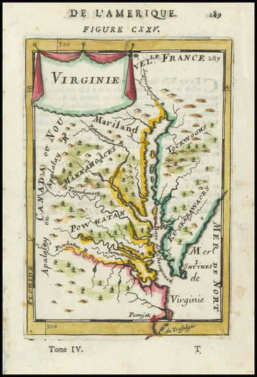
Paris / 1683
Size:
4.5 x 6 inches
Condition:
VG+
Stock#:
91775
Place/Date:
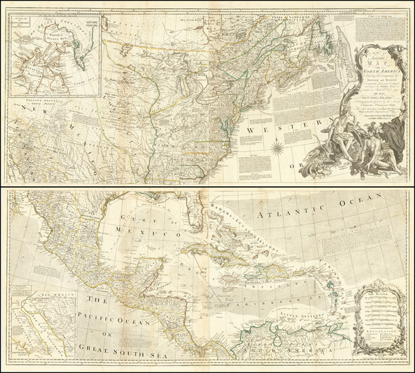
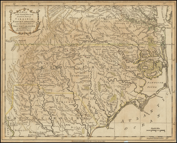
London / 1781
Size:
14.5 x 10 inches
Condition:
VG
Stock#:
96537
Place/Date:
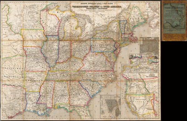
Bamberg / 1852
Size:
21.5 x 29 inches
Condition:
VG
Stock#:
48081
Antique map showing the Southeast by Buchnerschen Buchhandlung, 1852.
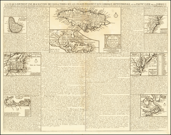
Place/Date:
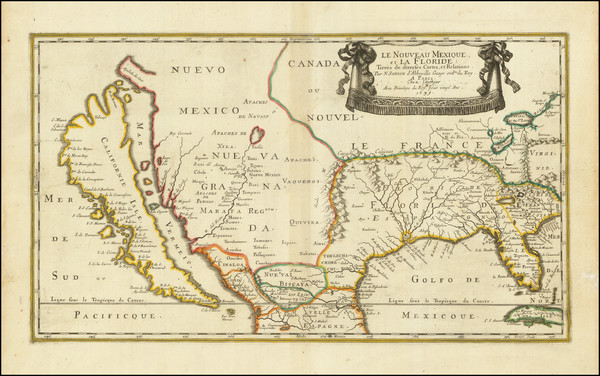
Paris / 1656
Size:
21.5 x 12.5 inches
Condition:
VG
Stock#:
95763
Original map showing the Southeast by Sanson made in 1656.
Place/Date:
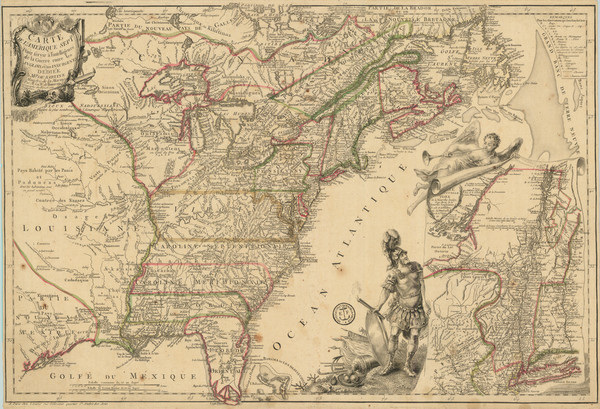
Paris / 1777
Size:
24.5 x 17 inches
Condition:
VG
Stock#:
95721
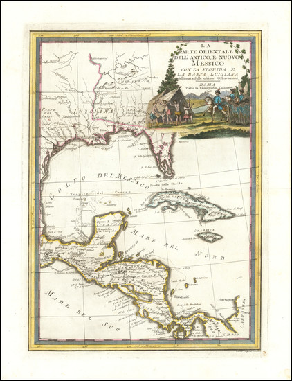
Place/Date:
Rome / 1798
Size:
14 x 19 inches
Condition:
VG+
Stock#:
95815
Place/Date:
Paris / 1683
Size:
4.5 x 7 inches
Condition:
VG
Stock#:
96421
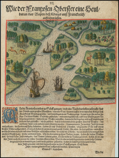
Place/Date:
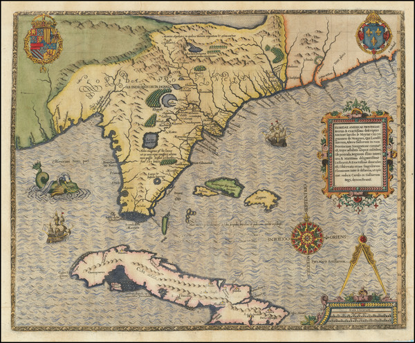
Frankfurt / 1591
Size:
8.5 x 11 inches
Condition:
VG
Stock#:
95828
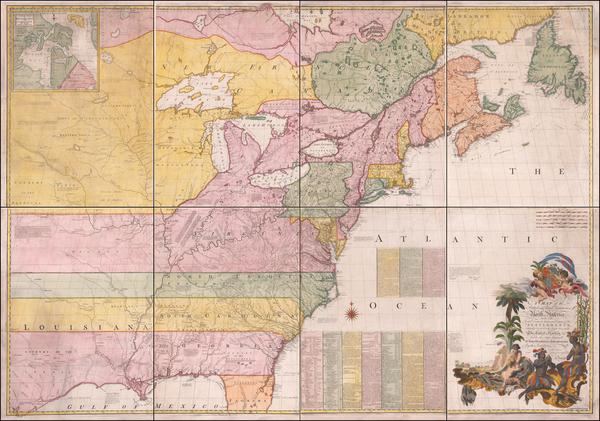
Place/Date:
London / 1755 - 1757
Size:
76 x 53 inches If Joined
Condition:
Good
Stock#:
60574dg
Mitchell's 1755 antique map showing the Southeast.
Place/Date:
London / 1685 (1715 ca)
Size:
21.5 x 18 inches
Condition:
VG+
Stock#:
60306op
Original map showing the Southeast by Morden / Lea / Willdey / Thornton made in 1685.
Place/Date:
London / 1775
Size:
45.5 x 40.5 inches (if joined)
Condition:
VG
Stock#:
94848
Place/Date:
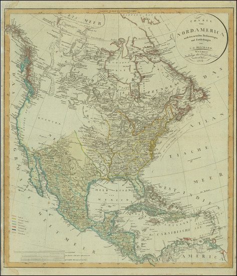
Wiemar / 1802
Size:
20.5 x 23.5 inches
Condition:
VG
Stock#:
80449
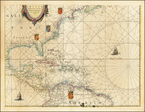
Place/Date:
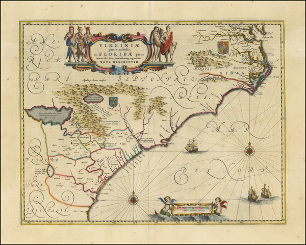
Amsterdam / 1640
Size:
20 x 15 inches
Condition:
VG+
Stock#:
94131
Place/Date:
London / 1676
Size:
19.5 x 15 inches
Condition:
VG
Stock#:
93641
Place/Date:
Nuremberg / 1745
Size:
22 x 19 inches
Condition:
VG+
Stock#:
60331
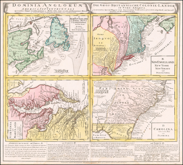
Homann Heirs's 1745 original map showing the Southeast.
Place/Date:
Frankfurt / 1591
Size:
18 x 14.5 inches
Condition:
VG
Stock#:
80172
Place/Date:
Amsterdam / 1720
Size:
22 x 19 inches
Condition:
VG+
Stock#:
92480
Place/Date:
Frankfurt / 1692
Size:
3 x 2.5 inches
Condition:
VG
Stock#:
78112
Place/Date:
London / 1781
Size:
13.5 x 11 inches
Condition:
Good
Stock#:
77438
Place/Date:
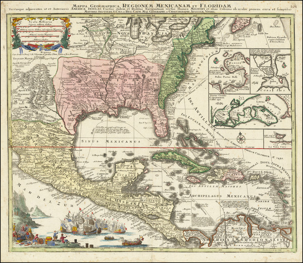
Augsburg / 1740
Size:
22.5 x 19.5 inches
Condition:
Good
Stock#:
71713
Seutter's 1740 antique map showing the Southeast.
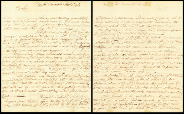
Place/Date:
Pensacola, Florida; Mobile; Philadelphia / 1797
Size:
9.5 x 15 inches
Condition:
VG+
Stock#:
90005
Place/Date:
Amsterdam / 1719
Size:
17 x 14.5 inches
Condition:
VG+
Stock#:
93146
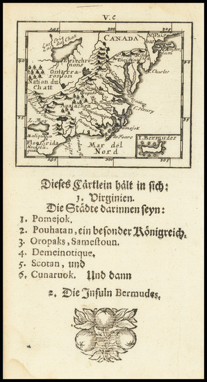
Place/Date:
Frankfurt / 1692
Size:
3 x 2.5 inches
Condition:
VG
Stock#:
71479
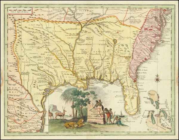
Place/Date:
Venice / 1740
Size:
17 x 13 inches
Condition:
VG+
Stock#:
84142

Place/Date:
Madrid / 1826
Size:
36.5 x 24.5 inches
Condition:
VG
Stock#:
48746
Direccion Hidrografica de Madrid's 1826 rare map showing the Southeast.
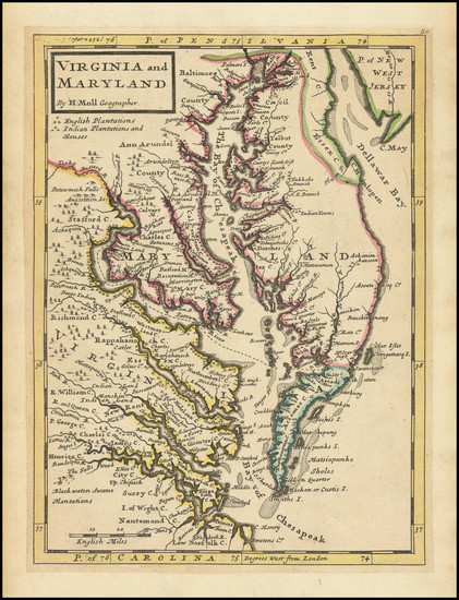
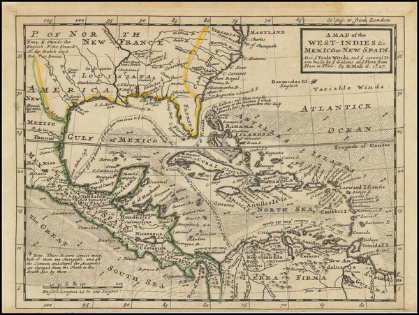
Place/Date:
London / 1729
Size:
8 x 11 inches
Condition:
VG
Stock#:
93311
1729 antique Moll map showing the Southeast.
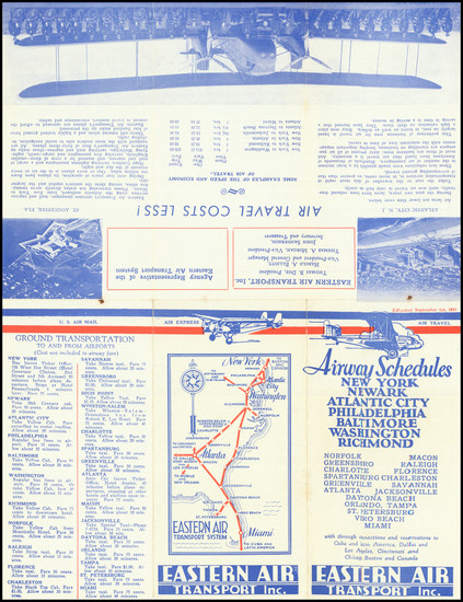
Place/Date:
n.p. / 1932
Size:
9.4 x 12.4 inches
Condition:
VG
Stock#:
75843
Place/Date:
London / 1745 circa
Size:
22.5 x 18 inches
Condition:
Good
Stock#:
92742
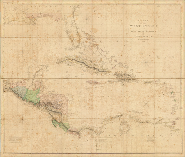
Place/Date:
London / 1810
Size:
49 x 37.5 inches
Condition:
Good
Stock#:
68459
Place/Date:
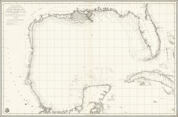
Madrid / 1799
Size:
37 x 24 inches
Condition:
VG
Stock#:
41973
Original map showing the Southeast by Direccion Hidrografica de Madrid, 1799.
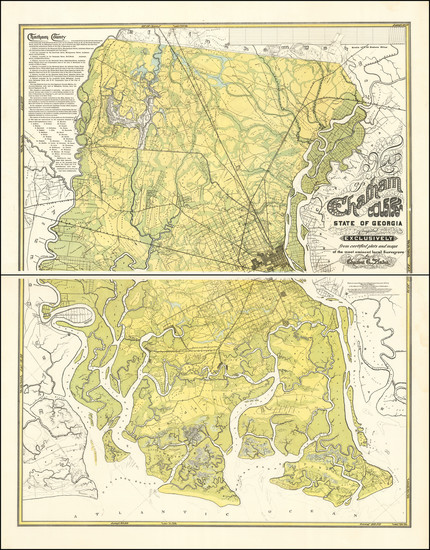
Place/Date:
Savannah / 1875
Size:
40 x 52 inches
Condition:
VG+
Stock#:
92011
Place/Date:
Amsterdam / 1719
Size:
22 x 18 inches
Condition:
VG
Stock#:
61480
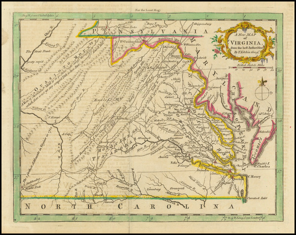
Place/Date:
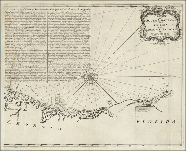
London / 1761
Size:
9 x 7 inches
Condition:
VG
Stock#:
91778
Place/Date:
London / 1729
Size:
10.5 x 8 inches
Condition:
VG
Stock#:
91687
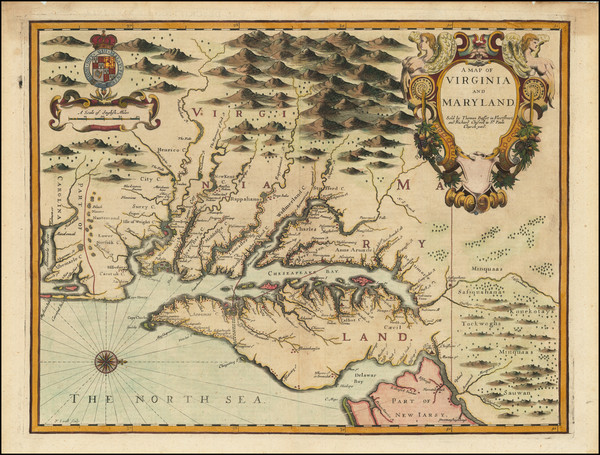
Hall's 1636 antique map showing the Southeast.
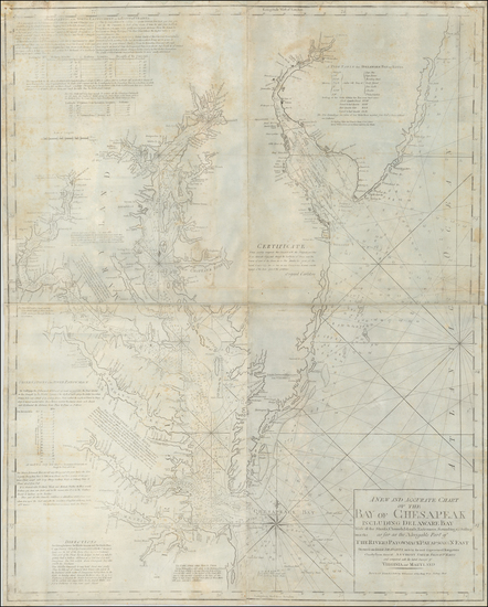
Place/Date:
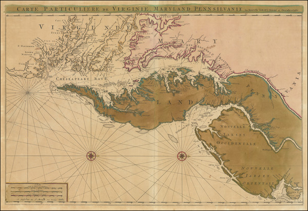
Amsterdam / 1692
Size:
31.5 x 21.5 inches
Condition:
VG
Stock#:
61392mp2
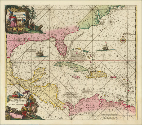
17th Century Sea Chart of The Chesapeake and Delaware Bay -- Virginia, Maryland, Delaware, New Jersey
Place/Date:
London / 1754
Size:
10 x 8 inches
Condition:
VG
Stock#:
90978
Place/Date:
n.p. / 1817
Size:
23.5 x 16 inches
Condition:
VG
Stock#:
91580
Place/Date:
Leiden / 1633 circa
Size:
14 x 11 inches
Condition:
VG+
Stock#:
91178

Place/Date:
Paris / 1665
Size:
9 x 6.5 inches
Condition:
VG+
Stock#:
91072
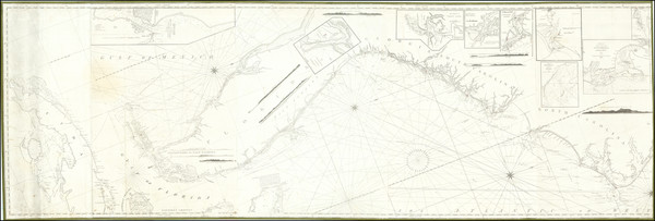
Place/Date:
New York / 1825 circa
Size:
86 x 29 inches
Condition:
VG
Stock#:
77294
Place/Date:
Pensacola, Florida / 1763
Size:
9.25 x 15 inches
Condition:
VG
Stock#:
86620
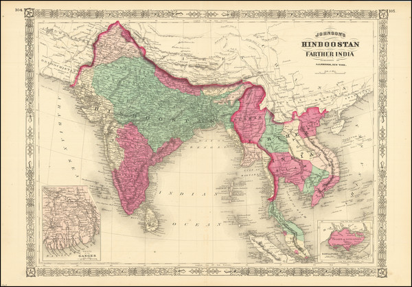
Place/Date:
New York / 1867
Size:
22.5 x 17 inches
Condition:
VG+
Stock#:
89069
Place/Date:
Amsterdam / 1730
Size:
23.5 x 17.5 inches
Condition:
VG
Stock#:
75931
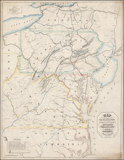
Place/Date:
Baltimore / 1838 circa
Size:
20.5 x 27 inches
Condition:
VG
Stock#:
45033
Soiecki's 1838 antique map showing the Southeast.
Place/Date:
Amsterdam / 1634
Size:
22 x 16.5 inches
Condition:
VG
Stock#:
75672
Place/Date:
Boston / 1794 (1803)
Size:
41 x 33 inches
Condition:
VG
Stock#:
55919ops
Antique map showing the Southeast by Norman, 1794.