
Search

Place/Date:
Strasbourg / 1520
Size:
23 x 16 inches
Condition:
VG
Stock#:
78537
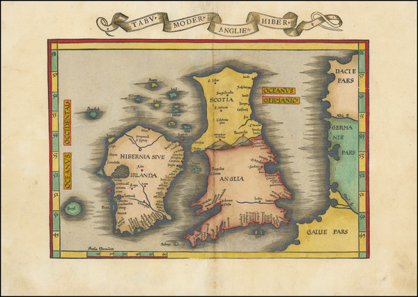
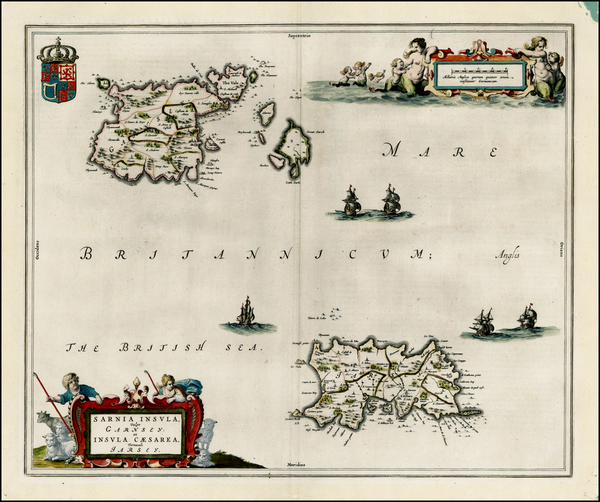
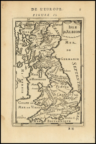
Place/Date:
Vienne, Dauphiné / 1535
Size:
16.5 x 11.5 inches
Condition:
VG
Stock#:
103164
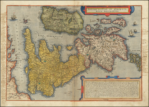
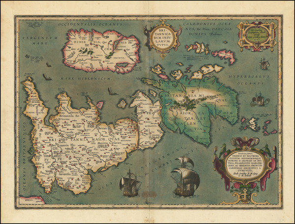
1535 rare Fries map showing the British Isles.
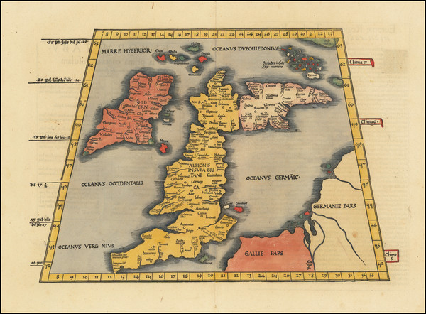
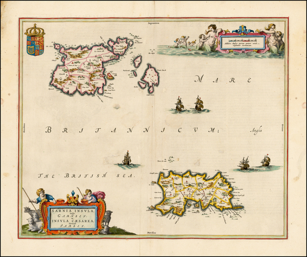
Place/Date:
Strasbourg / 1541
Size:
17 x 11.5 inches
Condition:
VG
Stock#:
72090
Rare map showing the British Isles by Fries, 1541.
Place/Date:
Cologne / 1572
Size:
19 x 13 inches
Condition:
VG
Stock#:
57410
Braun & Hogenberg's 1572 rare map showing the British Isles.
Place/Date:
Basle / 1588
Size:
14 x 12.5 inches
Condition:
VG
Stock#:
91286
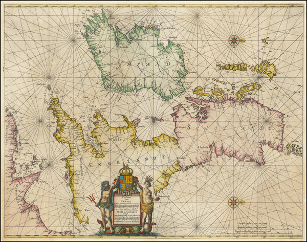
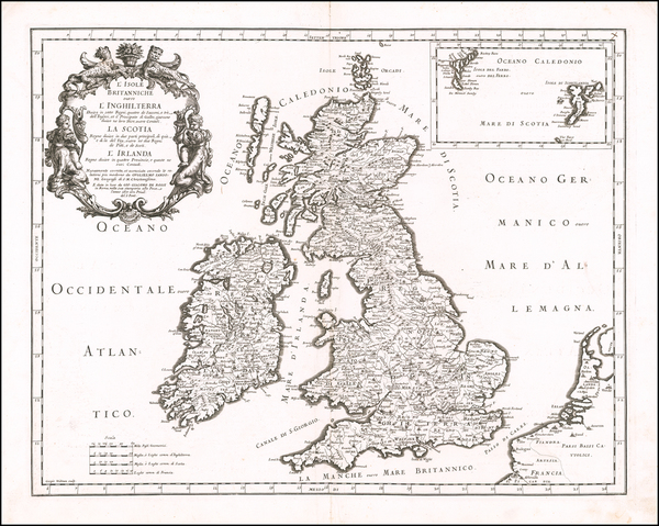
Place/Date:
n.p. / 1590 circa
Size:
27.5 x 28.5 inches
Condition:
VG
Stock#:
78621
Place/Date:
Frankfurt / 1591
Size:
6.5 x 9 inches Image Only
Condition:
VG
Stock#:
99837
Place/Date:
Antwerp / 1593
Size:
21 x 14 inches
Condition:
VG+
Stock#:
82238
Place/Date:
Rome / 1596 circa
Size:
8.75 x 6.5 inches
Condition:
VG+
Stock#:
75074
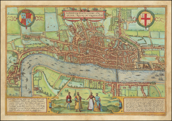
Place/Date:
London / 1598
Size:
13.5 x 10.5 inches
Condition:
VG+
Stock#:
78964
Place/Date:
London / 1598 circa
Size:
15 x 12.5 inches
Condition:
VG+
Stock#:
74642
1598 antique Munster map showing the British Isles.
Place/Date:
Cologne / 1599
Size:
17 x 13 inches
Condition:
VG+
Stock#:
96876

Place/Date:
Antwerp / 1603
Size:
19.5 x 13.5 inches
Condition:
VG
Stock#:
95838
Place/Date:
Antwerp / 1606
Size:
20 x 14.5 inches
Condition:
VG
Stock#:
101659
Place/Date:
Antwerp / 1609
Size:
22.5 x 17 inches
Condition:
VG
Stock#:
100532
Place/Date:
London / 1610 circa
Size:
20.25 x 15 inches
Condition:
VG
Stock#:
94248
Place/Date:
London / 1610 (1623)
Size:
20 x 15 inches
Condition:
VG
Stock#:
102121
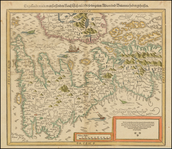
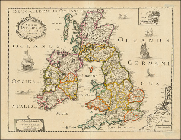
Place/Date:
Augsburg / 1612 circa
Size:
15 x 21.5 inches
Condition:
VG+
Stock#:
99752
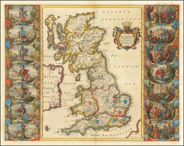
Place/Date:
London / 1613 and 1622
Size:
7.5 x 11 inches
Condition:
VG+
Stock#:
92111

Place/Date:
Amsterdam / 1619
Size:
16.5 x 14 inches
Condition:
VG
Stock#:
51580
Rare map showing the British Isles by Mercator made in 1619.
Place/Date:
Amsterdam / 1623
Size:
14 x 10.25 inches
Condition:
Stock#:
75243
Place/Date:
Amsterdam / 1623
Size:
14 x 10.25 inches
Condition:
VG+
Stock#:
96664
Place/Date:
Amsterdam / 1630
Size:
22 x 18 inches
Condition:
VG
Stock#:
100400
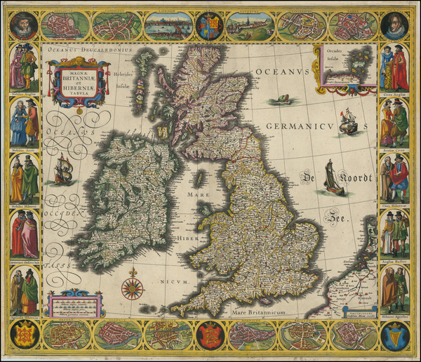
Place/Date:
Amsterdam / 1631
Size:
20 x 15 inches
Condition:
VG
Stock#:
84962

Place/Date:
Amsterdam / 1636 circa
Size:
20 x 15.5 inches
Condition:
VG
Stock#:
40067
Original map showing the British Isles by Jansson, 1636.
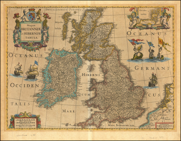
Place/Date:
Amsterdam / 1640 circa
Size:
21.5 x 16.5 inches
Condition:
VG
Stock#:
64024
1640 original Blaeu map showing the British Isles.
Place/Date:
Amsterdam / 1640 circa
Size:
19 x 15 inches
Condition:
VG
Stock#:
72562

Place/Date:
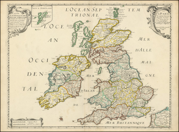
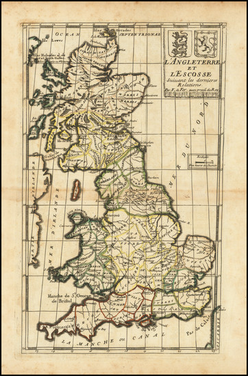
Paris / 1640
Size:
20.25 x 14.5 inches
Condition:
VG+
Stock#:
82032

Place/Date:
Paris / 1641
Size:
20 x 15.5 inches
Condition:
VG
Stock#:
62165
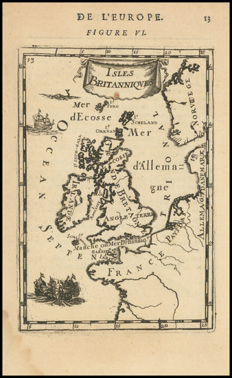
Antique Map of the Romano-British period in the United Kingdon / England / Scotland / Ireland /Wales
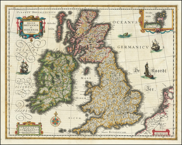
Place/Date:
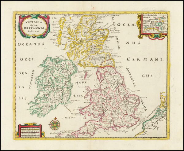
Amsterdam / 1648 circa
Size:
19 x 15.5 inches
Condition:
Stock#:
26195
1648 original Blaeu map showing the British Isles.
Place/Date:
Amsterdam / 1648 circa
Size:
19 x 15.5 inches
Condition:
VG+
Stock#:
34548
Blaeu's 1648 antique map showing the British Isles.
Place/Date:
Amsterdam / 1650
Size:
21.5 x 17 inches
Condition:
VG
Stock#:
73571
1650 antique Jansson map showing the British Isles.
Place/Date:
Paris / 1650 circa
Size:
19 x 14.25 inches
Condition:
VG
Stock#:
86100

Place/Date:
Paris / 1654
Size:
21 x 14.5 inches
Condition:
VG+
Stock#:
88556

Place/Date:
Paris / 1657 (1683)
Size:
7.5 x 9.5 inches
Condition:
VG+
Stock#:
83662
Sanson's 1657 antique map showing the British Isles.
Place/Date:
Paris / 1658
Size:
15.5 x 21 inches
Condition:
VG+
Stock#:
102580
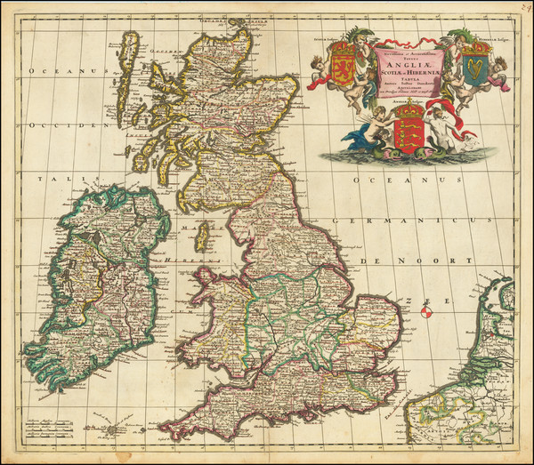
Place/Date:
Amsterdam / 1661
Size:
10.5 x 8.5 inches
Condition:
VG+
Stock#:
91779
Place/Date:
Amsterdam / 1662
Size:
15 x 23 inches (binding size)
Condition:
VG+
Stock#:
99196
Place/Date:
London / 1675
Size:
11 x 13 inches
Condition:
VG
Stock#:
53318
Original map showing the British Isles by Anonymous, 1675.
Place/Date:
London / 1675
Size:
17.5 x 13 inches
Condition:
VG
Stock#:
100748
Place/Date:
Rome / 1677
Size:
21.5 x 16.5 inches
Condition:
VG
Stock#:
60052
Rossi - Cantelli da Vignola's 1677 antique map showing the British Isles.
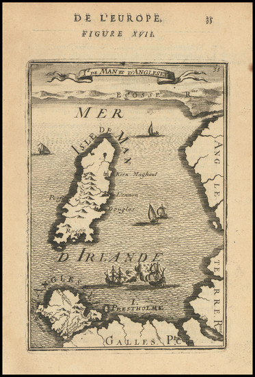
Place/Date:
Paris / 1683
Size:
4 x 6 inches
Condition:
VG
Stock#:
98148
Place/Date:
Paris / 1683
Size:
4 x 6 inches
Condition:
VG
Stock#:
101246
Antique map showing the British Isles by Mallet, 1683.
Place/Date:
Paris / 1683
Size:
7 x 12 inches
Condition:
VG
Stock#:
101316
Place/Date:
Paris / 1683
Size:
5.75 x 4 inches
Condition:
VG+
Stock#:
101482
Place/Date:
Paris / 1683
Size:
4.5 x 6 inches
Condition:
VG
Stock#:
103167
Original map showing the British Isles by Mallet, 1683.

Place/Date:
Paris / 1685
Size:
19 x 18 inches
Condition:
VG+
Stock#:
50234
1685 antique Besson / Du Val map showing the British Isles.
Place/Date:
Amsterdam / 1685
Size:
22.5 x 19.5 inches
Condition:
VG
Stock#:
72120
1685 rare Danckerts map showing the British Isles.

Place/Date:
Amsterdam / 1688
Size:
19.25 x 23 inches
Condition:
VG
Stock#:
83669