
Search
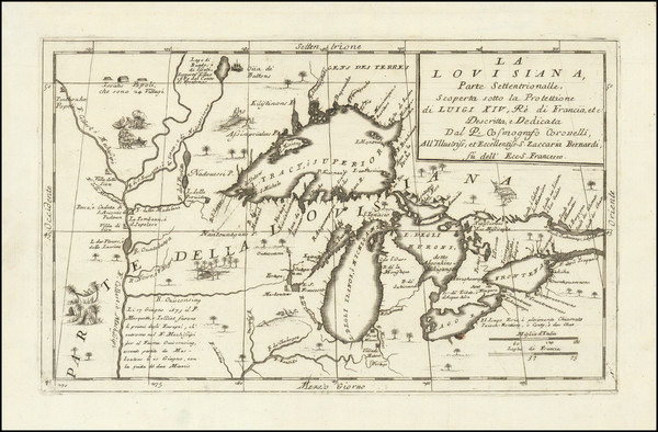
Place/Date:
Venice / 1691
Size:
17 x 10 inches
Condition:
VG+
Stock#:
98656
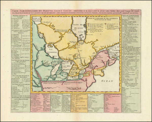
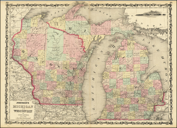
Place/Date:
Amsterdam / 1719
Size:
18 x 14 inches
Condition:
VG
Stock#:
100582
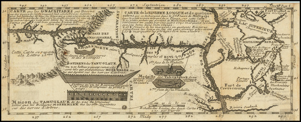
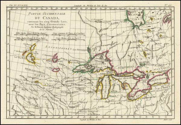
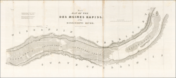
Place/Date:
Paris / 1741
Size:
11.5 x 4.5 inches
Condition:
VG
Stock#:
84108
Lahontan's 1741 antique map showing Wisconsin.
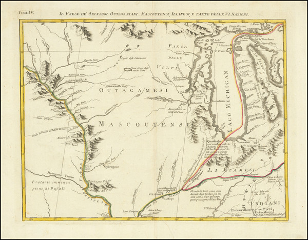
Place/Date:
Venice / 1778
Size:
16.5 x 13 inches
Condition:
VG
Stock#:
75927
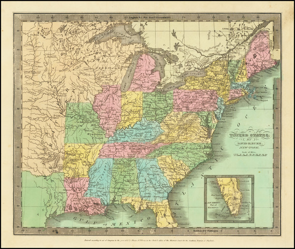
Place/Date:
Paris / 1787
Size:
12.5 x 8.5 inches
Condition:
VG
Stock#:
98377
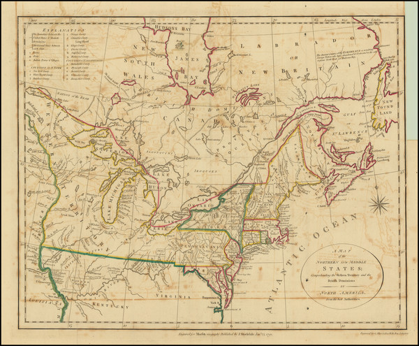
Place/Date:
London / 1792
Size:
15.5 x 12.5 inches
Condition:
VG
Stock#:
99856
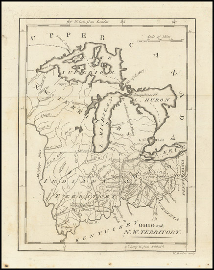
Place/Date:
Philadelphia / 1805
Size:
6 x 8 inches
Condition:
VG+
Stock#:
100506
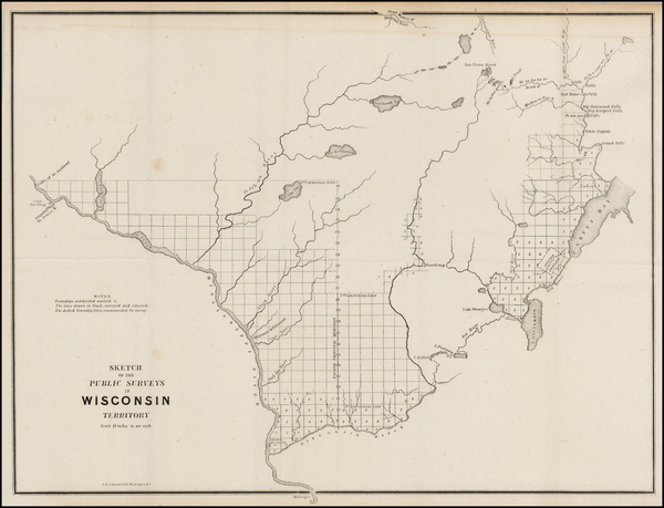
Place/Date:
London / 1827
Size:
8.5 x 24.5 inches
Condition:
VG+
Stock#:
99811
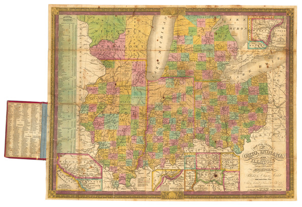
Place/Date:
Philadelphia / 1834
Size:
21.8 x 17.5 inches
Condition:
VG
Stock#:
89955
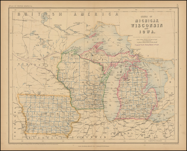
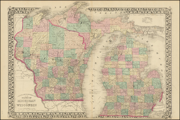
Place/Date:
New York / 1835
Size:
12.5 x 11 inches
Condition:
VG+
Stock#:
71862
Burr's 1835 original map showing Wisconsin.
Place/Date:
Cincinnati / 1836
Size:
21 x 20.5 inches
Condition:
VG
Stock#:
71024
Place/Date:
Washington / 1836
Size:
13 x 18 inches
Condition:
VG
Stock#:
93321
Place/Date:
Washington, DC / 1837
Size:
21 x 50 inches
Condition:
VG+
Stock#:
53313
1837 rare Lee map showing Wisconsin.
Place/Date:
Washington, D.C. / 1842 circa
Size:
10.5 x 12.5 inches
Condition:
VG+
Stock#:
43144
General Land Office's 1842 original map showing Wisconsin.
Place/Date:
New York / 1844
Size:
15.5 x 12.5 inches
Condition:
VG
Stock#:
99294
Place/Date:
New York / 1845
Size:
20 x 24.5 inches
Condition:
VG
Stock#:
68734
Place/Date:
Boston / 1846
Size:
12.5 x 14 inches
Condition:
VG
Stock#:
81889
Place/Date:
Philadelphia / 1849
Size:
13.5 x 16 inches
Condition:
VG
Stock#:
94311
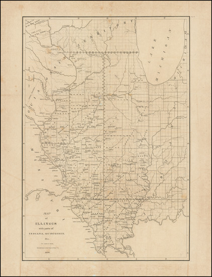
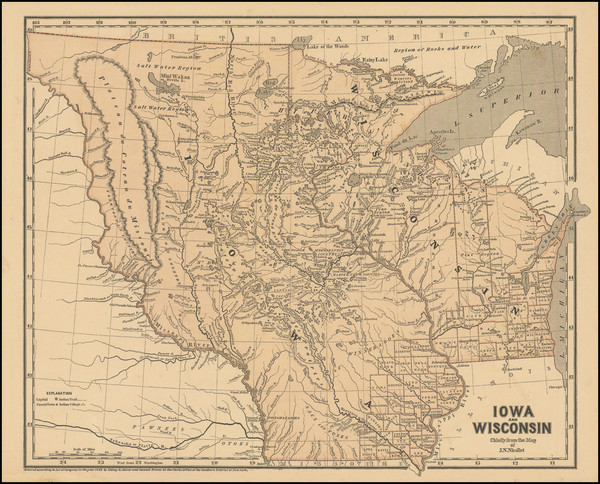
Place/Date:
n.p. / 1850 circa
Size:
9 x 12 inches
Condition:
VG
Stock#:
89215
Place/Date:
Gottingen / 1851
Size:
6 x 9 inches
Condition:
VG
Stock#:
82591
Place/Date:
Washington, D.C. / 1853
Size:
21 x 17.5 inches
Condition:
VG
Stock#:
91054
Place/Date:
Washington, D.C. / 1854
Size:
21 x 17.5 inches
Condition:
VG
Stock#:
66420
Place/Date:
n.p. / 1854
Size:
27.5 x 17 inches
Condition:
Good
Stock#:
90670
Place/Date:
Chicago / 1854
Size:
24 x 20 inches
Condition:
VG
Stock#:
91691
Place/Date:
Philadelphia / 1855
Size:
13.5 x 16 inches
Condition:
Good
Stock#:
78549
Place/Date:
St. Paul / 1855 circa
Size:
20 x 16.5 inches
Condition:
VG+
Stock#:
84868

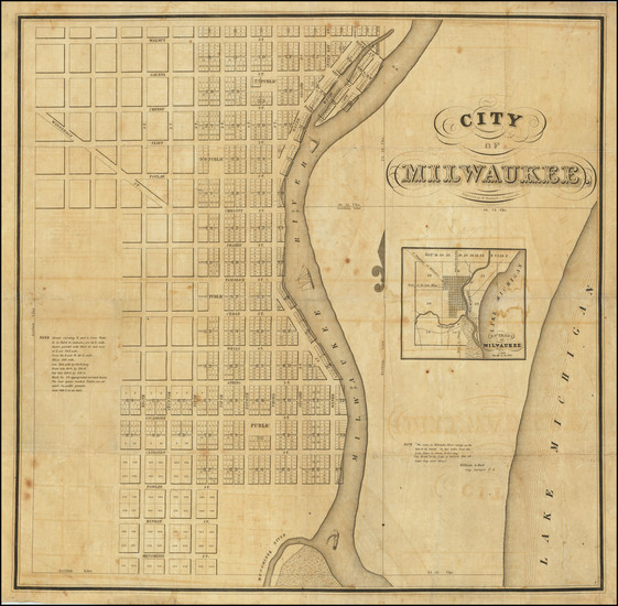
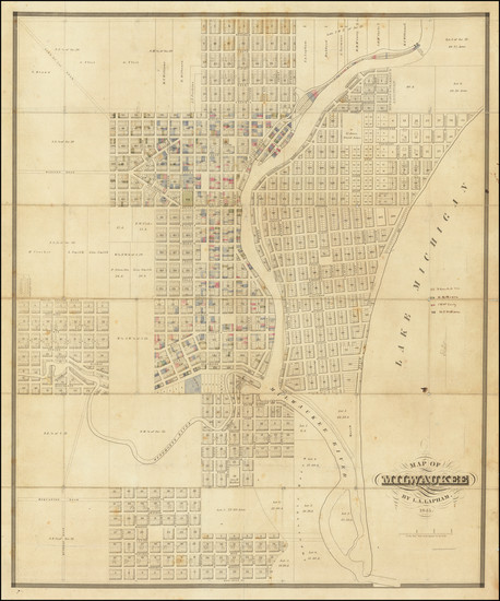
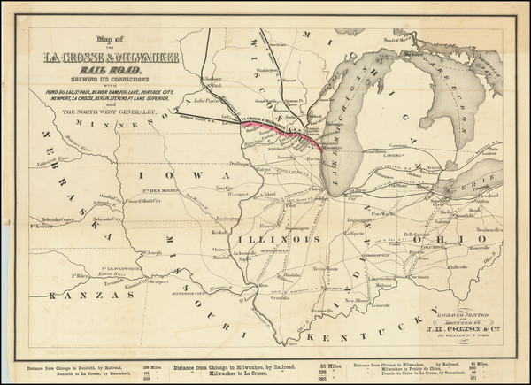
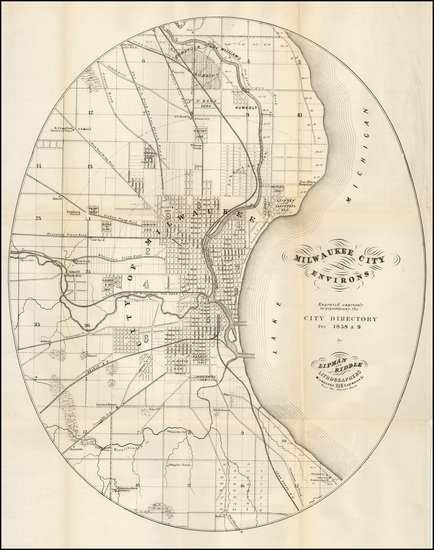
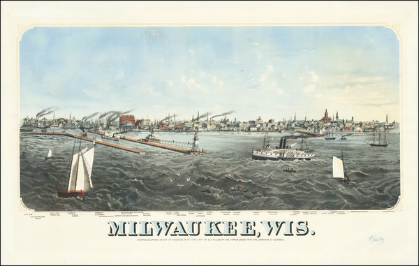
Place/Date:
Milwaukee / 1856
Size:
31.5 x 22.3 inches
Condition:
VG
Stock#:
68573
Place/Date:
New York / 1856
Size:
13 x 15 inches
Condition:
VG+
Stock#:
82736
Place/Date:
New York / 1856
Size:
28 x 19.5 inches
Condition:
VG+
Stock#:
84612
Place/Date:
St. Paul / 1856 circa
Size:
20.5 x 26 inches
Condition:
VG
Stock#:
84806
Place/Date:
New York / 1856
Size:
32.5 x 34.5 inches
Condition:
VG
Stock#:
91852
Place/Date:
New York / 1856
Size:
12 x 14 inches
Condition:
VG+
Stock#:
92102
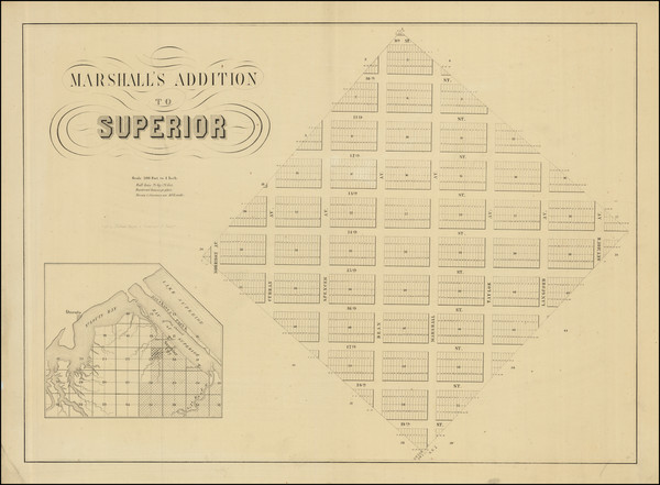
Place/Date:
Milwaukee / 1856
Size:
19.5 x 13.5 inches (map)
Condition:
VG
Stock#:
101516
Place/Date:
St. Paul / 1857 circa
Size:
26.5 x 19 inches
Condition:
VG+
Stock#:
85282
Place/Date:
Edinburgh / 1857
Size:
16 x 13 inches
Condition:
VG
Stock#:
102817
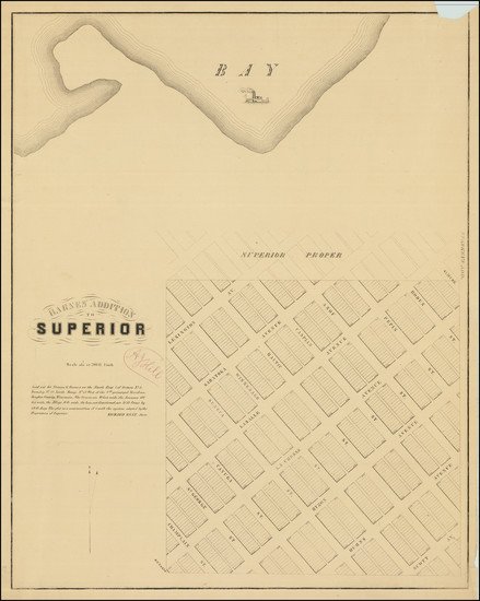
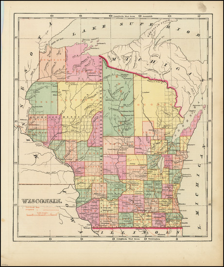
Place/Date:
Milwaukee, WI / 1858
Size:
15.5 x 19 inches
Condition:
VG
Stock#:
57977
Original map showing Wisconsin by Unknown made in 1858.
Place/Date:
New York / 1859
Size:
30 x 20.5 inches
Condition:
Good
Stock#:
85964
Place/Date:
Washington / 1860
Size:
9 x 6 inches
Condition:
VG
Stock#:
28598
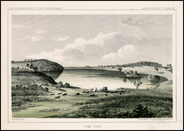
Original map showing Wisconsin by U.S. Pacific RR Surveys, 1860.
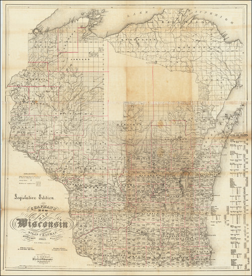
Place/Date:
Milwaukee / 1861
Size:
30.5 x 33 inches
Condition:
Good
Stock#:
69257
Place/Date:
New York City / 1861
Size:
24 x 17 inches
Condition:
VG
Stock#:
84322
Place/Date:
Oshkosh, Wisconsin / 1862
Size:
16 x 22.5 inches
Condition:
VG
Stock#:
93787
Place/Date:
Philadelphia / 1864
Size:
14 x 11.5 inches
Condition:
VG+
Stock#:
86528

Place/Date:
Philadelphia / 1867
Size:
14 x 11.5 inches
Condition:
VG+
Stock#:
84877
Place/Date:
New York / 1872
Size:
22 x 16 inches
Condition:
VG
Stock#:
90288
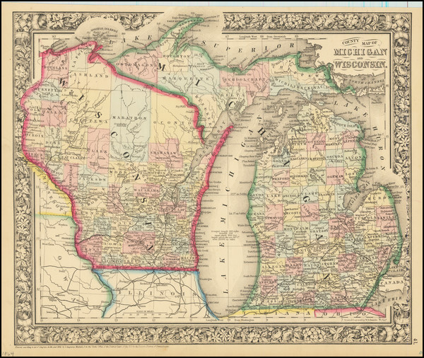
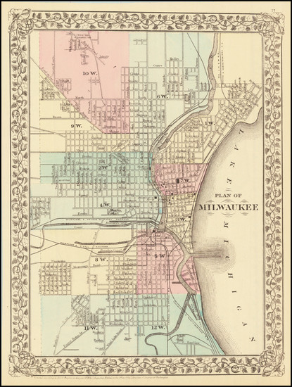
Place/Date:
Milwaukee, Wisconsin / 1874
Size:
29 x 16.5 inches
Condition:
VG
Stock#:
92267
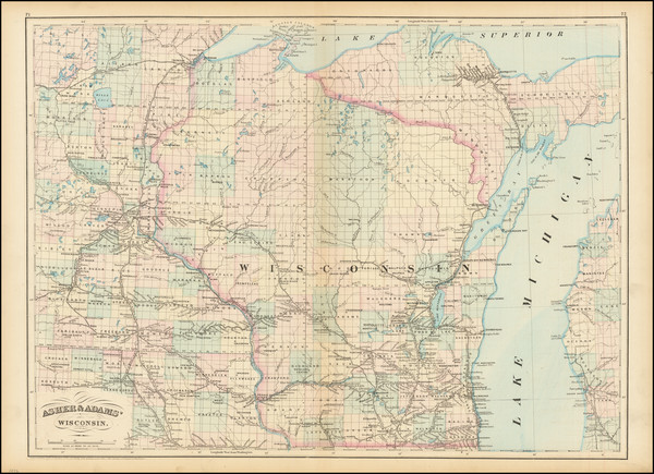
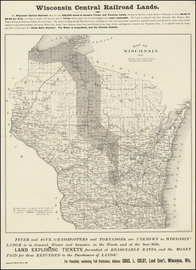
Place/Date:
Philadelphia / 1877
Size:
21 x 15 inches
Condition:
VG+
Stock#:
86712
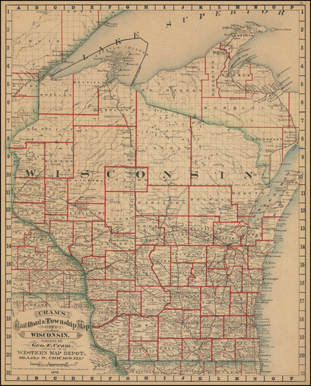
Place/Date:
Chicago / 1878
Size:
16 x 21 inches
Condition:
VG
Stock#:
101225
Place/Date:
Philadelphia / 1879
Size:
10.5 x 13 inches
Condition:
VG+
Stock#:
83346
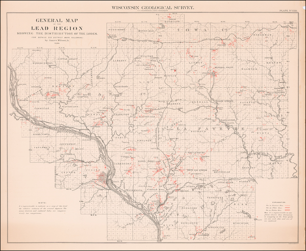
Place/Date:
n.p. / 1880
Size:
32.3 x 28.4 inches
Condition:
VG
Stock#:
59314
Antique map showing Wisconsin by Geological Survey of Wisconsin made in 1880.
Place/Date:
Milwaukee, Wisconsin / 1881
Size:
15 x 21 inches
Condition:
VG+
Stock#:
93315