
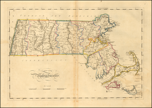
Search
Place/Date:
London / 1839
Size:
7 x 5 inches
Condition:
VG
Stock#:
23568
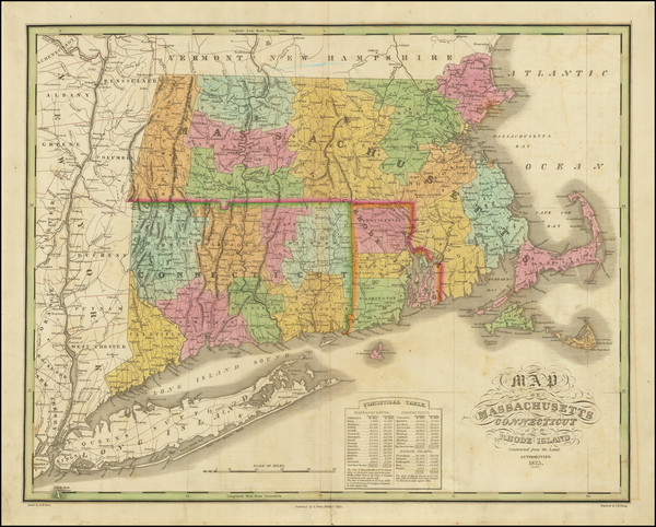
Antique map showing Massachusetts by Virtue, 1839.
Place/Date:
Worchester / 1839
Size:
7.5 x 4.5 inches
Condition:
VG
Stock#:
20714
Barber's 1839 antique map showing Massachusetts.
Place/Date:
Worchester / 1839
Size:
7.5 x 4.5 inches
Condition:
VG
Stock#:
20888
Antique map showing Massachusetts by Barber made in 1839.

Place/Date:
New York / 1837
Size:
44 x 40 inches
Condition:
VG
Stock#:
26159
1837 antique Wilkes / Stiles, Sherman & Smith map showing Massachusetts.
Place/Date:
New York / 1859
Size:
23 x 34 inches
Condition:
Fair
Stock#:
37137
Antique map showing Massachusetts by Bachelder, 1859.

Place/Date:
Worcester / 1839
Size:
12 x 7 inches
Condition:
VG+
Stock#:
51791
Rare map showing Massachusetts by Dorr, Howland & Company made in 1839.
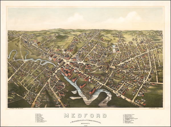
Place/Date:
Boston / 1880
Size:
25.5 x 19 inches
Condition:
VG+
Stock#:
51982
Bailey's 1880 rare map showing Massachusetts.
Place/Date:
Boston / 1915 circa
Size:
16 x 11 inches
Condition:
VG
Stock#:
52416
Crosby & Co.'s 1915 rare map showing Massachusetts.
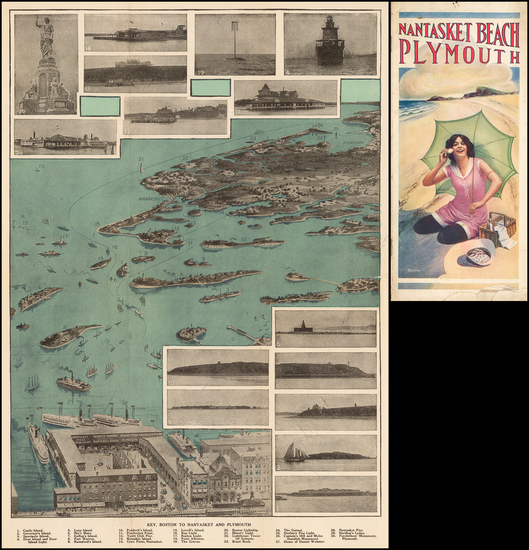
Place/Date:
Boston / 1910 circa
Size:
10.5 x 17 inches
Condition:
VG+
Stock#:
51723
Antique map showing Massachusetts by Walker & Co., 1910.

Place/Date:
New York / 1842
Size:
15 x 12.5 inches
Condition:
VG+
Stock#:
59737
Antique map showing Massachusetts by Morse & Breese, 1842.
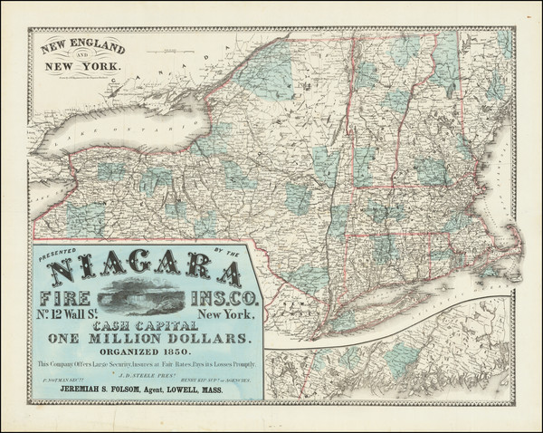
Place/Date:
Boston / 1866
Size:
39 x 29.5 inches
Condition:
VG
Stock#:
45819
Antique map showing Massachusetts by Meisel, 1866.
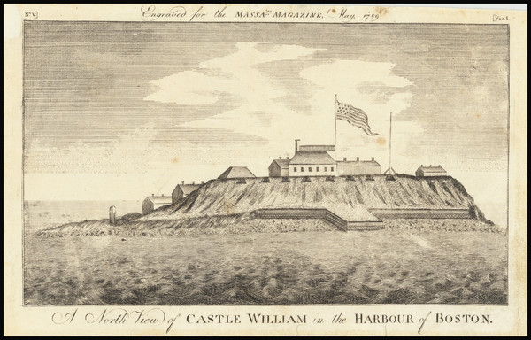
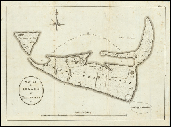
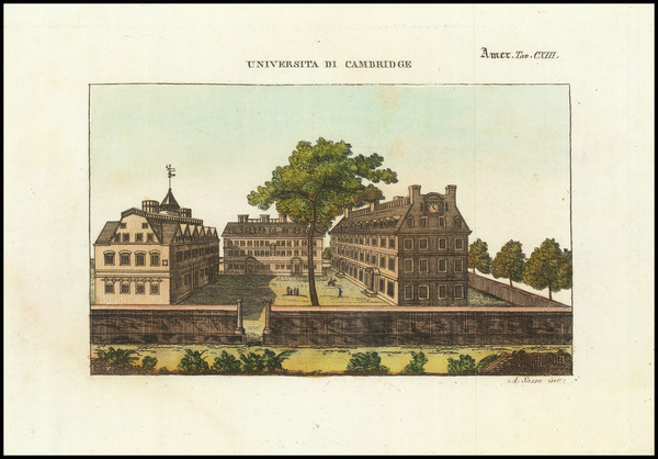
Place/Date:
Boston / 1789
Size:
7 x 4 inches
Condition:
VG
Stock#:
66468
Place/Date:
Philadelphia / 1847
Size:
15 x 11.5 inches
Condition:
VG
Stock#:
68321
Place/Date:
Boston / 1835
Size:
10 x 8 inches
Condition:
VG+
Stock#:
63036
Place/Date:
Boston / 1825
Size:
16.5 x 9.5 inches
Condition:
VG+
Stock#:
56978
Antique map showing Massachusetts by Fuller made in 1825.
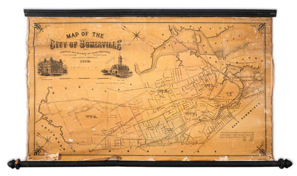
Place/Date:
Somerville, MA / 1872
Size:
29 x 17 inches
Condition:
Fair
Stock#:
58547
Antique map showing Massachusetts by Bufford's Lith. made in 1872.
Place/Date:
Philadelphia / 1814
Size:
18 x 12.5 inches
Condition:
VG
Stock#:
57687
Antique map showing Massachusetts by Carey, 1814.

Place/Date:
Philadelphia / 1827
Size:
20.5 x 16.5 inches
Condition:
VG
Stock#:
73393
Place/Date:
New York / 1865
Size:
28 x 22 inches
Condition:
VG+
Stock#:
74900mj
Place/Date:
Chicago / 1888
Size:
22 x 16 inches
Condition:
VG+
Stock#:
76361

Place/Date:
Paris / 1785
Size:
10.5 x 8.5 inches
Condition:
VG+
Stock#:
76714
Place/Date:
London / 1775
Size:
21 x 18 inches
Condition:
VG
Stock#:
37758ops
1775 original Sayer & Bennett map showing Massachusetts.
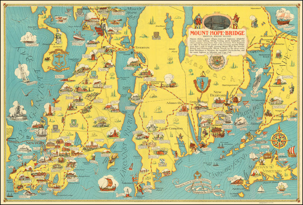
Place/Date:
Bristol, RI / 1933
Size:
25.5 x 17 inches
Condition:
VG+
Stock#:
78181
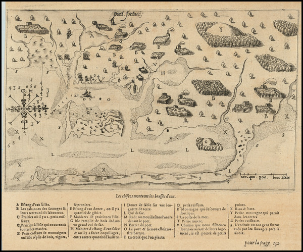
Place/Date:
Paris / 1613
Size:
9.5 x 7.5 inches (including text)
Condition:
VG+
Stock#:
78785
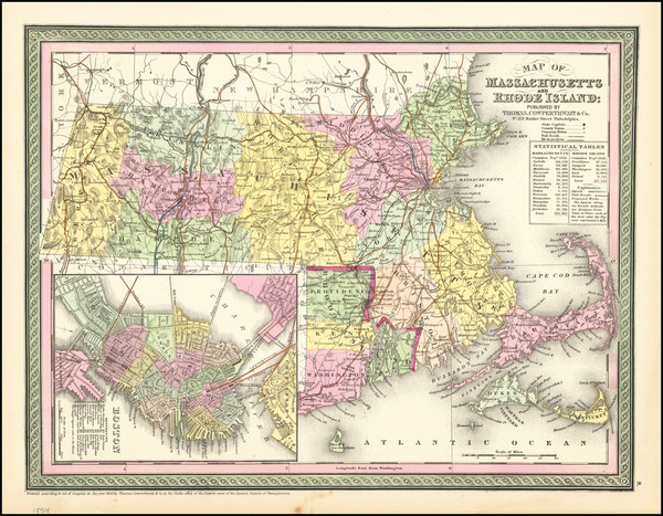
Place/Date:
Philadelphia / 1852
Size:
15 x 11.5 inches
Condition:
VG
Stock#:
79108
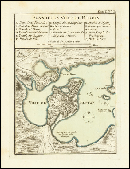
Place/Date:
Paris / 1764
Size:
6 x 8.5 inches
Condition:
VG+
Stock#:
80660
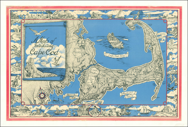
Place/Date:
Westwood, Massachusetts / 1950 circa
Size:
33 x 22 inches
Condition:
VG
Stock#:
77709

Place/Date:
Washington, DC / 1836
Size:
69.5 x 56.5 inches (if joined)
Condition:
VG
Stock#:
50917
United States Bureau of Topographical Engineers's 1836 rare map showing Massachusetts.
Place/Date:
Philadelphia / 1825
Size:
22 x 17 inches
Condition:
VG
Stock#:
81450

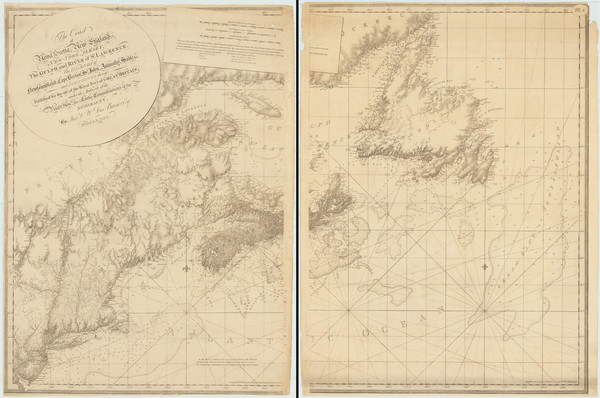
Place/Date:
Amsterdam / 1702
Size:
23 x 20.5 inches
Condition:
VG
Stock#:
33948mb
Early Sea Chart of Manhattan, Long Island, Nantucket, Martha's Vineyard, Block Island, Hudson River, New England
Place/Date:
London / 1782
Size:
11 x 8 inches
Condition:
VG
Stock#:
81909
1782 original St. Jean De Crevecoeur map showing Massachusetts.

Place/Date:
Hildburghausen / 1846
Size:
15 x 11.5 inches
Condition:
VG+
Stock#:
56859
Meyer's 1846 original map showing Massachusetts.
Place/Date:
London / 1777
Size:
29 x 20.5 inches
Condition:
VG+
Stock#:
65118

Place/Date:
Philadelphia / 1867
Size:
14 x 12 inches
Condition:
VG
Stock#:
84103
Place/Date:
New York / 1855
Size:
16 x 13 inches
Condition:
Good
Stock#:
84327
Place/Date:
Boston / 1830 circa
Size:
10 x 8 inches
Condition:
Fair
Stock#:
84598
Place/Date:
n.p. / 1812 -1830
Size:
17.5 x 14.5 inches
Condition:
Good
Stock#:
83877
Place/Date:
London / 1794
Size:
26 x 19 inches
Condition:
VG
Stock#:
45177
Antique map showing Massachusetts by Laurie & Whittle, 1794.
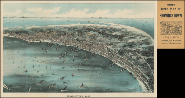
Place/Date:
Boston / 1907 circa
Size:
20.25 x 13.5 inches
Condition:
VG+
Stock#:
82486
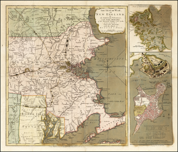
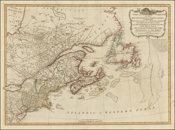
Place/Date:
London / 1780
Size:
46 x 32.3 inches (if joined)
Condition:
Good
Stock#:
69631
Place/Date:
Italy / 1880 circa
Size:
6.6 x 4.4 inches
Condition:
Stock#:
88045
Place/Date:
Washington, D.C. / 1951
Size:
14 x 19.5 inches
Condition:
VG+
Stock#:
88471
Place/Date:
Chicago / 1897
Size:
27 x 19.5 inches Including Text
Condition:
VG+
Stock#:
89042
Place/Date:
New York / 1875
Size:
23.2 x 14.4 inches
Condition:
VG
Stock#:
88729
Place/Date:
Boston / 1801
Size:
45 x 30 inches
Condition:
Good
Stock#:
72471
Place/Date:
Chicago / 1896
Size:
27 x 19.5 inches Including Text
Condition:
VG
Stock#:
89737
Place/Date:
Philadelphia / 1853
Size:
21.5 x 17 inches
Condition:
Fair
Stock#:
89957
Place/Date:
Philadelphia / 1814
Size:
8 x 6 inches
Condition:
VG
Stock#:
90231
Place/Date:
London / 1781
Size:
19 x 26 inches
Condition:
VG+
Stock#:
51249
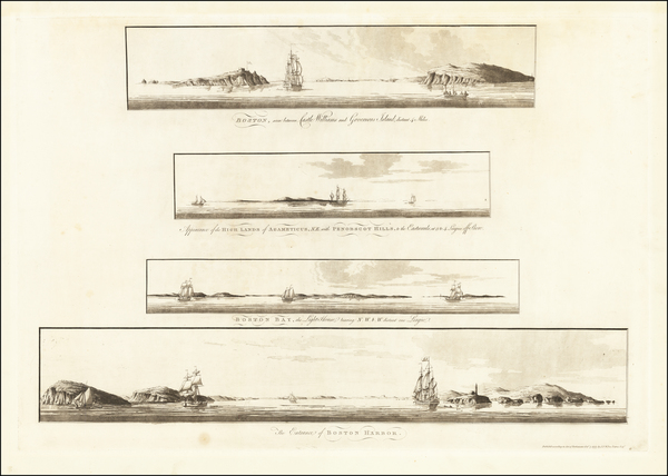
1781 antique Des Barres map showing Massachusetts.
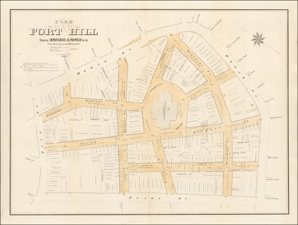
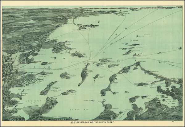
Place/Date:
Boston, Massachusetts / 1895
Size:
32.5 x 58 inches
Condition:
VG
Stock#:
90724