Search
John Farmer first became a school teacher and taught map drafting among other topics in upstate New York.
At the time, Michigan Territory was in need of teachers. In December 1821 the board of University of Michigan in Detroit (still only primary and secondary education) offered Farmer a position as head of the Lancasterian School.
Trained as a draftsman, Farmer supplemented his income by copying surveyor's township maps and selling the maps to new settlers. He also drew for the Treasurer of the United States a map of Michigan’s first real road, which had been funded by the federal government and assisted Orange Risdon in his map of the surveyed part of Michigan. When Risdon’s project stalled, Farmer ended up publishing his own detailed map of the state in 1826.
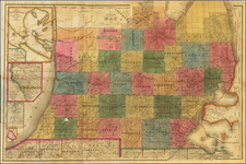
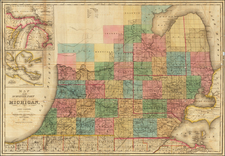
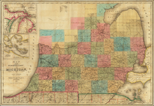
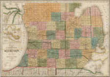
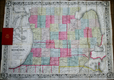
By 1830, Farmer had created a new large format map of Michigan which had so much detail that the engraving of the map had to be outsourced to engravers in New York City. This Map of the Surveyed Part of the State of Michigan depicts in great detail the southern half of Michigan’s lower peninsula.
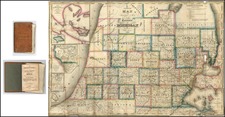
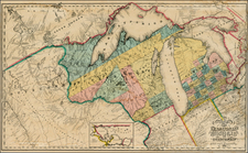
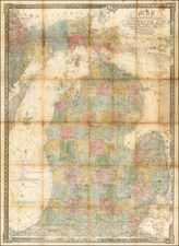
Farmer also produced regional maps starting in 1835 when both Michigan and Wisconsin were still mere territories, ontinuously revising them over the years to reflect changes in development. At the time of his death nearly 25 years later he was still producing a Michigan & Wisconsin map, now titled Map of the States of Michigan and Wisconsin, embracing a great part of Iowa and Illinois and the whole mineral region with a chart of the lakes: Exhibiting the sections, the geological formations, and the general topography.
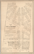
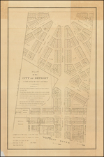
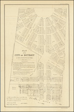
After a few years Farmer sold the publishing rights to his maps to eastern publisher J. H. Colton and turned his attention to mapping new communities and became involved in the formation of a Detroit Board of School Inspectors.
In 1844, Farmer issued the first edition of his The State of Michigan and the Surrounding Country. This map contained extreme detail of every surveyed square mile, every stream, swamp, and every road and trail and would be published by the Farmer family for the next 30 years.
Farmer died March 24, 1859 in Detroit, Michigan. His widow Rachel Farmer and sons Silas, Arthur and John carried on the business for some time afterward. Maps published after John Farmer's death, however, never maintained the detail and currency of his former work.

Archived