
Search
Place/Date:
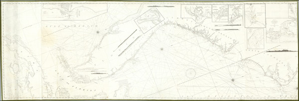
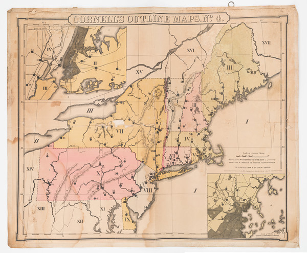
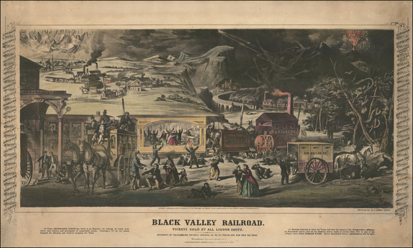
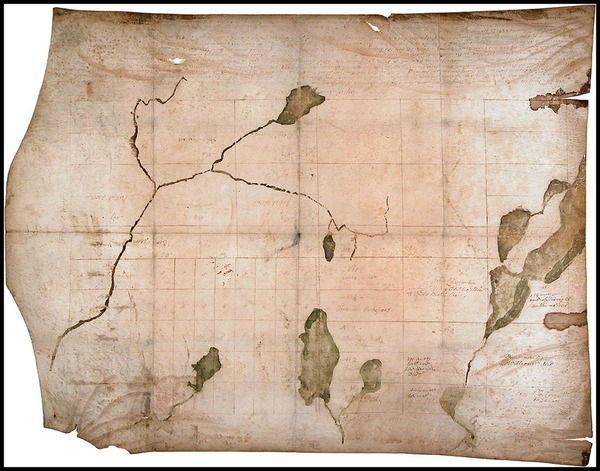
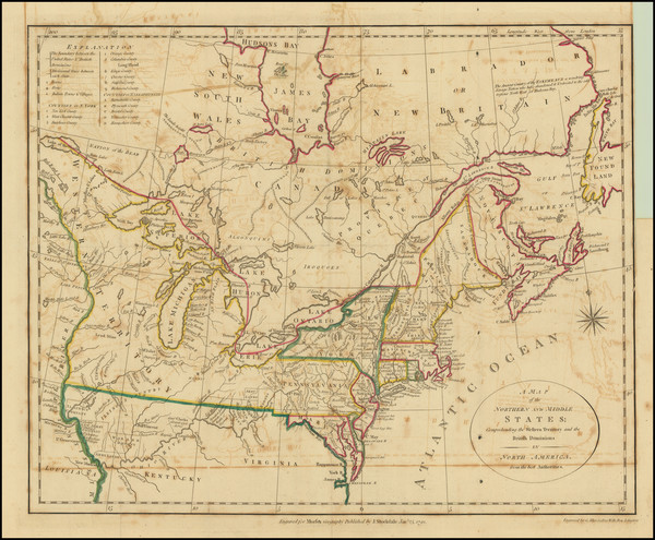
New York / 1825 circa
Size:
86 x 29 inches
Condition:
VG
Stock#:
77294
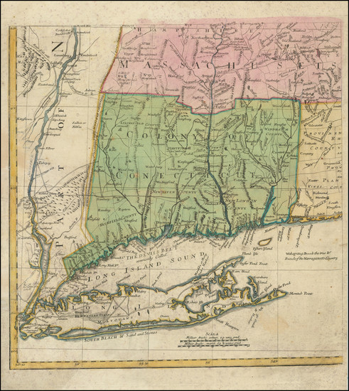
Place/Date:
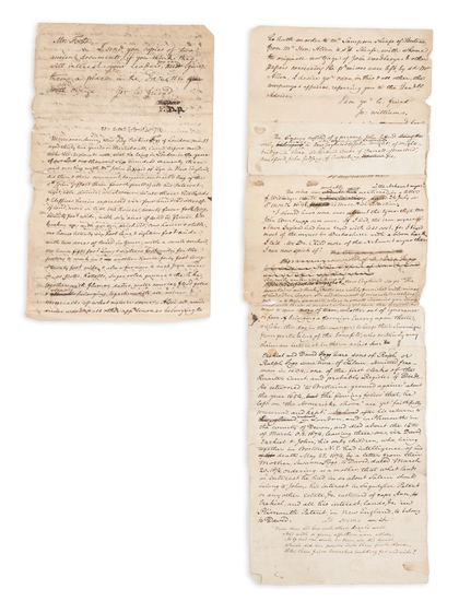
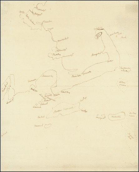
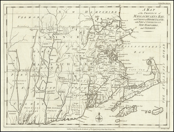
n.p. (Salem, Massachusetts?) / 1674 [but written ca. 1830]
Size:
8 x 12 inches
Condition:
Good
Stock#:
93113
Place/Date:
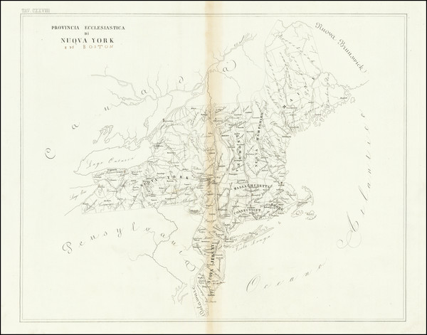
Rome / 1856
Size:
23 x 19 inches
Condition:
VG
Stock#:
89777
Place/Date:
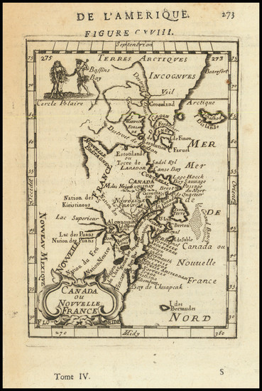
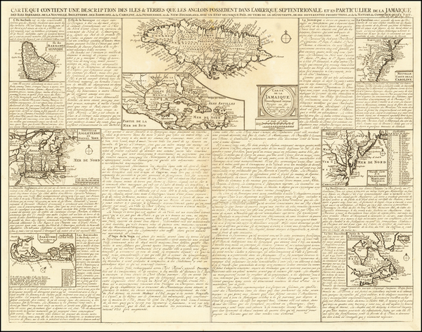
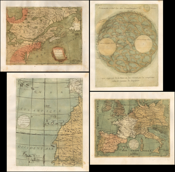
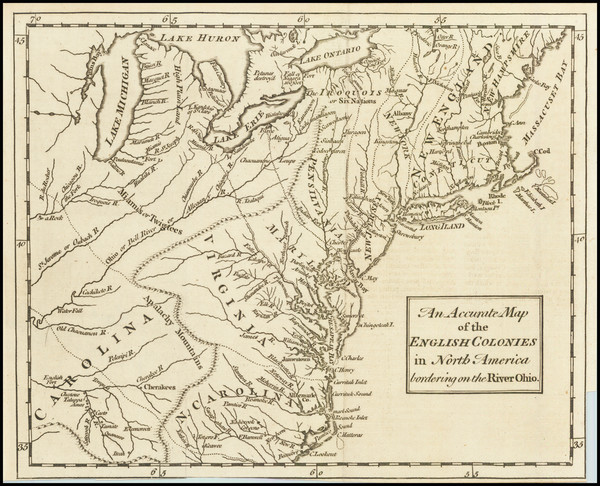
Paris / 1683
Size:
4.5 x 6 inches
Condition:
VG+
Stock#:
97657
Mallet's 1683 antique map showing New England.
Place/Date:
Augsburg / 1777 circa
Size:
19 x 20 inches
Condition:
VG+
Stock#:
91964
1777 antique Lotter map showing New England.
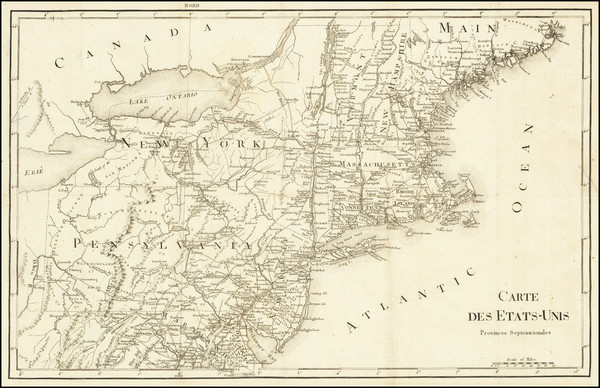
Place/Date:
Paris / 1799
Size:
20 x 13 inches
Condition:
VG
Stock#:
73326rd
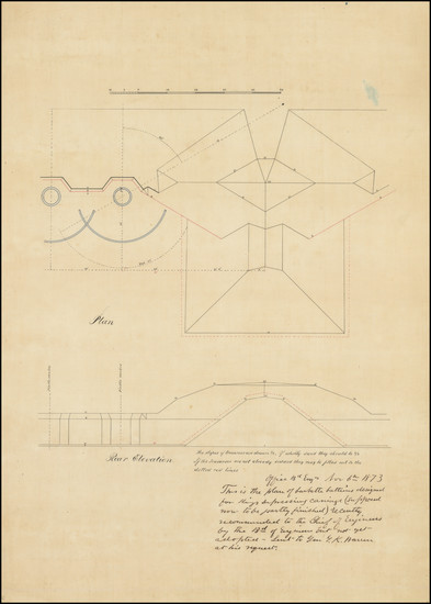
Place/Date:
n.p. / 1873 circa
Size:
(Various)
Condition:
VG
Stock#:
92401
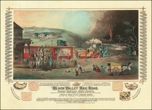
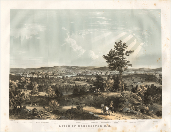
Place/Date:
Boston / 1863
Size:
22 x 15 inches (including text)
Condition:
VG+
Stock#:
83100
Place/Date:
New York / 1859
Size:
30 x 20.5 inches
Condition:
Good
Stock#:
85961

Place/Date:
n.p. / 1780 circa
Size:
6 x 7.5 inches
Condition:
VG
Stock#:
51660
Rare map showing New England by Anonymous made in 1780.
Place/Date:
London / 1793
Size:
17 x 19 inches
Condition:
VG
Stock#:
70223
Place/Date:
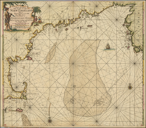
Amsterdam / 1695 circa
Size:
23 x 20 inches
Condition:
VG+
Stock#:
94453
Van Keulen's 1695 antique map showing New England.
Place/Date:
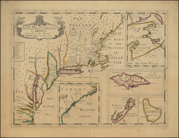
Oxford / 1700
Size:
19 x 14 inches
Condition:
VG
Stock#:
98233

Place/Date:
New York / 1857
Size:
51.5 x 37.5 inches
Condition:
Fair
Stock#:
85637
Place/Date:
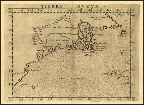
Venice / 1561 (1574)
Size:
10 x 7.5 inches
Condition:
VG+
Stock#:
86737
Ruscelli's 1561 antique map showing New England.
Place/Date:
Munich / 1700
Size:
13.75 x 9 inches
Condition:
VG
Stock#:
95667
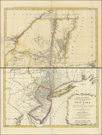
Place/Date:
Nuremberg / 1778
Size:
22 x 28 inches
Condition:
VG
Stock#:
103550
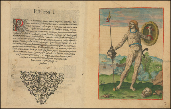
Place/Date:
Frankfurt / 1591
Size:
6.5 x 9 inches Image Only
Condition:
VG
Stock#:
99837
Place/Date:
Boston & New York / 1865
Size:
39.5 x 22 inches including text
Condition:
VG
Stock#:
101469
Place/Date:
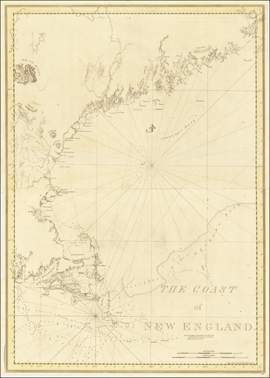
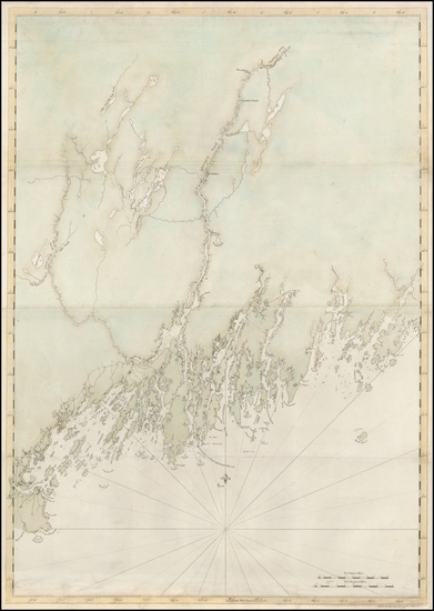
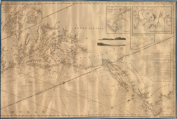
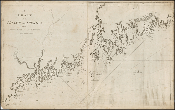
London / 1776
Size:
29.5 x 41.5 inches
Condition:
VG
Stock#:
63672
1776 Antique Sea Chart of the Coast of New England
Place/Date:
Amsterdam / 1719
Size:
22 x 18 inches
Condition:
VG
Stock#:
61480
Place/Date:
n.p. / 1780 circa
Size:
15 x 18.5 inches
Condition:
VG
Stock#:
69611
Place/Date:
New Hampshire / 1768
Size:
30 x 22 inches
Condition:
VG
Stock#:
17048
Antique map showing New England by Batchelder made in 1768.
Place/Date:
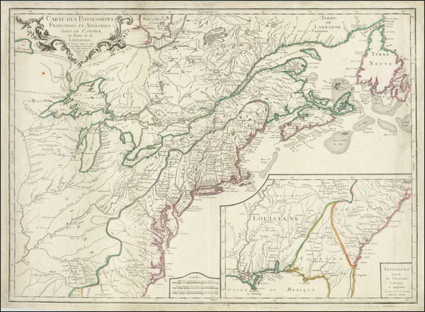
Paris / 1756
Size:
30 x 21.5 inches
Condition:
VG
Stock#:
94026
Place/Date:
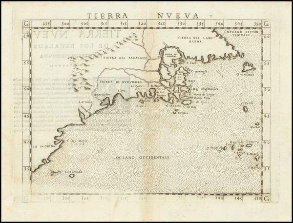
Venice / 1561
Size:
10 x 7 inches
Condition:
VG
Stock#:
64626
1561 Antique Map of North American Coastline.
Place/Date:
London / 1776
Size:
41 x 29 inches
Condition:
VG
Stock#:
50079
Antique map showing New England by Des Barres, 1776.
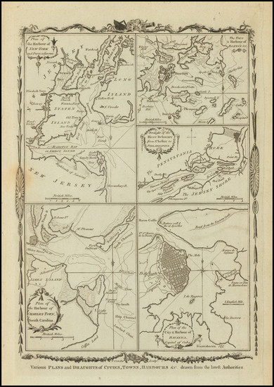
Place/Date:
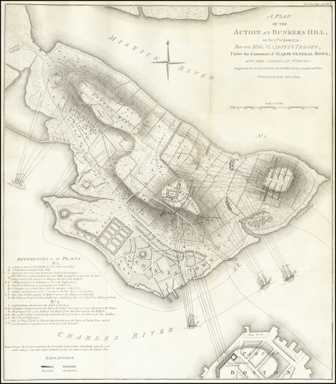
London / 1779
Size:
8.5 x 12 inches
Condition:
VG
Stock#:
83450
Place/Date:
London / 1830 circa
Size:
47 x 31.5 inches
Condition:
VG+
Stock#:
55819
Norie's 1830 rare map showing New England.
Place/Date:
Paris / 1756
Size:
13.5 x 11 inches ( Whole Sheet)
Condition:
VG
Stock#:
52293op
Gautier d'Agoty's 1756 antique map showing New England.
Place/Date:
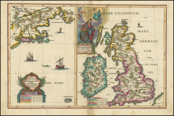
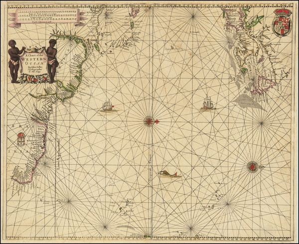
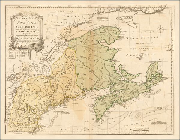
London / 1674 circa
Size:
21.5 x 16.5 inches
Condition:
VG+
Stock#:
69704mb
Place/Date:
Boston / 1794 (1801)
Size:
32 x 20 inches
Condition:
VG
Stock#:
26305
1794 rare Norman map showing New England.
Place/Date:
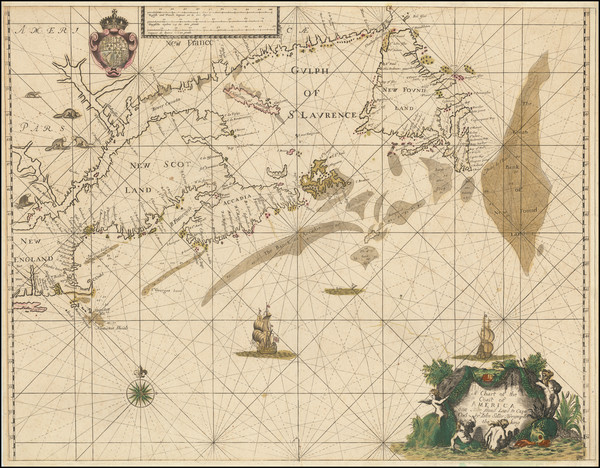
London / 1674
Size:
21 x 17 inches
Condition:
VG
Stock#:
80520
Place/Date:
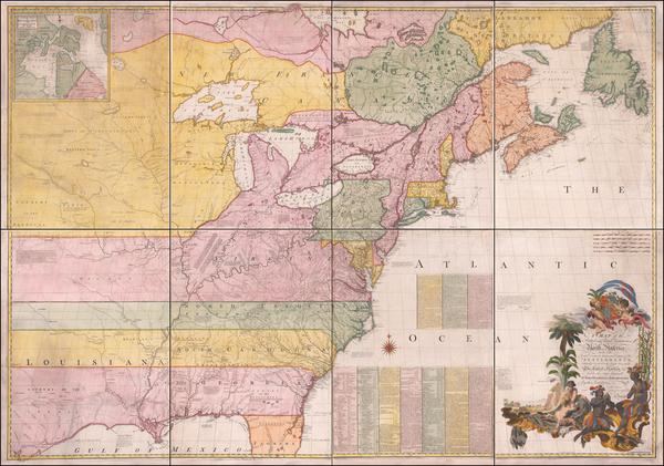
London / 1755 - 1757
Size:
76 x 53 inches If Joined
Condition:
Good
Stock#:
60574dg
Mitchell's 1755 antique map showing New England.
Place/Date:
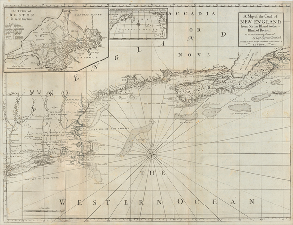
London / 1777 circa
Size:
31.5 x 24 inches
Condition:
Good
Stock#:
53739
Antique map showing New England by Mount & Page / Southack, 1777.
Place/Date:
London / 1792
Size:
15.5 x 12.5 inches
Condition:
VG
Stock#:
99856
Place/Date:
London / 1782
Size:
14.5 x 11 inches
Condition:
VG+
Stock#:
89228

Place/Date:
Augsburg / 1777
Size:
22 x 28.5 inches
Condition:
VG
Stock#:
58857
Rare map showing New England by Lotter, 1777.
Place/Date:
London / 1747
Size:
17 x 14 inches
Condition:
VG
Stock#:
80358
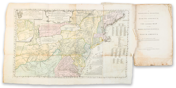
Place/Date:
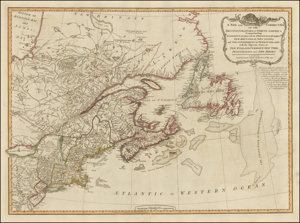
London / 1794
Size:
26 x 19 inches
Condition:
VG
Stock#:
45177
Antique map showing New England by Laurie & Whittle, 1794.
Place/Date:
London / 1733
Size:
24.5 x 40.5 inches
Condition:
VG+
Stock#:
101277
Place/Date:
London / 1746
Size:
18.5 x 13.5 inches
Condition:
VG
Stock#:
55886
Antique map showing New England by Gentleman's Magazine, 1746.
Place/Date:
London / 1685 (1715 ca)
Size:
21.5 x 18 inches
Condition:
VG+
Stock#:
60306op
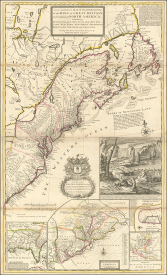
Original map showing New England by Morden / Lea / Willdey / Thornton made in 1685.
Place/Date:
London / 1775
Size:
24.5 x 18.5 inches
Condition:
VG
Stock#:
81952
Place/Date:
London / 1755
Size:
24 x 18.5 inches
Condition:
VG
Stock#:
51712
1755 antique Jefferys map showing New England.
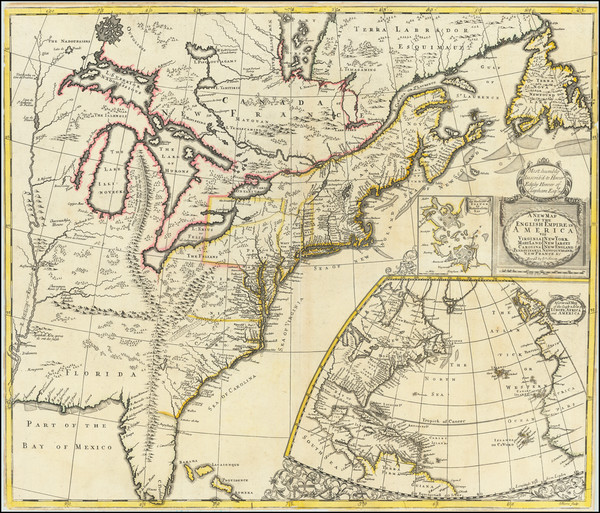
Place/Date:
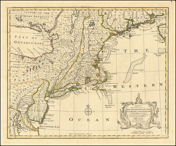
London / 1719
Size:
23.5 x 20 inches
Condition:
VG
Stock#:
74465
Rare map showing New England by Senex made in 1719.
Place/Date:
London / 1776
Size:
10.5 x 17 inches (book size)
Condition:
VG+
Stock#:
100077
Place/Date:
New York / 1855
Size:
26 x 33.5 inches
Condition:
VG
Stock#:
0088bm
Rare map showing New England by Bachelder, 1855.
Place/Date:
London / 1754
Size:
10 x 8 inches
Condition:
VG
Stock#:
90978
Place/Date:
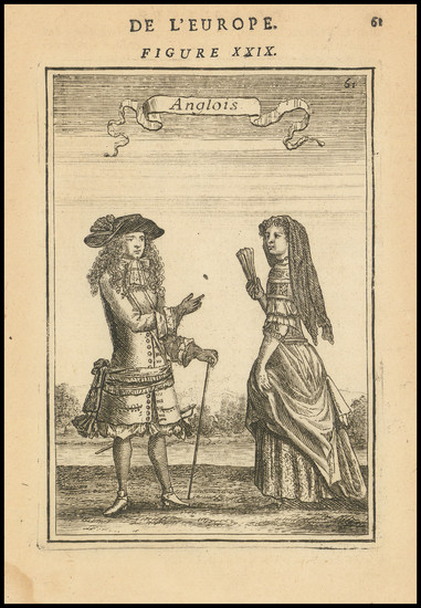
Paris / 1683
Size:
4.5 x 6 inches
Condition:
VG
Stock#:
103167
Original map showing New England by Mallet, 1683.

Place/Date:
Amsterdam / 1651 (1660 ca)
Size:
20.5 x 17.5 inches
Condition:
VG
Stock#:
66922
Jansson's 1651 antique map showing New England.