
Search
Old and antique maps of Canada for sale. Our authentic Canada map inventory features antique maps of Canada from the period of New France, the Hudson Bay Company, and early exploration by mapmakers such as Champlain, Vancouver, and Mackenzie. Our map inventory typically includes antique and vintage city views and plans of Montreal, Quebec, Toronto, and Vancouver. Vintage pictorial maps of Canada are also for sale.
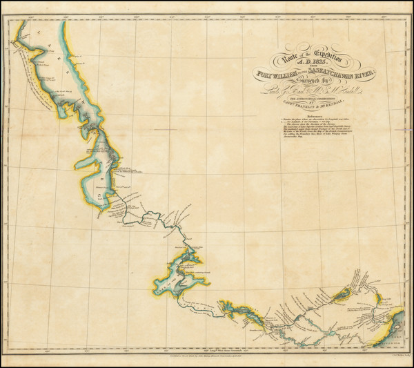
Place/Date:
London / 1828
Size:
17 x 14 inches
Condition:
VG
Stock#:
99372
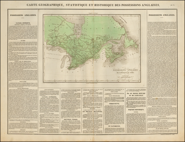
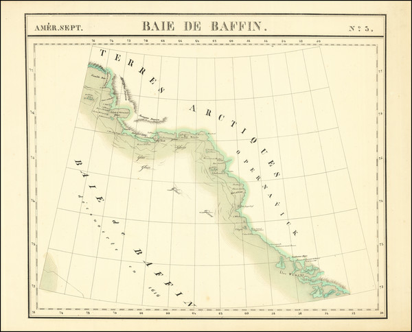
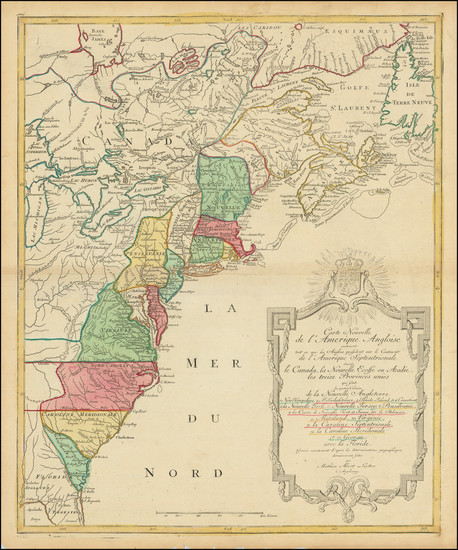
Place/Date:
Paris / 1825
Size:
25 x 18.5 inches
Condition:
VG
Stock#:
43027
Antique map of British Canada
Place/Date:
Venice / 1691
Size:
17 x 10 inches
Condition:
VG+
Stock#:
98656
Place/Date:
Paris / 1757
Size:
11.5 x 7.5 inches
Condition:
VG+
Stock#:
96603
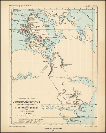
Place/Date:
Gotha / 1880
Size:
7.25 x 9.75 inches
Condition:
VG+
Stock#:
98476
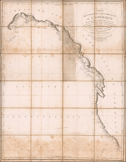
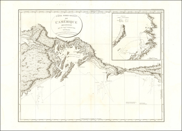
Place/Date:
Paris / 1800 circa
Size:
23 x 29.5 inches
Condition:
Good
Stock#:
58500
Antique map showing Canada by Vancouver, 1800.
Place/Date:
Brussels / 1825
Size:
20 x 18 inches
Condition:
VG+
Stock#:
1795RB
Vandermaelen's 1825 antique map showing Canada.
Place/Date:
Brussels / 1825
Size:
23 x 19.5 inches
Condition:
VG+
Stock#:
87865
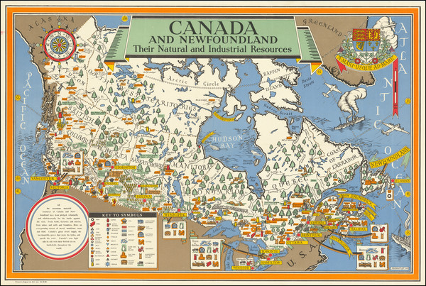
Place/Date:
London / 1942
Size:
29 x 19 inches
Condition:
VG+
Stock#:
77756
Place/Date:
Augsburg / 1776
Size:
19.25 x 23.75 inches
Condition:
VG
Stock#:
100143
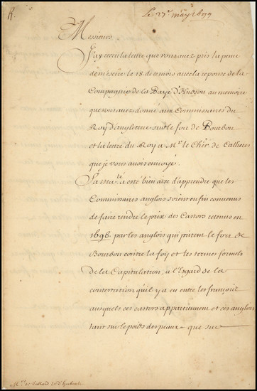
Place/Date:
Versailles / 1699
Size:
8.3 x 12.5 inches
Condition:
VG
Stock#:
100562
Place/Date:
London / 1784
Size:
26.5 x 15.5 inches
Condition:
VG+
Stock#:
68831
Place/Date:
New York / 1856
Size:
15 x 10 inches
Condition:
Good
Stock#:
101874
Place/Date:
Oxford / 1700
Size:
19 x 14 inches
Condition:
VG
Stock#:
98233
Place/Date:
Frankfurt / 1789
Size:
9 x 14 inches
Condition:
VG+
Stock#:
57192
Antique map showing Canada by Therbu, 1789.
Place/Date:
Berlin / 1791
Size:
25 x 19 inches
Condition:
VG
Stock#:
41816dm
Forster's 1791 antique map showing Canada.
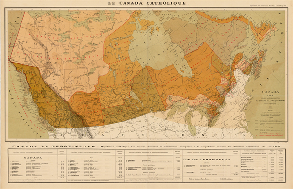
Place/Date:
Paris / 1893
Size:
36 x 23 inches
Condition:
VG+
Stock#:
37899
Antique map showing Canada by Baillairge made in 1893.
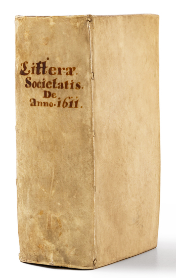
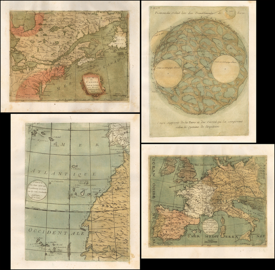
Place/Date:
Dillingen / 1611 circa -1615
Size:
3.6 x 6.6 inches
Condition:
VG
Stock#:
84352
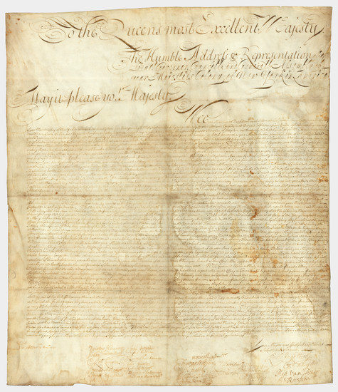
Place/Date:
n.p. (New York or Albany?) / 1709
Size:
23 x 27 inches Sheet Size
Condition:
VG
Stock#:
85409
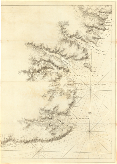
Place/Date:
London / 1755 (1756)
Size:
22.5 x 17 inches
Condition:
Stock#:
86975
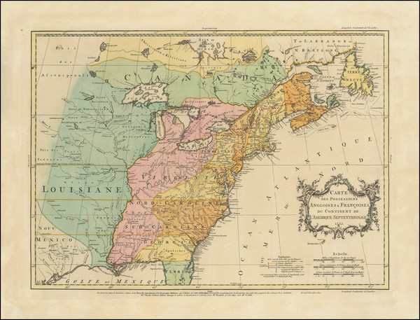
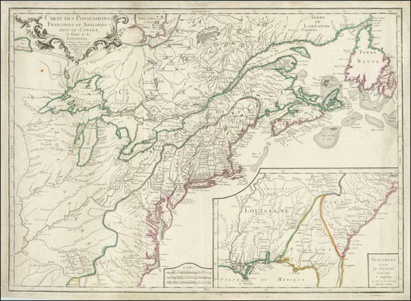
Place/Date:
Paris / 1799
Size:
28 x 21.5 inches
Condition:
VG+
Stock#:
92676
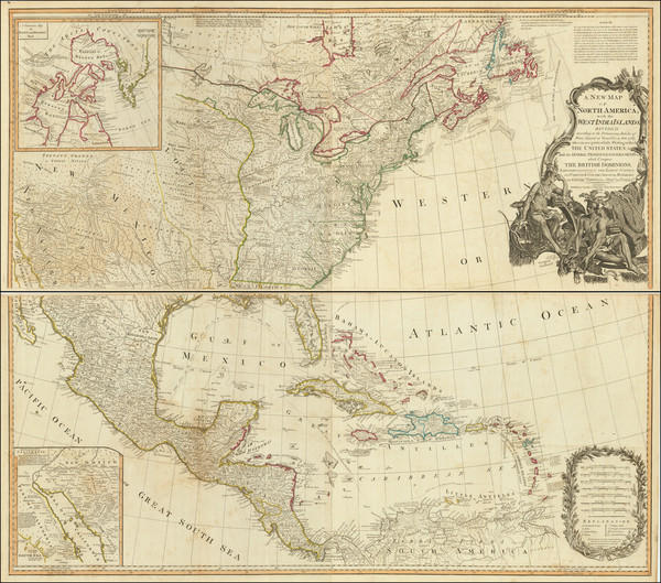
Place/Date:
London / 1781
Size:
30 x 41 inches
Condition:
VG
Stock#:
62849
Place/Date:
London / 1733
Size:
19.5 x 20 inches
Condition:
VG+
Stock#:
92714
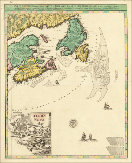
Place/Date:
Paris / 1756
Size:
30 x 21.5 inches
Condition:
VG
Stock#:
94026
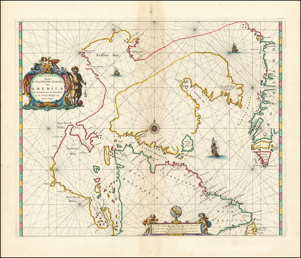
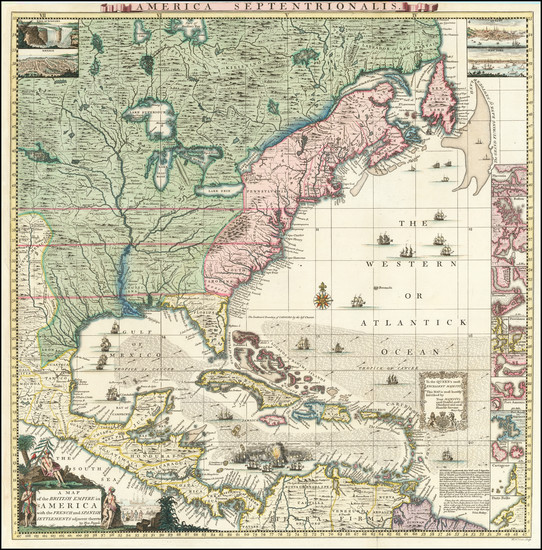
Place/Date:
Amsterdam / 1666
Size:
21.5 x 18 inches
Condition:
VG
Stock#:
93148
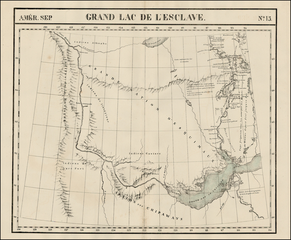
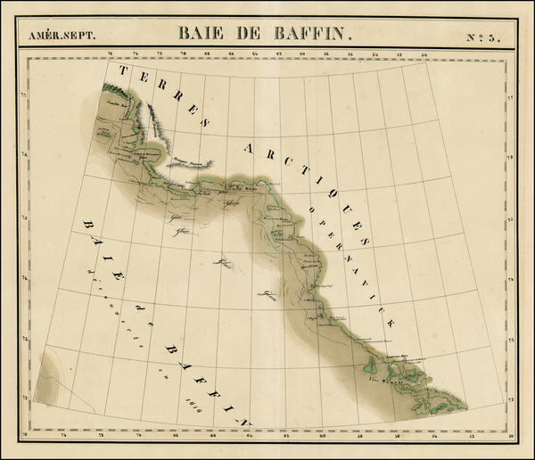
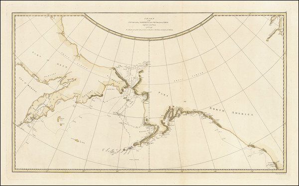
[MacKenzie River, Yukon Territory and Northwest Territory] Amer. Sep. No. 15. Grand Lac De L'Esclave
Place/Date:
Brussels / 1825
Size:
20 x 18 inches
Condition:
VG
Stock#:
19469
Vandermaelen's 1825 original map showing Canada.
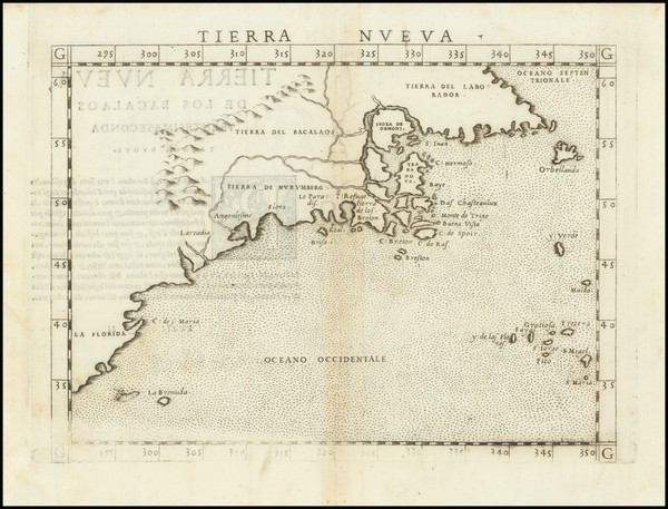
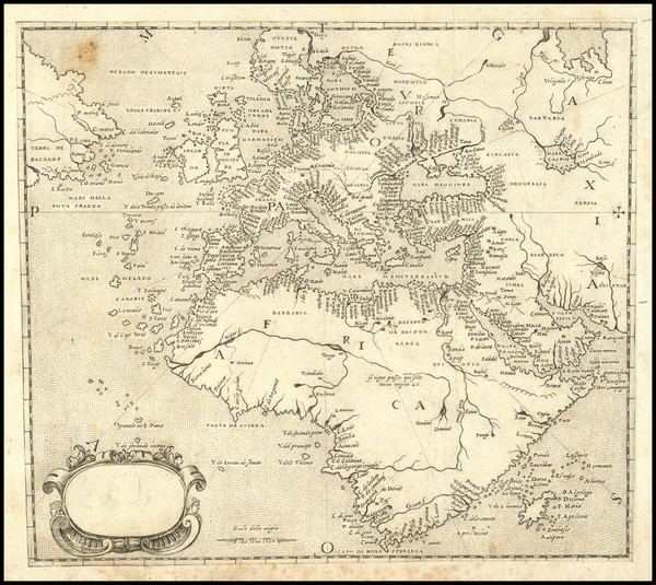
Place/Date:
Venice / 1561
Size:
10 x 7 inches
Condition:
VG
Stock#:
64626
1561 Antique Map of North American Coastline.
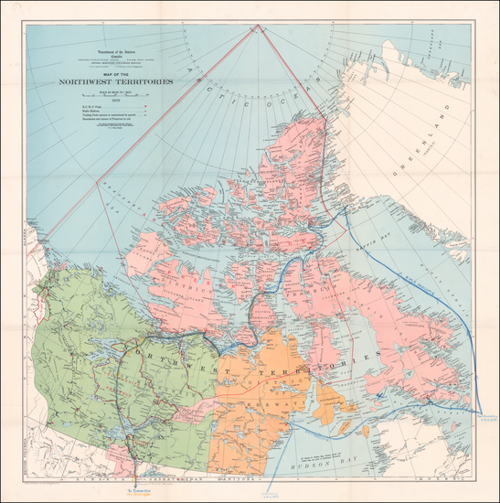
Place/Date:
Ottawa / 1929
Size:
34 x 35 inches
Condition:
VG+
Stock#:
60046
Original map showing Canada by Canadian Department of the Interior made in 1929.
Place/Date:
London / 1794
Size:
46 x 40 inches If Joined
Condition:
VG
Stock#:
89085
Place/Date:
Paris / 1756
Size:
13.5 x 11 inches ( Whole Sheet)
Condition:
VG
Stock#:
52293op
Gautier d'Agoty's 1756 antique map showing Canada.
Place/Date:
Amsterdam / 1696 circa
Size:
23 x 18.5 inches
Condition:
VG
Stock#:
47720
Visscher I's 1696 original map showing Canada.
Place/Date:
Padua (Venice?) / 1570 (circa 1575)
Size:
8 x 7 inches
Condition:
VG
Stock#:
89582

Place/Date:
London / 1868 (corrections to 1925)
Size:
37.5 x 35 inches
Condition:
VG
Stock#:
68029
Place/Date:
London / 1775
Size:
19 x 44 inches
Condition:
VG
Stock#:
0002dg
1775 rare Sayer & Bennett map showing Canada.
Place/Date:
London / 1773
Size:
19.5 x 15.5 inches
Condition:
VG
Stock#:
48018
Antique map showing Canada by Basire, 1773.
Place/Date:
London / 1674 circa
Size:
21.5 x 16.5 inches
Condition:
VG+
Stock#:
69704mb
Place/Date:
Boston / 1794 (1801)
Size:
32 x 20 inches
Condition:
VG
Stock#:
26305
1794 rare Norman map showing Canada.
Place/Date:
London / 1775
Size:
19.5 x 24 inches
Condition:
VG
Stock#:
66231
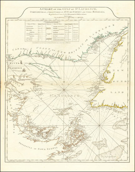
Antique Map of Gulf of St. Laurence
Place/Date:
London / 1795
Size:
14 x 9 inches
Condition:
VG
Stock#:
63006
Place/Date:
London / 1674
Size:
21 x 17 inches
Condition:
VG
Stock#:
80520
Place/Date:
London / 1756
Size:
8.5 x 6 inches
Condition:
VG+
Stock#:
43552dp
Antique map showing Canada by Jefferys made in 1756.
Place/Date:
London / 1815
Size:
27 x 12 inches (map)
Condition:
VG
Stock#:
81775
Place/Date:
London / 1777 circa
Size:
31.5 x 24 inches
Condition:
Good
Stock#:
53739
Antique map showing Canada by Mount & Page / Southack, 1777.
Place/Date:
Philidelphia / 1814
Size:
10 x 10 inches
Condition:
VG
Stock#:
104328
Antique map showing Canada by Carey made in 1814.
Place/Date:
Oxford / 1680
Size:
23 x 18 inches
Condition:
VG
Stock#:
91429

Place/Date:
Augsburg / 1777
Size:
22 x 28.5 inches
Condition:
VG
Stock#:
58857
Rare map showing Canada by Lotter, 1777.
Place/Date:
London / 1746
Size:
16.5 x 15 inches
Condition:
VG+
Stock#:
77246
Rare map showing Canada by Bowen made in 1746.
Place/Date:
London / 1746
Size:
18.5 x 13.5 inches
Condition:
VG
Stock#:
55886
Antique map showing Canada by Gentleman's Magazine, 1746.
Place/Date:
London / 1755
Size:
24 x 18.5 inches
Condition:
VG
Stock#:
51712
1755 antique Jefferys map showing Canada.
Place/Date:
London / 1805
Size:
20.5 x 18 inches
Condition:
VG+
Stock#:
87487