|
||

|

|
|

|
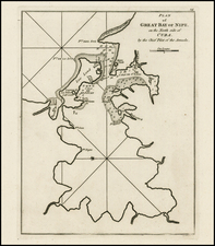
This map of the Siege of Havanna, drawn by an officer on the spot in 1762, offers a detailed depiction of the pivotal events surrounding the British capture of Havana during the Seven Years' War. This historically significant map provides an officer’s view of the layout and fortifications of Havana, marked by the delineation of siege lines and positions, fortresses, and the encampments of the besieging forces.
In the context of the Seven Years' War, the capture of Havana was a major event in the global conflict between Britain and Spain. The siege, lasting from March to August 1762, was a part of the broader struggle for control in the Caribbean, a region of critical strategic and economic importance due to its sugar-producing islands. The British victory at Havana demonstrated military prowess and shifted the balance of colonial power, leading to significant territorial changes stipulated in the Treaty of Paris of 1763.
The map is remarkable for its detailed representation of the military tactics employed during the siege. It shows the placement of British ships, the locations of Spanish defensive structures, and the topography of the region.
The Gentleman’s Magazine was a British publication that helped to normalize the use of maps in support of articles and features. It was founded in 1731 by the prominent London publisher Edward Cave, a pioneer in periodical journalism. The magazine continued in print for nearly two centuries, shuttering production in 1922.
This was the publication which first used the word “magazine”, from the French for storehouse. Cave wanted to create a storehouse of knowledge and he employed some of London’s best writers to fill his pages: Samuel Johnson gained his first regular employment by writing for the Gentleman’s Magazine. Other famous contributors included Jonathan Swift.
The publication covered a broad range of topics, from literature to politics, and, from 1739, frequently used maps as illustrations. The first map they printed was a woodcut of Crimea; the second was a fold-out map of Ukraine by Emanuel Bowen. Maps were used to show battle lines, to chronicle voyages, and to educate about areas with which Britain traded. Certain geographers, like Thomas Jefferys, contributed several maps to the publication.
![[Revolutionary War Plans of New York, Boston, Charleston, Delaware River to Philadelphia & Havana] Various Plans and Draughts of Cities, Towns, Harbours &c . . .](https://storage.googleapis.com/raremaps/img/small/83450.jpg)
![Cuba. Western Portion. [with:] Cuba. Eastern Portion](https://storage.googleapis.com/raremaps/img/small/90688.jpg)