|
||

|

|
|

|
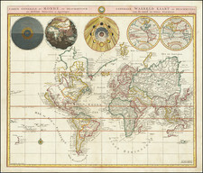
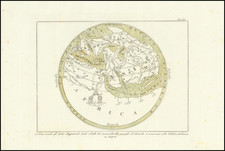
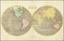
Decorative map of the World, Showing California as an Island. Double Hemisphere map, surrounded by additional hemispheric projections, one of the earliest maps to abandon the baroque style of the 17th Century for a more scientific appearance. Traditional double hemisphere, plus eith other spheres, showing the world in various orientations. Allard's innovative style was copied by a number of other mapmakers, including Schenk, Zurner, Homann and Seutter. Shirley 578. A nice dark example of this historically significant world map Narrowed margins, as issued. The upper right corner of the map has a long tear which has been archivally repaired on the verso and is nearly invisible. A visually striking example.
Carel (Carol) Allard (Allardt) (1648–1709) was an engraver and publisher based in Amsterdam. Part of a prominent family of Dutch mapmakers, publishers, and print sellers, his father was engraver and publisher Hugo Allard (1627–1684), who left his business to Carel upon his death. Carel published anything in demand, including maps, topography, ethnography, newsprints, and restrikes of old plates of artistic prints, many of which likely came from his father’s stock. In 1706, Carel gave his copperplates to his son Abraham Allard, before going bankrupt.