
Search
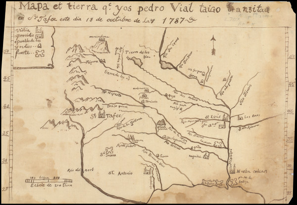
Place/Date:
n.p. / 1787 (but likely 20th Century)
Size:
11.5 x 8 inches
Condition:
Good
Stock#:
3645
Original map showing Oklahoma & Indian Territory by Vial, 1787.
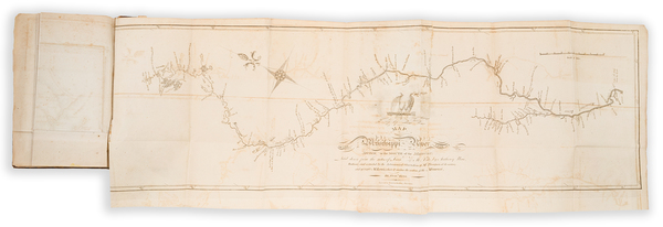
Place/Date:
Philadelphia / 1810
Size:
29.25 x 9 inches
Condition:
VG+
Stock#:
81745
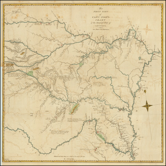
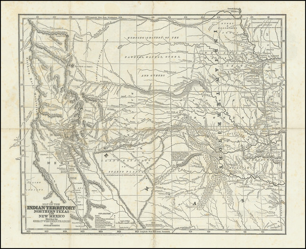
Place/Date:
Philadelphia / 1810
Size:
18.5 x 18 inches
Condition:
VG
Stock#:
83485
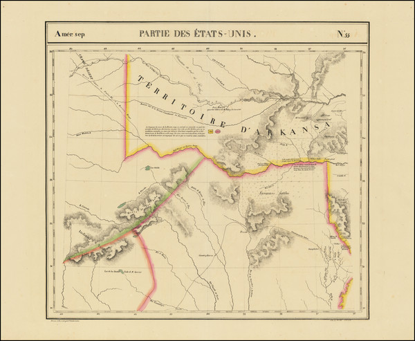
Place/Date:
Brussels / 1825 circa
Size:
20 x 18.5 inches
Condition:
VG+
Stock#:
93537
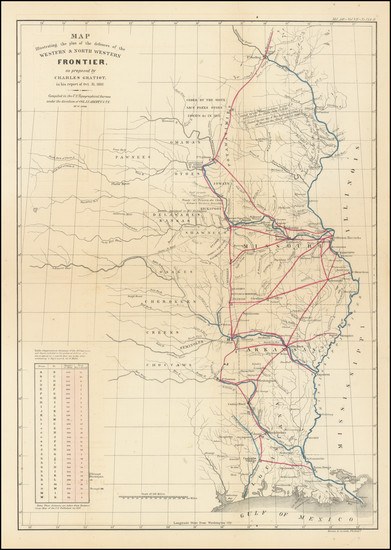
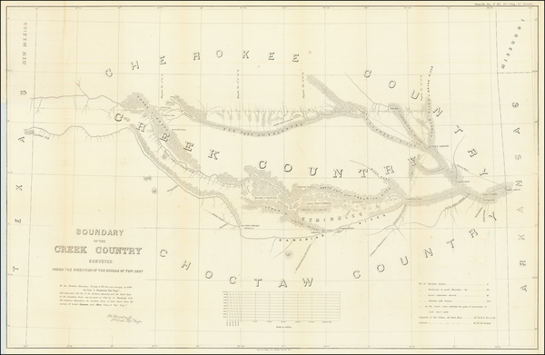
Place/Date:
Washington / 1837
Size:
15 x 21.5 inches
Condition:
VG
Stock#:
102750
Place/Date:
London / 1844 circa
Size:
18.5 x 12.75 inches
Condition:
VG+
Stock#:
93925
Place/Date:
New York / 1844
Size:
15.5 x 13 inches
Condition:
Good
Stock#:
98558
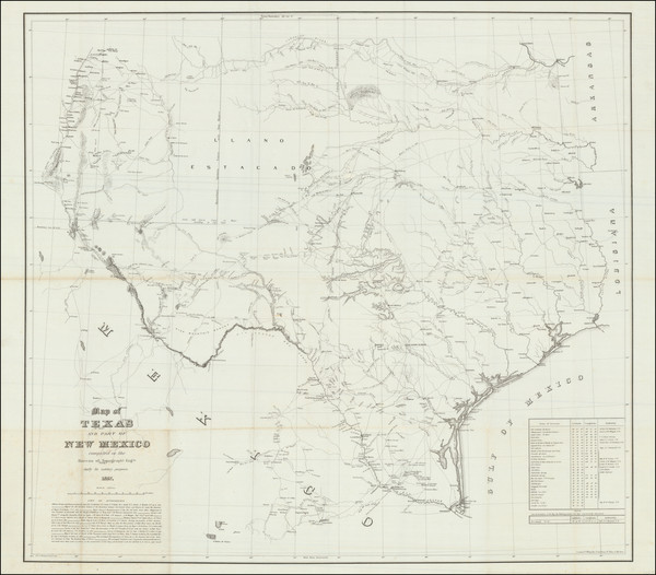
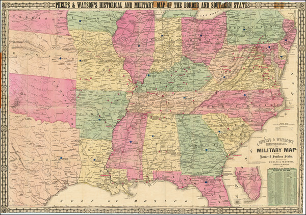
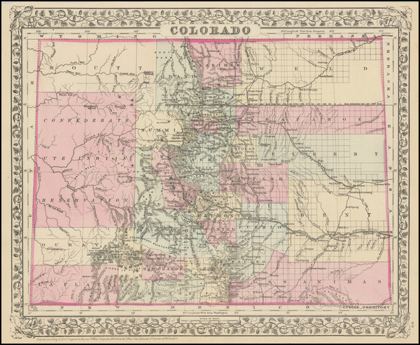
Place/Date:
New York / 1857
Size:
36.5 x 33 inches
Condition:
VG
Stock#:
94668
Place/Date:
Washington / 1858
Size:
37 x 24 inches
Condition:
VG
Stock#:
63234
Place/Date:
New York / 1864
Size:
35.5 x 25 inches sheet size
Condition:
VG
Stock#:
101831
Place/Date:
[Okmulgee, Indian Territory] / 1870 circa
Size:
8 x 5.5 inches
Condition:
Good
Stock#:
78740
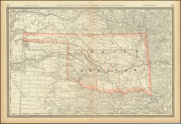
Place/Date:
New York / 1874
Size:
16 x 13 inches
Condition:
VG+
Stock#:
101158
Place/Date:
Edinburgh / 1875
Size:
14.5 x 11 inches
Condition:
VG+
Stock#:
92045
Place/Date:
Pawhuska, Indian Territory / 1875 circa
Size:
5.5 x 8 inches
Condition:
VG
Stock#:
92655
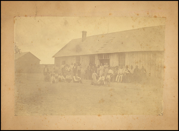
Place/Date:
Fort Sill, Indian Territory / 1875 circa
Size:
4 x 6.5 inches
Condition:
VG
Stock#:
93032
Place/Date:
Chicago / 1878
Size:
19.5 x 15 inches
Condition:
VG
Stock#:
101211
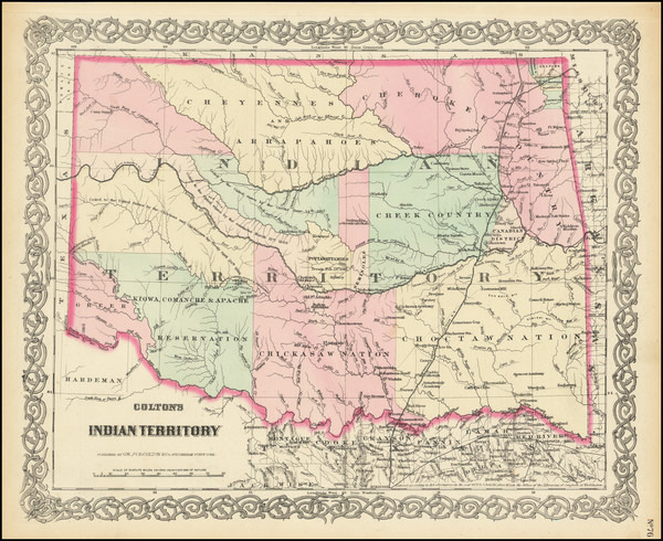
Place/Date:
Chicago / 1879
Size:
21 x 28.5 inches
Condition:
VG+
Stock#:
101166
Place/Date:
n.p. (Indian Territory?) / 1880 circa
Size:
8 x 5.5 inches
Condition:
VG
Stock#:
82871
Place/Date:
/ 1880 circa
Size:
7.5 x 4.5 inches
Condition:
Good
Stock#:
93019
Place/Date:
Np / 1880 circa
Size:
2.5 x 4 inches
Condition:
VG
Stock#:
93109
Place/Date:
Philadelphia / 1880
Size:
14 x 11 inches
Condition:
VG+
Stock#:
101102
Place/Date:
Chicago / 1882
Size:
19.5 x 13 inches
Condition:
VG+
Stock#:
88321
Place/Date:
Philadelphia / 1887
Size:
15 x 12 inches
Condition:
VG+
Stock#:
74706
Place/Date:
Chicago / 1887
Size:
13 x 10 inches
Condition:
VG+
Stock#:
90613
Place/Date:
n.p. (Washita County, Indian Territory?) / 1890 circa
Size:
7.75 x 4.75 inches
Condition:
VG+
Stock#:
78743
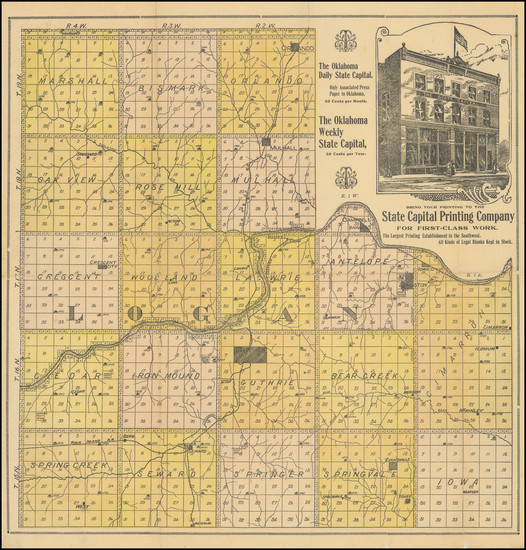
Place/Date:
Guthrie, Oklahoma / 1890
Size:
15.5 x 15.75 inches
Condition:
VG+
Stock#:
100818
Place/Date:
New York / 1891 - 1895
Size:
27.5 x 17.5 inches
Condition:
VG
Stock#:
95113
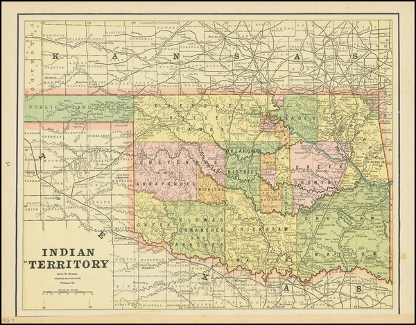
Place/Date:
Chicago / 1892
Size:
25 x 16.5 inches
Condition:
VG+
Stock#:
90495
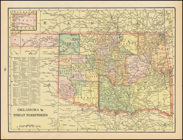
Place/Date:
Neosho County, Kansas / 1893
Size:
20.5 x 20 inches
Condition:
VG
Stock#:
66608jc
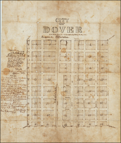
Antique Hand Drawn Plan of Dover, Oklahoma Territory
Place/Date:
Chicago / 1893
Size:
13 x 9.25 inches
Condition:
VG+
Stock#:
80267
Place/Date:
New York / 1893
Size:
9 x 11.5 inches
Condition:
VG+
Stock#:
99547
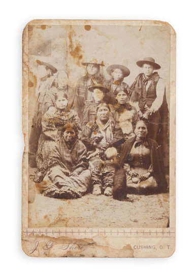
Place/Date:
Cushing, Oklahoma Territory / 1895 circa
Size:
4 x 6 inches
Condition:
Fair
Stock#:
93103
Place/Date:
Chicago / 1895
Size:
22.8 x 16.25 inches
Condition:
VG
Stock#:
101104

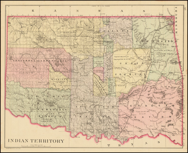
Place/Date:
Washington, D.C. / 1898
Size:
18 x 20 inches
Condition:
VG
Stock#:
49293
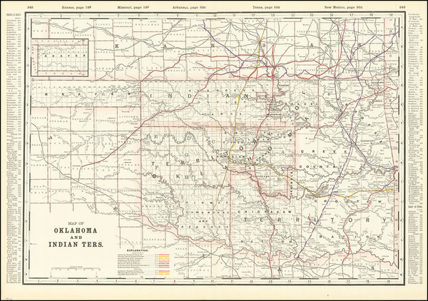
United States Department of the Interior's 1898 original map showing Oklahoma & Indian Territory.
Place/Date:
Washington, D.C. / 1898
Size:
17 x 16.75 inches
Condition:
VG+
Stock#:
88866
Place/Date:
St. Louis / 1898
Size:
30.5 x 16.5 inches
Condition:
VG
Stock#:
91606
Place/Date:
Washington / 1899
Size:
28 x 24 inches
Condition:
VG+
Stock#:
97412
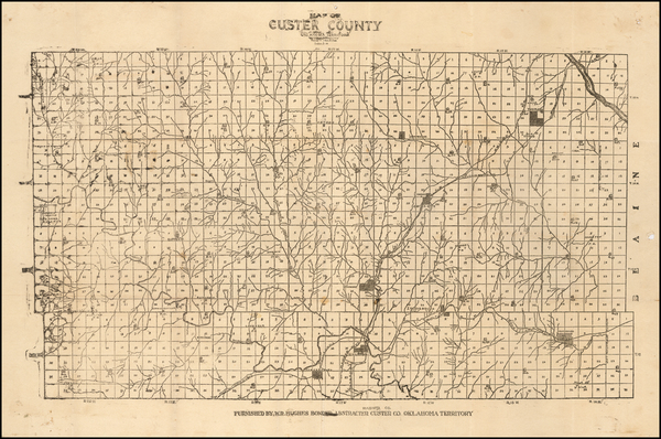
Place/Date:
Custer County, Oklahoma Territory / 1900 circa
Size:
18 x 12 inches
Condition:
VG+
Stock#:
57497
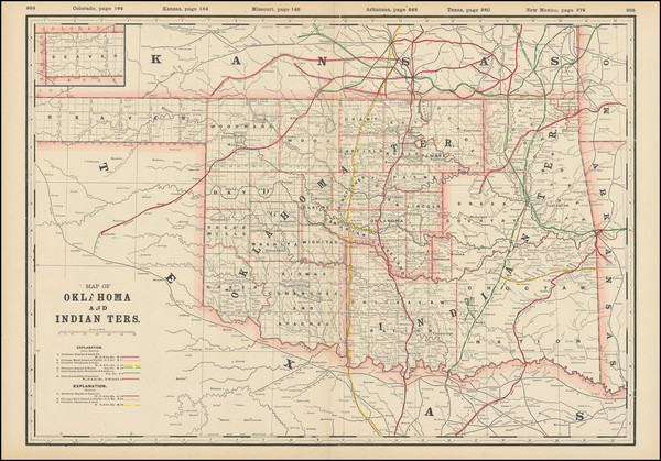
Rare map showing Oklahoma & Indian Territory by Hughes, 1900.
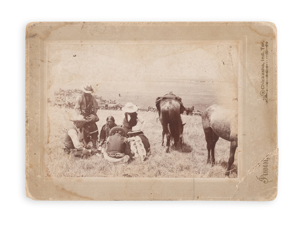
Place/Date:
Chickasha, Indian Territory / 1900 circa
Size:
6 x 4 inches
Condition:
Good
Stock#:
93106
Place/Date:
St. Louis / 1900 circa
Size:
29.5 x 35.5 inches
Condition:
VG
Stock#:
93210
Place/Date:
Washington, D.C. / 1900
Size:
30.25 x 33.2 inches
Condition:
VG
Stock#:
99045
Place/Date:
Washington / 1900
Size:
28 x 24 inches
Condition:
Stock#:
102956
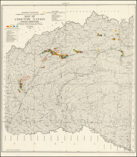
Place/Date:
Washington / 1901
Size:
10 x 19 inches
Condition:
VG
Stock#:
97446
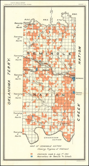
Place/Date:
Washington / 1901
Size:
27 x 29.5 inches
Condition:
VG+
Stock#:
97537
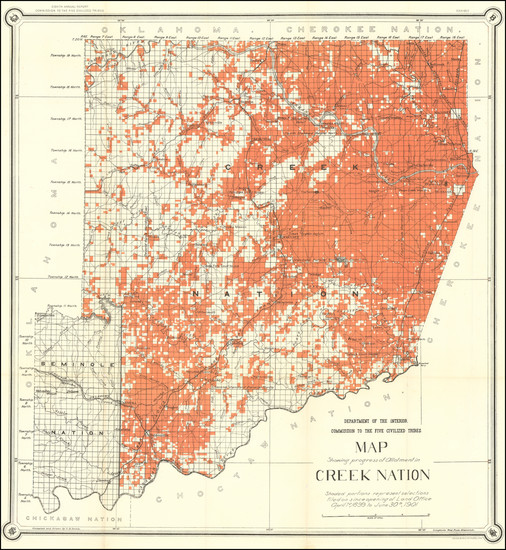
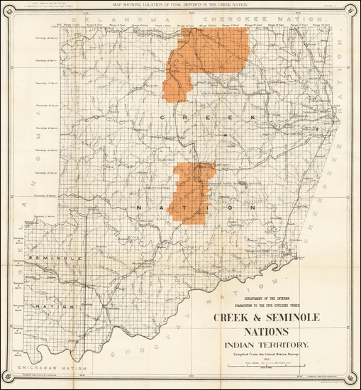
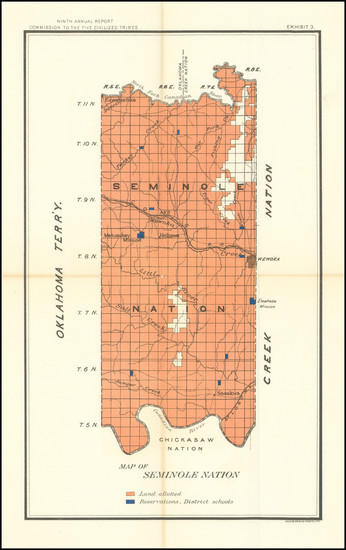
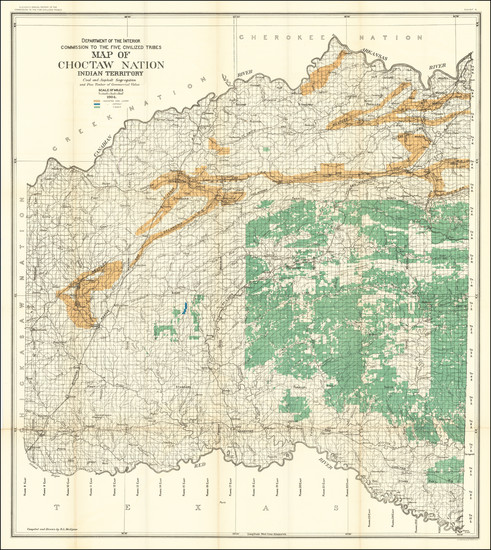
Place/Date:
Washington / 1902
Size:
27 x 29.5 inches
Condition:
VG
Stock#:
35573
Antique map showing Oklahoma & Indian Territory by United States GPO made in 1902.
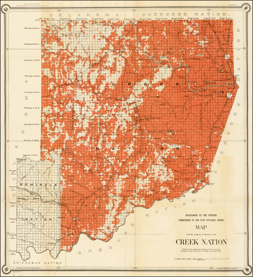
Place/Date:
Washington / 1902
Size:
24 x 28 inches
Condition:
VG
Stock#:
51182
1902 antique United States Department of the Interior map showing Oklahoma & Indian Territory.
Place/Date:
n.p. / 1902
Size:
11 x 17.5 inches
Condition:
VG
Stock#:
97612
Place/Date:
Chicago / 1902
Size:
13 x 9.5 inches
Condition:
VG+
Stock#:
99552
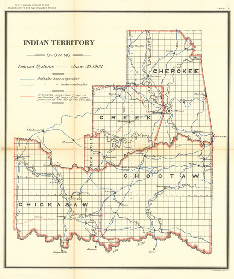
Place/Date:
Washington / 1903
Size:
24 x 16 inches
Condition:
VG
Stock#:
97488
Place/Date:
Washington / 1904
Size:
33 x 36.7 inches
Condition:
VG+
Stock#:
70108