


|
||

|

|
|

|
The DeWitt Clinton Copy of the First Edition of the First Government-Sanctioned Exploration of the American Southwest
Important association copy of Zebulon Pike’s important account of his two expeditions into the American West. Operating on the orders of Thomas Jefferson, Pike’s observations were crucial to the expansion of the United States. His maps were the first to show the trans-Mississippi West in such exacting detail, and the first to be based on first-hand observations.
This example is notable additionally because it belonged to U.S. Senator and New York City mayor DeWitt Clinton (1769-1828). As noted by Richard Brookhiser:
Politics was DeWitt Clinton’s job but not his only interest. He thought of himself as what we would now call a public intellectual. He belonged to a public-spirited class of gentlemen who helped found the growing city’s learned societies—the American Academy of the Arts, the Literary and Philosophical Society, and the New-York Historical Society. . . He gave a lecture, famous in its day, surveying American intellectual life: entitled “Introductory Discourse,” it proudly recounted our achievements (Benjamin Franklin’s inventions, Zebulon Pike’s discoveries) and anxiously fretted over our shortcomings (“we are far behind our European brethren in the pursuits of literature”). . . [An Introductory Discourse Delivered Before the Literary and Philosophical Society of New-York on the Fourth of May, 1814, By De Witt Clinton L.L. D . . . (1815)]
Zebulon Pike’s expeditions in the American West
Zebulon Pike was born in 1779 in New Jersey; his father was an officer in the Continental Army during the American Revolution. A teenage Zebulon followed in his footsteps, joining the army after being raised on a series of western outposts. One of his first assignments was to trail the French expedition under General Georges Henri Victor Collot, which was mapping the Mississippi frontier.
Following the Louisiana Purchase, President Thomas Jefferson needed to know more about the vast swath of land he had purchased, as well as extend American sovereignty into an area that already contained French, British, and Spanish trappers and traders. Additionally, he needed to create new treaties and relationships with the Indigenous peoples. To achieve these aims, Jefferson ordered several expeditions into the American West, including the Lewis and Clark expedition and what are now known as the first and second Pike expeditions.
Initially, Lieutenant Pike was charged with the command of a reconnaissance expedition to find the source of the Mississippi River. Pike’s mission left St. Louis on April 9, 1805 with orders to expel fur traders operating illegally within US borders, to establish cordial relations with several powerful tribes, and to survey the Mississippi and its tributaries. They set off upstream and reached the convergence of the Mississippi and the Minnesota Rivers in September. There, Pike purchased land from the Dakota people which would become Fort Snelling. They camped at the mouth of the Swan River and then continued north on the frozen waterway to contact British North West Company fur posts.
The farthest north they reached was Leech Lake. Pike told the traders there that they were now under US jurisdiction and he struck the British flag from the site. He also met with Ojibwe leaders. Pike thought that the nearby Upper Red Cedar Lake might be the upper source of the Mississippi and conducted latitude readings there. The American travelers headed south at the end of February 1806. They returned to St Louis on April 20, the first of the government’s western expeditions to return.
Only ten weeks later, Pike was off again, this time to the southwest. He was to map the headwaters of the Arkansas and Red Rivers, as well as to survey the southwestern Louisiana Territory. Pike and his men left on July 15, 1806. By November, they were in what is today Colorado. They attempted to climb the tallest elevation they had seen thus far; although he never scaled it, the mountain is now known as Pike’s Peak, one of the most famous geographic features in the Continental United States.
From Colorado the group turned south, which brought them into Spanish territory. They were seized by Spanish soldiers and brought to Santa Fe to be interrogated and detained. From there, they journeyed to Chihuahua state in Mexico, where they stayed for several months. Pike’s papers were seized. However, he was allowed to socialize with the officers and learned much about the state of affairs and politics in what was then New Spain. He took new notes and smuggled these out in the gun barrels of his men. The US and Spain were at peace during this time; therefore, Pike and his men were escorted from Spanish holdings via San Antonio to the American border in early July.
Pike would go on to serve in the War of 1812, where he was promoted to the rank of brigadier general. He died fighting at the Battle of York in April 1813.
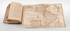
The seizure of his journals did not seem to faze Pike, who wrote a stirring account of his adventures, with part on the second expedition drawn mainly from memory. This was published in 1810 as An Account Of Expeditions To The Sources Of The Mississippi, And Through The Western Parts Of Louisiana. The narrative proved popular and was quickly released in Dutch, French, and German editions. It was a must-read for explorers and settlers of the American West until well into the twentieth century.
Pike provided some of the first descriptions of the American West—especially of Texas, Colorado, and New Mexico—to the reading public. For example, the section on Texas is the first to describe the area in detail in English. His is one of the most important books on western exploration and one of the pillars of Western Americana.
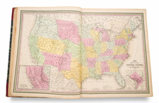
Pike also produced several maps to accompany the account which are very influential in the history of American cartography. These were the first maps of the Louisiana Territory to be based on first-hand observations. His map of New Spain was based on Humboldt’s, although the latter was not published until a year later. All of Pike’s maps were foundational for later cartographers and are some of the earliest western maps produced in the still-growing United States.
Provenance
The account was incredibly influential at the time of publication and it proved popular over the course of the nineteenth century. This particular copy belonged to DeWitt Clinton (1769-1828), who would have acquired the book at the time of its publication, about the time Clinton ran against then-President James Madison for President of the United States in 1812.
A native of New York, Clinton attended Columbia University and then became a lawyer. He quickly entered politics thanks to his uncle Governor George Clinton, whom he served as secretary. In 1797, Dewitt was elected in his own right to the New York House of Representatives. From 1798 to 1802 he served in the New York Senate. In 1802, he was elected to the United States Senate. A year later Clinton was elected to his first term as mayor of New York City. He served in that position until 1807 and held the office again from 1811 to 1815. Clinton was next elected Governor of New York in 1817, holding office until his death on February 11, 1828.
- DeWitt Clinton (bookplate)
- Michael Sharpe (bookplate)
- Ira Lipman (purchased at the Lipman sale, Sotheby's New York, 13 April 2021)
![[ Indian Territory / North Texas / Arkansas ] General Topographical Map. Sheet XXIV. Plate CLIX](https://storage.googleapis.com/raremaps/img/small/95113.jpg)
![[California, Texas, and Southwest Globe Gore] with [Strait of Anian Globe Gore]](https://storage.googleapis.com/raremaps/img/small/99425.jpg)
![[ Early Western Automobile Road Map ] Goodrich Road Map of Arizona - Colorado - New Mexico - Utah](https://storage.googleapis.com/raremaps/img/small/101927.jpg)