
Search

Place/Date:
Amsterdam / 1695 circa
Size:
39 x 32 inches
Condition:
VG
Stock#:
46848
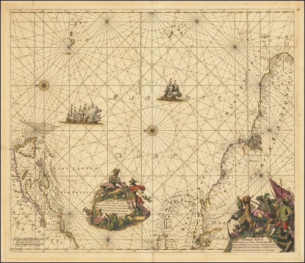
17th Century Dutch Sea Chart on Vellum
Place/Date:
Paris / 1683
Size:
4.5 x 6 inches
Condition:
VG+
Stock#:
91775
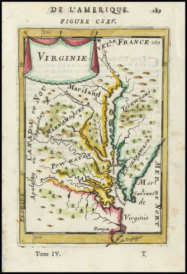
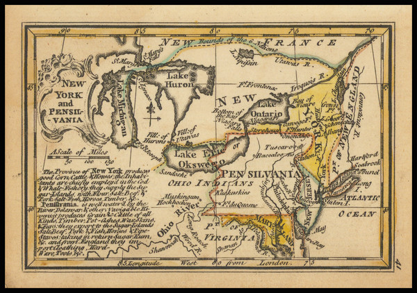
Place/Date:
London / 1729
Size:
8 x 11 inches
Condition:
VG
Stock#:
93311
1729 antique Moll map showing the Mid-Atlantic.
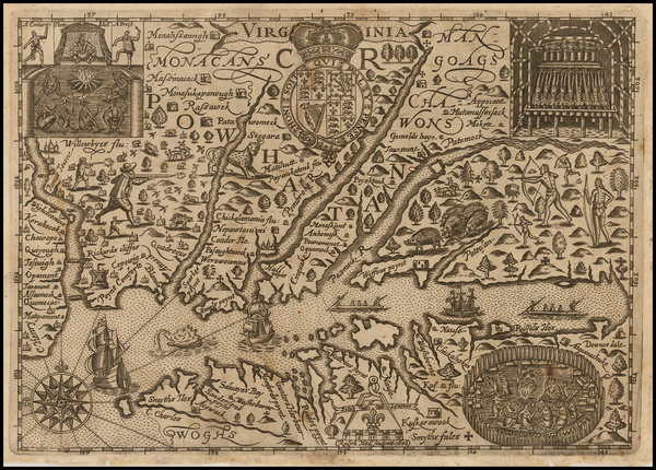
Hall's 1636 antique map showing the Mid-Atlantic.

Place/Date:
London / 1818
Size:
28 x 20 inches
Condition:
VG
Stock#:
46588
Pinkerton's 1818 original map showing the Mid-Atlantic.
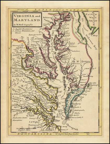
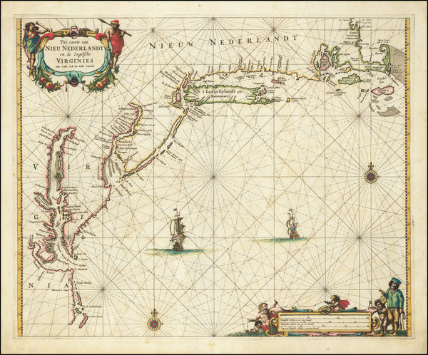
Place/Date:
Amsterdam / 1680 circa
Size:
21 x 18.25 inches
Condition:
VG
Stock#:
91239
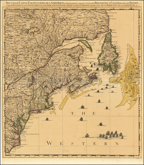
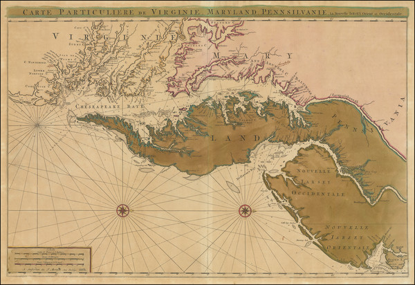
Place/Date:
London / 1776
Size:
20.5 x 43.5 inches Each Sheet
Condition:
Good
Stock#:
91422
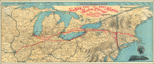
Place/Date:
New York / 1901
Size:
39 x 15.5 inches
Condition:
VG
Stock#:
92665

Place/Date:
London / 1802
Size:
9.5 x 7.25 inches
Condition:
VG
Stock#:
95082
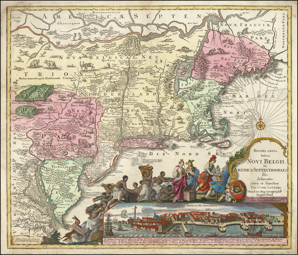
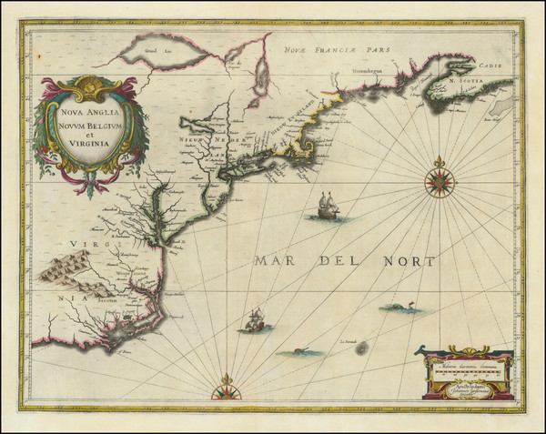
Place/Date:
Amsterdam / 1675
Size:
22.5 x 19 inches
Condition:
VG+
Stock#:
73515
De Wit's 1675 rare map showing the Mid-Atlantic.
Place/Date:
Edinburgh / 1857
Size:
16 x 13 inches
Condition:
Stock#:
102830
Place/Date:
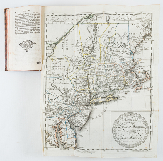
Braunschweig / 1778
Size:
11.7 x 14.8 inches (map size)
Condition:
VG
Stock#:
84175
Place/Date:
Augsburg / 1757 circa
Size:
22.5 x 19.5 inches
Condition:
Good
Stock#:
63924
Original map showing the Mid-Atlantic by Lotter, 1757.
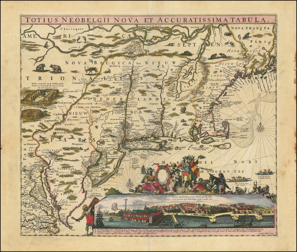
Place/Date:
Amsterdam / 1666
Size:
21 x 17 inches
Condition:
VG
Stock#:
66883op
Place/Date:
Amsterdam / 1672 circa
Size:
21.5 x 17 inches
Condition:
VG
Stock#:
84924
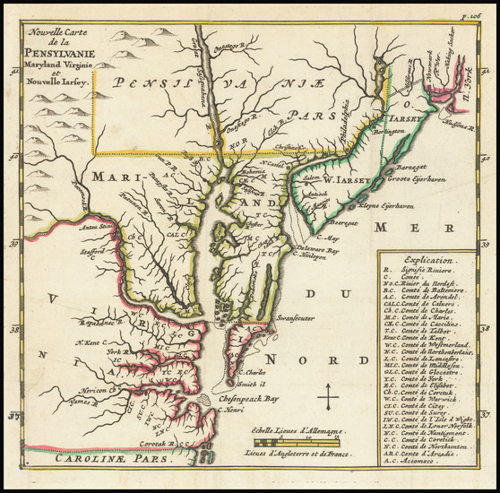
Place/Date:
Paris / 1755
Size:
24.5 x 19 inches
Condition:
VG
Stock#:
93097
Place/Date:
London / 1798
Size:
18.5 x 16 inches
Condition:
VG
Stock#:
81546
Place/Date:
London / 1795
Size:
12 x 8.5 inches
Condition:
VG+
Stock#:
89227

Place/Date:
Amsterdam / 1684 circa
Size:
21.5 x 18.5 inches
Condition:
VG
Stock#:
93874
Place/Date:
Amsterdam / 1656 (1684)
Size:
22 x 18.5 inches
Condition:
VG
Stock#:
85388
Place/Date:
Amsterdam / 1640
Size:
19 x 15 inches
Condition:
VG
Stock#:
93234
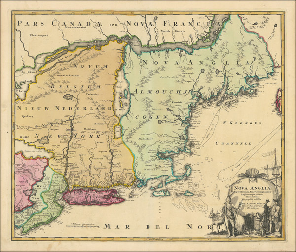
Place/Date:
Amsterdam / 1696
Size:
23 x 18.5 inches
Condition:
Good
Stock#:
75875
Place/Date:
Amsterdam / 1640 circa
Size:
20 x 15.5 inches
Condition:
VG+
Stock#:
91974
Place/Date:
Antwerp / 1625
Size:
14 x 11 inches
Condition:
VG+
Stock#:
91528
Place/Date:
Nurmberg / 1716
Size:
22.5 x 19 inches
Condition:
VG
Stock#:
100105
Place/Date:
Amsterdam / 1637
Size:
20 x 15.5 inches
Condition:
VG
Stock#:
91920
Place/Date:
Amsterdam / 1737
Size:
20.5 x 22 inches
Condition:
Good
Stock#:
64717
Place/Date:
Amsterdam / 1688
Size:
6.5 x 6.5 inches
Condition:
VG
Stock#:
69405

Place/Date:
Paris / 1748
Size:
6.5 x 7.5 inches
Condition:
VG+
Stock#:
99262
Place/Date:
London / 1787
Size:
23 x 23 inches (Map)
Condition:
VG
Stock#:
55181
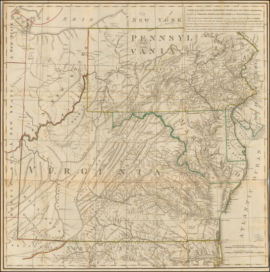
Thomas Jefferson's Map / Book on Virginia
Place/Date:
Louvain / 1597 (1607)
Size:
11.5 x 9 inches
Condition:
VG
Stock#:
98918

Place/Date:
Sweden / 1816
Size:
20.5 x 15 inches
Condition:
VG+
Stock#:
64709
Place/Date:
Edinburgh / 1814
Size:
23 x 19.5 inches
Condition:
VG
Stock#:
83869
Place/Date:
London / 1844
Size:
13 x 15 inches
Condition:
VG+
Stock#:
76586
Place/Date:
London / 1758
Size:
3.75 x 2.5 inches
Condition:
VG+
Stock#:
98229

Place/Date:
Edinburgh / 1767
Size:
10 x 8 inches
Condition:
VG+
Stock#:
98156
Place/Date:
Bamberg / 1852
Size:
21.5 x 29 inches
Condition:
VG
Stock#:
48081
Antique map showing the Mid-Atlantic by Buchnerschen Buchhandlung, 1852.

Place/Date:
Washington / 1863
Size:
27 x 23.5 inches
Condition:
VG
Stock#:
47081
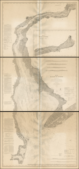
Original map showing the Mid-Atlantic by United States Coast Survey made in 1863.
Place/Date:
Baltimore / 1838 circa
Size:
20.5 x 27 inches
Condition:
VG
Stock#:
45033
Soiecki's 1838 antique map showing the Mid-Atlantic.
Place/Date:
Philadelphia / 1813
Size:
18 x 16 inches
Condition:
VG
Stock#:
66754
Place/Date:
Washington / 1848
Size:
35.5 x 77 inches (if joined)
Condition:
VG
Stock#:
0004sh
1848 rare U.S. Coast Survey map showing the Mid-Atlantic.
Place/Date:
Leiden / 1715
Size:
9 x 6 inches
Condition:
VG+
Stock#:
92418
Place/Date:
Paris / 1670 circa
Size:
21.5 x 14 inches
Condition:
VG+
Stock#:
67805
155

Place/Date:
Washington, DC / 1871 circa
Size:
28.5 x 8 inches
Condition:
VG
Stock#:
38475mb
U.S. Army Corps of Engineers's 1871 antique map showing the Mid-Atlantic.
Place/Date:
Nuremberg / 1745
Size:
22 x 19 inches
Condition:
VG+
Stock#:
60331
Homann Heirs's 1745 original map showing the Mid-Atlantic.
Place/Date:
New York / 1855
Size:
16 x 13 inches
Condition:
VG
Stock#:
78692

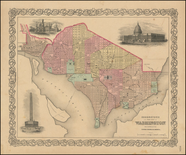
Place/Date:
New York / 1859
Size:
16 x 13 inches
Condition:
VG
Stock#:
88159
1859 antique Colton map showing the Mid-Atlantic.

Place/Date:
New York / 1875
Size:
39 x 24 inches
Condition:
Good
Stock#:
80633
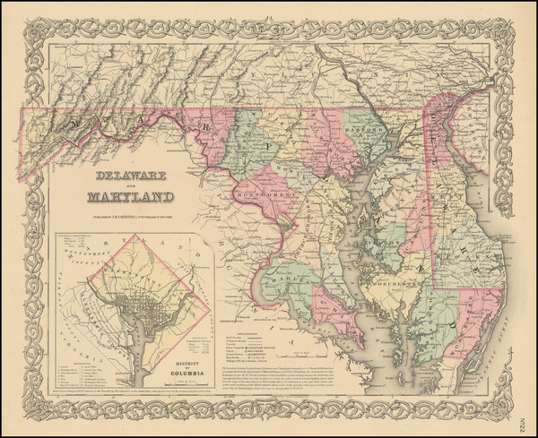
Place/Date:
New York / 1856
Size:
16 x 13 inches
Condition:
VG
Stock#:
96145
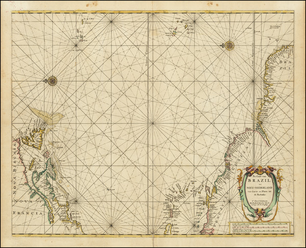
Place/Date:
Amsterdam / 1692
Size:
31.5 x 21.5 inches
Condition:
VG
Stock#:
61392mp2
17th Century Sea Chart of The Chesapeake and Delaware Bay -- Virginia, Maryland, Delaware, New Jersey