
Search
Place/Date:
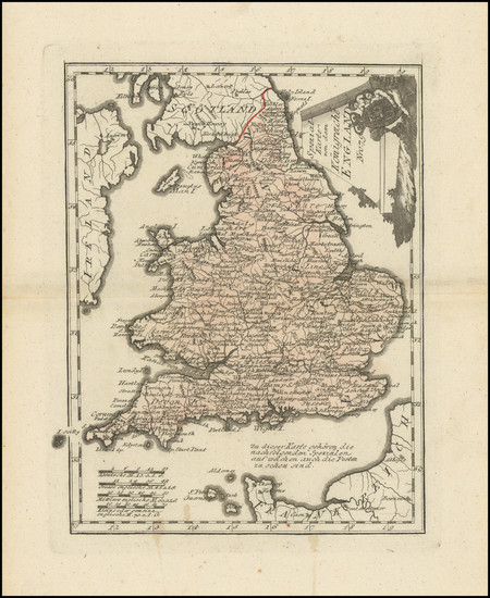
Vienna / 1789 circa
Size:
8.25 x 11 inches
Condition:
VG+
Stock#:
103945
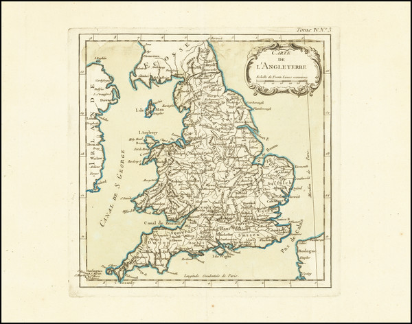
Place/Date:
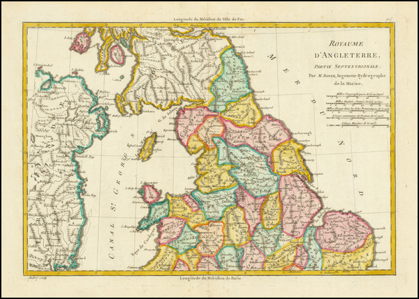
Paris / 1787
Size:
13.5 x 9.5 inches
Condition:
VG+
Stock#:
83659
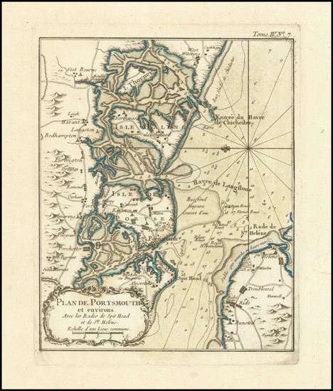
Place/Date:
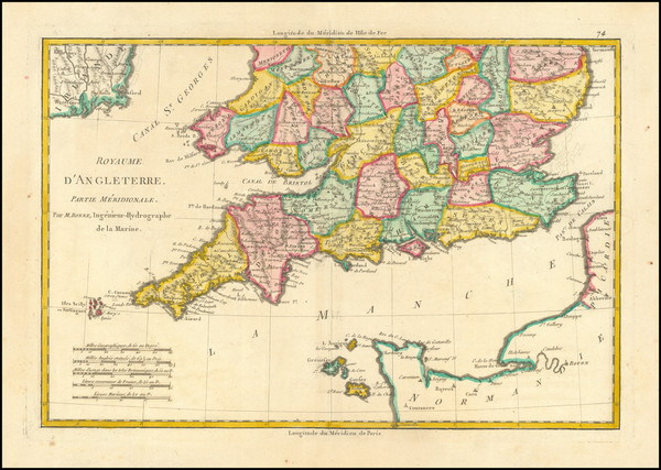
Paris / 1787
Size:
13.5 x 9.5 inches
Condition:
VG
Stock#:
83660
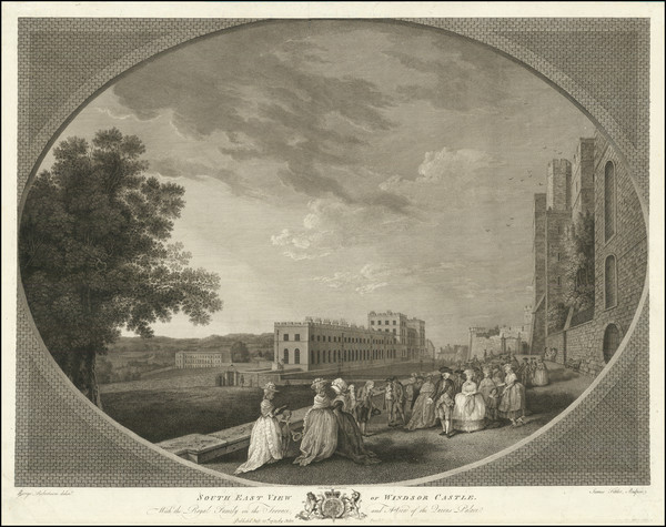
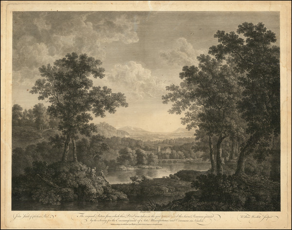
Place/Date:
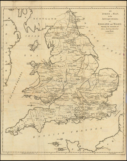
London / 1787
Size:
17.5 x 20.6 inches
Condition:
Good
Stock#:
96673
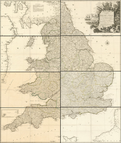
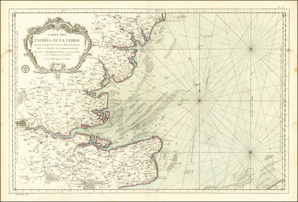
Place/Date:
Vienna / 1787
Size:
42.6 x 50.4 inches
Condition:
VG+
Stock#:
100876
Place/Date:
Catstock (Cattistock) / 1784 circa
Size:
(see description)
Condition:
VG
Stock#:
53556
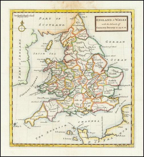
Phelips's 1784 antique map showing England.
Place/Date:
London / 1783
Size:
23 x 18.5 inches
Condition:
VG
Stock#:
85121
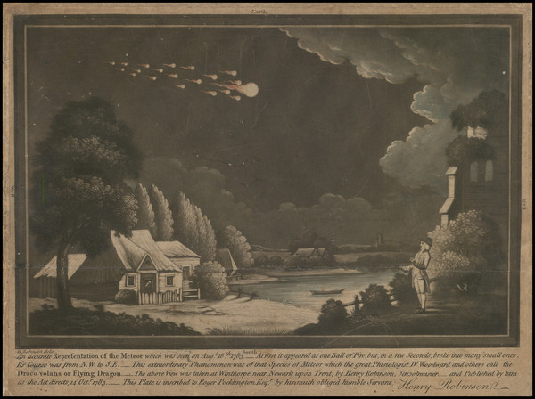
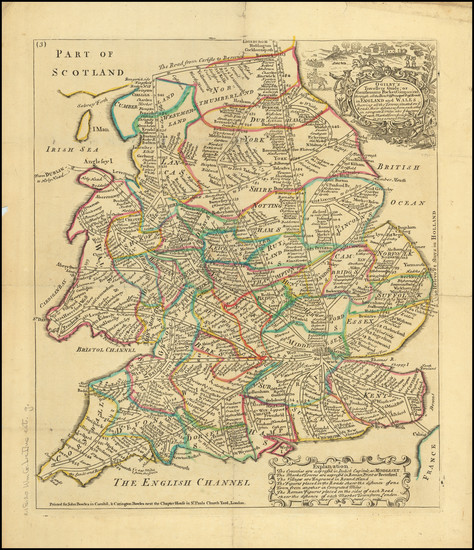
Place/Date:
n.p. (Winthorpe?) / 1783
Size:
9.75 x 6.5 inches
Condition:
VG
Stock#:
97046
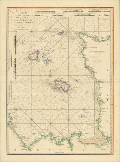
Place/Date:
London / 1781
Size:
20 x 27.5 inches
Condition:
VG
Stock#:
102203

Place/Date:
London / 1780
Size:
38 x 45 inches
Condition:
VG
Stock#:
56438
Sayer's 1780 antique map showing England.
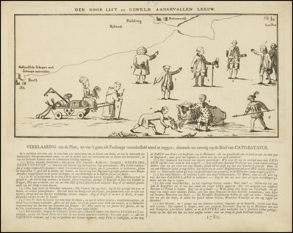
Place/Date:
Amsterdam / 1780
Size:
14.75 x 6.75 inches (envraving)
Condition:
VG
Stock#:
99580
Place/Date:
Venice / 1778
Size:
20.5 x 18.5 inches
Condition:
VG
Stock#:
89084
Place/Date:
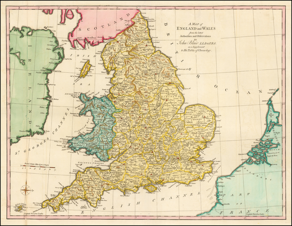
London / 1773
Size:
23 x 17 inches
Condition:
VG
Stock#:
51581
1773 antique Blair map showing England.
Place/Date:
Paris / 1764
Size:
9.25 x 9.25 inches
Condition:
VG+
Stock#:
76802
Place/Date:
Paris / 1764
Size:
7 x 8.5 inches
Condition:
VG
Stock#:
77076
Place/Date:
London / 1763
Size:
23 x 18 inches
Condition:
Good
Stock#:
99879
Place/Date:
Paris / 1759
Size:
34.5 x 23 inches
Condition:
VG
Stock#:
77484
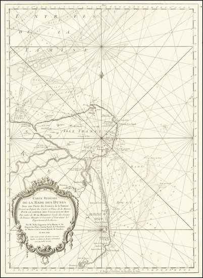
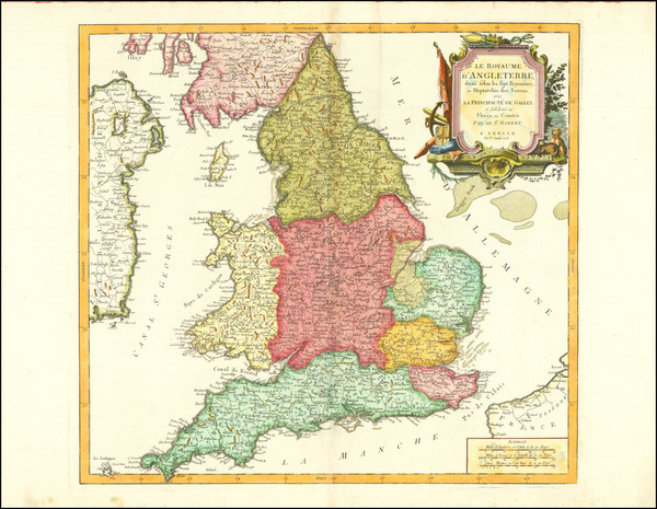
Place/Date:
Paris / 1757
Size:
16.5 x 23 inches
Condition:
VG
Stock#:
85226
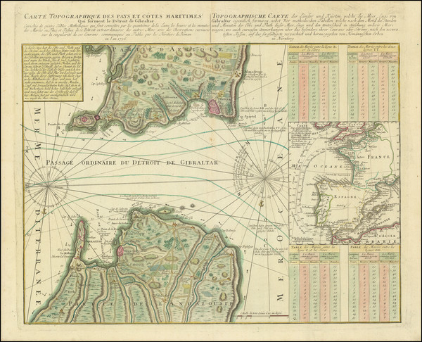
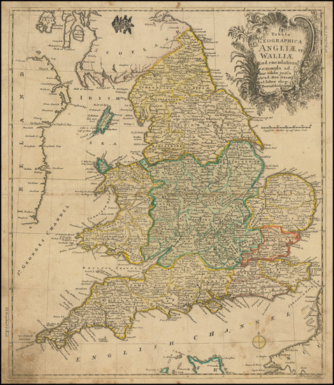
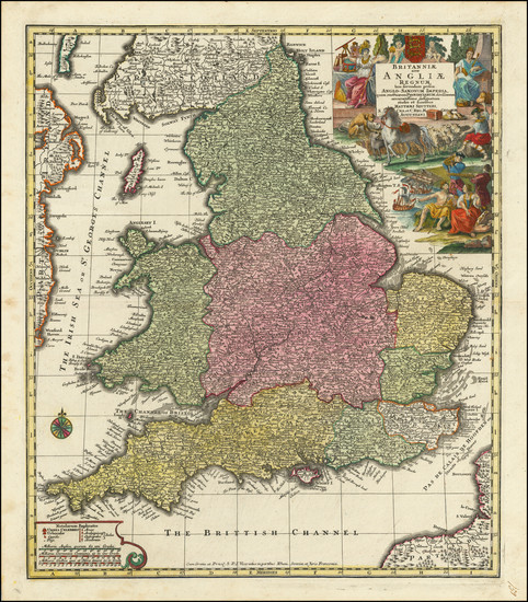
Place/Date:
Nuremberg / 1756
Size:
22.5 x 18.5 inches
Condition:
VG+
Stock#:
97137
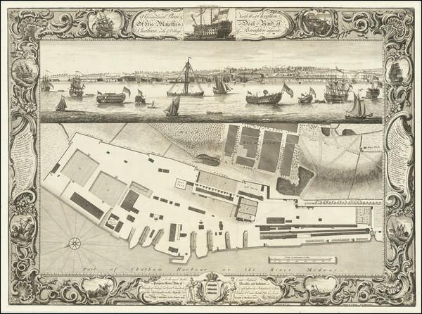
Place/Date:
London / 1755
Size:
25.5 x 18.5 inches
Condition:
VG+
Stock#:
84698
Place/Date:
Berlin / 1752
Size:
12 x 14 inches
Condition:
VG
Stock#:
102846
Place/Date:
Amsterdam / 1750 circa
Size:
37 x 22.25 inches
Condition:
VG
Stock#:
85129
Place/Date:
Amsterdam / 1750 circa
Size:
11.5 x 20 inches
Condition:
Stock#:
85217
Place/Date:
Amsterdam / 1745
Size:
22.75 x 18.5 inches
Condition:
VG+
Stock#:
92715
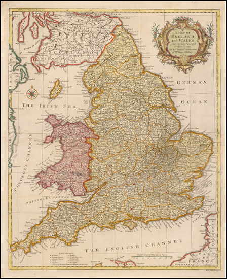
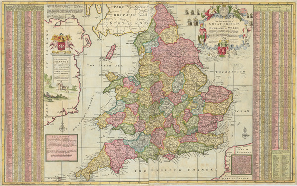
Place/Date:
London / 1740
Size:
18.5 x 15.5 inches
Condition:
VG+
Stock#:
51993
Rapin de Thoyras's 1740 antique map showing England.
Place/Date:
Augsburg / 1740
Size:
19 x 22.5 inches
Condition:
VG+
Stock#:
93408
Place/Date:
London / 1740 circa
Size:
38 x 24 inches
Condition:
VG
Stock#:
97674
Place/Date:
Amsterdam / 1734
Size:
23.5 x 20.5 inches
Condition:
VG
Stock#:
85127
Place/Date:
London / 1732
Size:
11 x 13 inches
Condition:
VG
Stock#:
87000
Place/Date:
London / 1730 circa
Size:
32 x 18 inches
Condition:
Good
Stock#:
80950
Place/Date:
Amsterdam / 1730 circa
Size:
23 x 20 inches
Condition:
VG+
Stock#:
85128
Place/Date:
Amsterdam / 1730 circa
Size:
11.5 x 19.5 inches
Condition:
VG
Stock#:
85218
Place/Date:
London / 1730 circa
Size:
10.5 x 8 inches
Condition:
VG+
Stock#:
95245
Rare map showing England by Moll, 1730.
Place/Date:
Leiden / 1729 circa
Size:
5 x 4.1 inches
Condition:
VG
Stock#:
99960

Place/Date:
London / 1728
Size:
10 x 14 inches
Condition:
VG
Stock#:
61539
Place/Date:
London / 1724 circa
Size:
10 x 11 inches
Condition:
VG
Stock#:
74275
Place/Date:
London / 1723
Size:
9.5 x 10.6 inches
Condition:
VG+
Stock#:
103265
Place/Date:
Nuremberg / 1720 circa
Size:
22.5 x 19 inches
Condition:
VG
Stock#:
54760
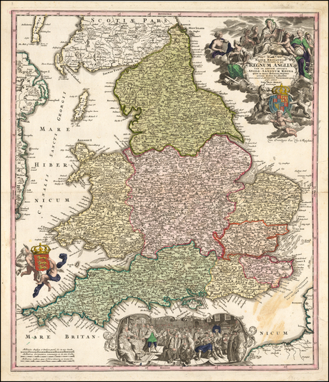
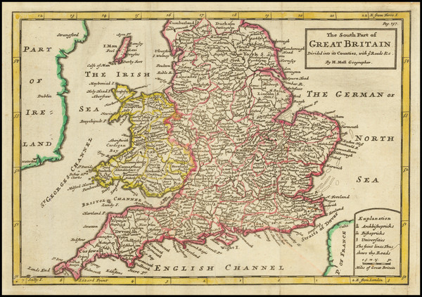
Antique map showing England by Homann, 1720.
Place/Date:
Amsterdam / 1720 circa
Size:
15 x 10.5 inches
Condition:
VG
Stock#:
99204
Place/Date:
Amsterdam / 1719
Size:
25 x 19 inches
Condition:
VG
Stock#:
31073
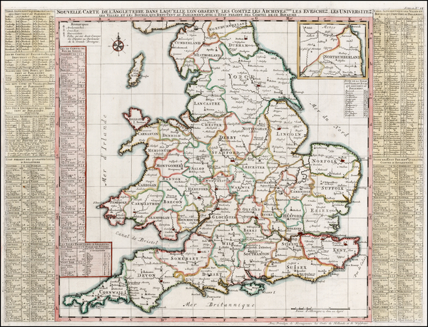
1719 rare Chatelain map showing England.
Place/Date:
Amsterdam / 1710 circa
Size:
22 x 18 inches
Condition:
VG+
Stock#:
51557
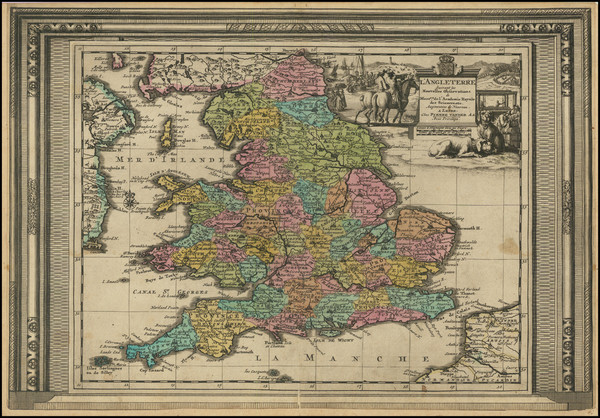
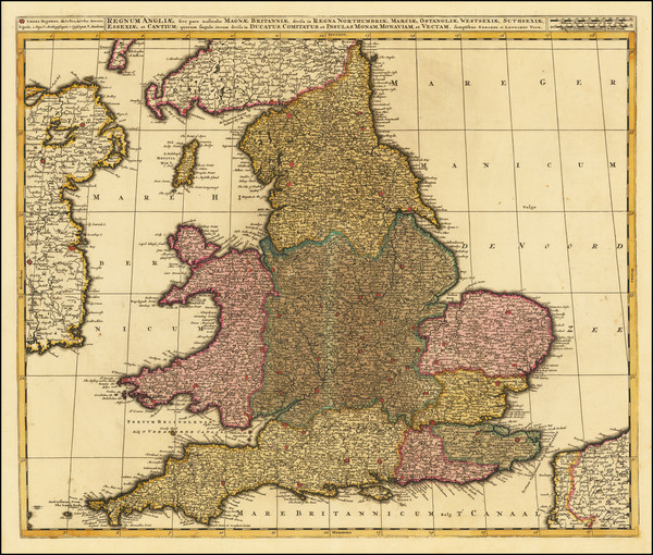
Antique map showing England by Mortier made in 1710.
Place/Date:
London / 1708
Size:
10 x 7 inches
Condition:
VG+
Stock#:
81572
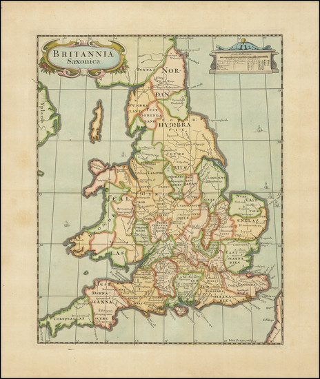
Place/Date:
Amsterdam / 1700 circa
Size:
23 x 19 inches
Condition:
VG
Stock#:
71391

Place/Date:
London / 1695
Size:
12 x 14.5 inches
Condition:
VG+
Stock#:
68932
Place/Date:
London / 1695
Size:
12 x 14.5 inches
Condition:
VG+
Stock#:
85220
Place/Date:
Amsterdam / 1693
Size:
37 x 23 inches
Condition:
VG
Stock#:
66551
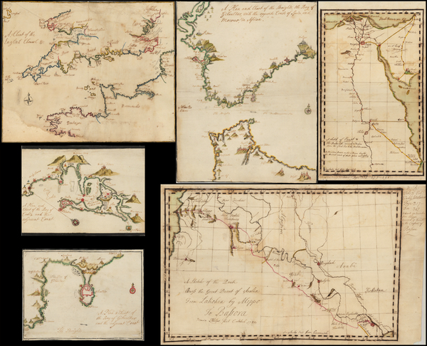
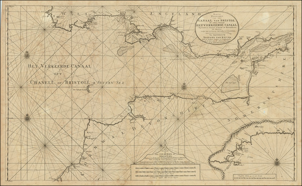
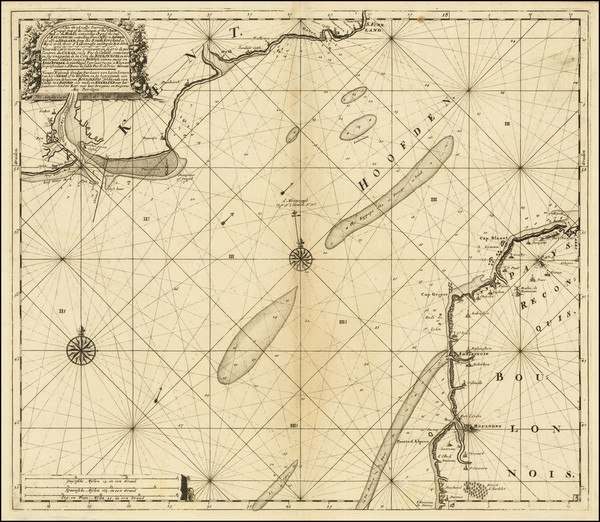
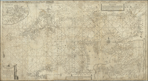
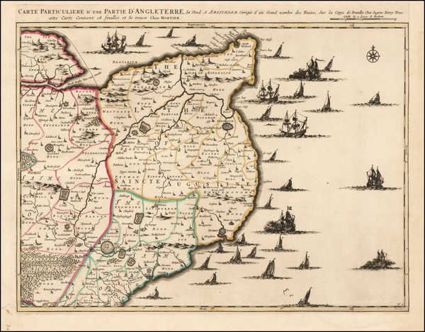
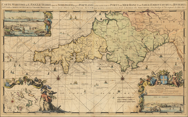
Antique sea chart of the Southwest Coast of England / Cornwall
Place/Date:
Amsterdam / 1693
Size:
34.5 x 18 inches
Condition:
VG+
Stock#:
73808
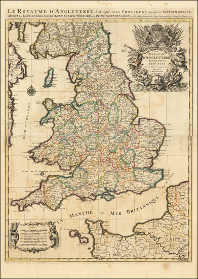
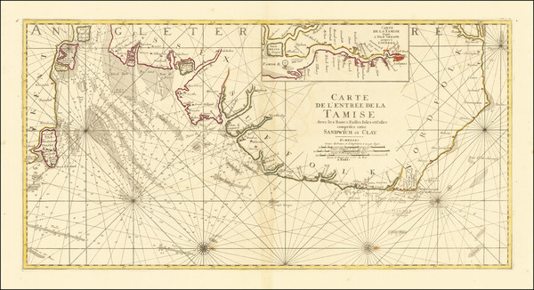
Place/Date:
Paris / 1693
Size:
23 x 30.5 inches
Condition:
VG
Stock#:
93509
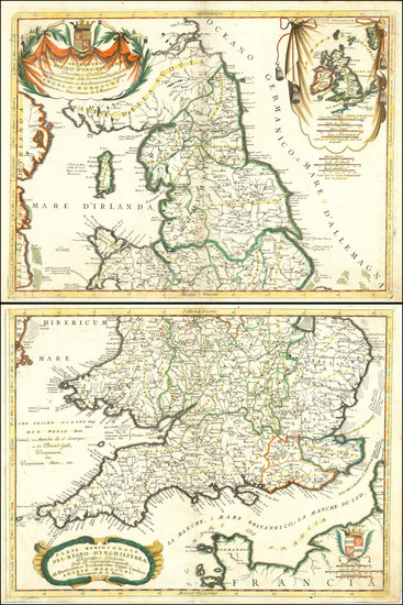
Place/Date:
Venice / 1690
Size:
24 x 18 inches (each sheet)
Condition:
VG
Stock#:
89516
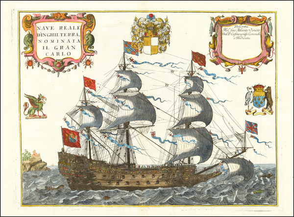
Place/Date:
Venice / 1688
Size:
23 x 17.5 inches
Condition:
VG+
Stock#:
94401