|
||

|

|
|

|
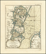
Attractive French map of England and Wales, with the Isles of Angelsey and Man also shown.
Minor detail is shown in Ireland and northern France.
This map originally appeared in Bellin's Le Petit Atlas Maritime. This nautical atlas contained numerous detailed maps which showed maritime detail of the various harbors of the world, with some regional maps to provide context.
Jacques-Nicolas Bellin (1703-1772) was among the most important mapmakers of the eighteenth century. In 1721, at only the age of 18, he was appointed Hydrographer to the French Navy. In August 1741, he became the first Ingénieur de la Marine of the Dépôt des cartes et plans de la Marine (the French Hydrographic Office) and was named Official Hydrographer of the French King.
During his term as Official Hydrographer, the Dépôt was the one of the most active centers for the production of sea charts and maps in Europe. Their output included a folio-format sea atlas of France, the Neptune Francois. He also produced a number of sea atlases of the world, including the Atlas Maritime and the Hydrographie Francaise. These gained fame and distinction all over Europe and were republished throughout the eighteenth and even in the nineteenth century.
Bellin also produced smaller format maps such as the 1764 Petit Atlas Maritime, containing 580 finely-detailed charts. He also contributed a number of maps for the 15-volume Histoire Generale des Voyages of Antoine François Prévost.
Bellin set a very high standard of workmanship and accuracy, cementing France's leading role in European cartography and geography during this period. Many of his maps were copied by other mapmakers across the continent.
![[East Coast of England - Great Yarmouth to Newcastle] Eijgentlijck ontwerp vande Noortcuste van Engelandt, tuschen Iarmunen en het Coggen eijlandt...](https://storage.googleapis.com/raremaps/img/small/62061.jpg)
![(Second World War - The Blitz) Ubersichtskarte Grossbritannien und Irland [General map of Great Britain and Ireland]](https://storage.googleapis.com/raremaps/img/small/89057.jpg)
![[ England ] Das künigreich Engelland mit dem anstossenden reich Schottland so vor zeiten Albion und Britannia han geheissen.](https://storage.googleapis.com/raremaps/img/small/95777.jpg)
![[ England & Wales ] Map of the Hills, Rivers, Canals, and Principal Roads, of England and Wales, with the Various Lines of Railroads and Exhibiting Most of the Places Whose Situation has been ascertained by the Stations and Intersections of the Trigonometrical Survey, Compiled by A. Arrowmsmith. Hydrographer to His Majesty.](https://storage.googleapis.com/raremaps/img/small/99932.jpg)
![(Second World War - Operation Sea Lion) Stadtdurchfahrtplane England (ohne London) 2. verbesserte Auflage [England transit maps without London]](https://storage.googleapis.com/raremaps/img/small/85951.jpg)