|
||

|

|
|

|
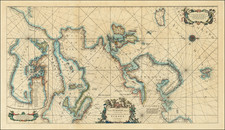
Napoleonic Era Collection of Separately Published Maps of Central Europe
Housed in two red Morocco slip cases with the arms of the House of Bourbon-Orleans, the present set of 12 maps is an interesting collection of separately published maps focused in on the broader German and Prussian Empire, the German ancestral lands of King George of England, several areas of Switzerland and the areas in northeastern Germany and contiguous parts of southwestern Poland.
A clue to the ownership may be the inclusion of the map of the Canton of Raetia (dated 1802), a short-lived canton of the Helvetic Republic from 1798 to 1803, corresponding to modern Graubünden and composed of the Free State of the Three Leagues. Until 1799, the canton was administered by the central government of the Helvetic Republic. With the Napoleonic Act of Mediation in 1803, the canton was reestablished as Graubünden, finally incorporating the Three Leagues into a decentralized and federal Switzerland.
As most of the maps were issued between 1800 and 1804, but with maps dating to as early as 1771, it would seem that the maps, which are contained in a box entitled "Allegmagne Cartes Particulieres" was likely reflective of a more or less chronological acquisition scheme, ie., the maps were added as acquired in the early 19th Century, and likely reflective of the owner's interest in current events in the Napoleonic Wars, etc.
The addition of the rare Luffman map of the hereditary lands of King George III is extremely rare. King George III held the title "King of France" until 1801, a title that dated back to the 14th Century. In October 1801, he made peace with the French, and in 1802 signed the Treaty of Amiens, a peace which lasted only until October 1803. The Luffman map seems to have been made in March 1801 to commemorate King Geoge III's renouncing his use of the title King of France.
List of maps:
- [ Germany, Poland, Austria, Northern Italy, etc ] D.F. Sotzmann, 1803: Generalkarte von Deutscland, der Batavischer und Helvetischen Republik, Ober und Mittel Italien und dem ostlichen Theil der Franzosischen Republik, in zwey Sectionen . . . (W x H 29.75 x 42.3 in)
- [ Duchy of Lauenburg] Berlin Academy of Science / Pasquier Jean Valet, 1771: Ducatus Lauenburgicucs Ad Statum Hodiernum Conscriptus cum fluvio Steckenitz ex Albi in mare balticum per cataractas constructas jam navigabili . . . 1771 (18 x 21.75 in)
- [ Duchy of Magdeburg etc. / Central Germany ] Special Karte vom Herzogthum Magdeburg der Grafschaft Mansfeld, den Furstenthumern Anhalt und Blankenburg, under der Abtey Quedlinburg, nebst dem grosten Theil der Altemark, des Furstenth: Halberstadt, der Grafs Weringerode in III Sectionen mit Genehmhaltung der Konigs Academie der Wissenschaftgen herausgegeben im Jahre 1800 von D.F. Sotzmann . . . (29 x 37.25 in)
- [ Duchy of Holstein, Hamburg, Lubeck etc ] William Faden, 1804. A Map of the Duchy of Holstein, with the Territories of the Imperial Towns of Hamburg & Lubek, The Bischoprick of Eutin, Laid down from Fischer's Map and Corrected by B__ (23.2 x 18.5 in)
- [ Silesia / Poland ] Anon., 1804 Karte von Schleisien . . . 1804 (28 x 31.1 in).
- [ Halberstadt / Harz ] A.F. Treuer, C.L. V Oesfeld, Simon Schropp, 1794. Karte vom Fursthenthum Halberstadt, den Grafschaften Wernigerode u: Hohenstein und der Abtey Quelingburg . . . 1788 (18.6 x 26 in).
- [ Saint Gothard Massif, Switzerland ] Charles Francois Exchaquet, Basle. Carte Petrogrographique du St. Gothard. . . .1791 (20.25 x 16.75 in)
- [ Rhetia or Grissons Canton ] Chretien de Mechel, Basle. Carte general du Canton Helvetique de la Rhetie autrefois Republiqe. des Grisons . . . 1802 (25.5 x 18.75 in)
- [ Post Map of Germany, Austria, Poland, Central Europe ] Carl Jack, 1801. Neueste Post Karte von Deutschland und dessen angrenzenden Landern . . . .1801 (31 x 21.4 in).
- [ German Empire ] William Faden, 1788. A New Map of the German Empire and the Neighboring States with their Principal Roads, Originally Published by the Royal Academy of Berlin . . . 1788 (30 x 25 in)
- [ Electorate of Hanover ] John Luffman, March 1801. A Map of the German Dominions of His Majesty King George the Third With the Principality of Brunswick-Wolfenbuttle and the Bishoprick of Heldesheim forming together the Electorate of Hanover. (13.5 x 19 in)
- [ Prussian States ] D.F. Sotzmann, 1802. General Karte von den saemmtlichen Kongl. Preussischen Staaten, welche zugleich also Postkarten durch die Lander der Preussischen Monarchie . . . in XVI Battern . . . 1802 (54.5 x 49.5 in)
![Europa Vetus [Ancient Europe]](https://storage.googleapis.com/raremaps/img/small/82034.jpg)