


|
||

|

|
|

|
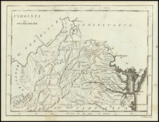
Navigate the Mid-Atlantic Courtesy of Sun Oil Company
A brochure designed by Rand McNally & Co. for the Sun Oil Company to showcase the routes that connect Delaware, Maryland, Virginia, and West Virginia. The maps are vivid, using different colors to illustrate the locations of highways, paved roads, roads under construction, and various points of interest. This map showcases the many roads that connect the metropolitan cities of the area to the rest of the country.
Inside, the pamphlet features three different maps that may be useful for a visitor to the area. The best map in this group is a colorful map of historic and scenic sights in the depicted states. Each location is accompanied by a fine illustration with text that describes what the site is and its location. Some of the featured locations include the ancient Grave Creek Mound, Thomas Jefferson's home of Monticello, Robert E. Lee's plantation, and the National Mall. These locations are numbered and marked on the map to help navigation. Above this map are two metropolitan maps of Baltimore and Washington D.C. which mostly feature the downtown area and surrounding neighborhoods. Similar to the rest of the brochure, these maps feature general points of interest that visitors would likely want to see.
A fine brochure filled with vivid maps of the Mid-Atlantic to encourage automobile tourism in the area.
Rand McNally & Co. is a large American map and navigation company best known for its annual atlases. The company got its start in 1856, when William Rand opened a print shop in Chicago. He was joined in 1858 by a new employee, Andrew McNally. Together, the men established their namesake company in 1868. Originally, the company was intended to print the tickets and timetables for the trains running to and through Chicago; their first railway guide was published in 1869.
By 1870, they had shifted from just printing to publishing directories, travel guides, and newspapers. Their first map appeared in 1872 in a railway guide. The map was produced using a new wax engraving method, a cheaper process that gave the company an edge.
By 1880 Rand McNally had entered the education market with globes, wall maps, and geography texts for students. In 1923, Rand McNally published the first Goode’s World Atlas, named after its editor, Dr. J. Paul Goode. For generations afterward, this would be the standard classroom atlas.
In 1899, William Rand left the company, but McNally and his family remained, controlling the company for over a century. In 1904, they published their first road map intended for automobiles and by 1907 were publishing Photo-Auto Guides, which combined photography and mapping to help drivers. In 1924, they produced the Auto Chum, a precursor to their famous road atlases. Rand McNally would remain the leader in road maps and atlases throughout the twentieth century.
In 1937, Rand McNally opened its first store in New York City. Ever on the frontier of technology, Rand McNally pioneered the scribing process for printing tickets in 1958 and printed their first full-color road atlas in 1960. Arthur Robinson developed his now-famous projection of Rand McNally in 1969. By the 1980s, the company was exploring digital reproduction and digital databases of maps for truckers. In the 1990s, they lead the charge to develop trip-planning software and websites. Today, most of its products are available online or in a digital format, including maps for tablets and phones.
![(Civil War) Stanford's Map of the Seat of War in America. Sheet I. [Mid-Atlantic States]](https://storage.googleapis.com/raremaps/img/small/96007.jpg)