|
||

|

|
|

|
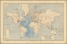
Comparative Views of Remarkable Geological Phenomena by A.K. Johnston, F.R.G.S., is an illustrative representation of significant geological formations and phenomena, providing details of the heights and topographical distinctions of several prominent volcanic terrains. The map includes plans of renowned volcanoes such as Pichincha, Antisana, Vesuvius, and Etna, as well as topographic insights into islands like Teneriffe, South Keeling, and Ascension. Originally published in The Physical Atlas of Natural Phenomena by Alexander Keith Johnston in 1857, this engraving offers a fascinating perspective on the grandeur and complexity of geological marvels during the mid-19th century.
The mid-19th century witnessed an invigorated interest in the natural sciences, with geology and topography emerging as prominent disciplines. The era observed numerous exploratory ventures and surveys, further deepening the understanding of Earth's varied landscapes. Johnston's comparative views come at a juncture of this period, capturing the zeitgeist of scientific fervor and inquisitiveness, drawing upon surveys from eminent figures like A. von Humboldt, H. Abich, and Leopold von Buch.
The engraving's representation of various volcanoes, namely Pichincha, Antisana, Vesuvius, and Etna, lends a perspective on the active volcanic realms of the time. These illustrations, replete with details like hachures and spot heights, not only indicate geographical expanse but also relay the magnitude of these natural wonders, contrasting their elevations against sea level. The attention to scales for each site—whether 1:200,000 for Pichincha and Antisana or 1:20,000 for the craters of Etna—underscores the precise nature of these surveys.
Island topographies, including Teneriffe, South Keeling, and Ascension, introduce a distinct layer to this comparative atlas. These visual renditions shed light on the unique geological phenomena of these regions, emphasizing their distinctiveness. For instance, the depiction of Ascension Island provides both a macroscopic view through the chart and a nuanced outlook through the perspective from the mountain road. Similarly, the overview of Teneriffe, with its peak and surrounding crater, affords an unparalleled glimpse into the island's geological composition.
Concluding the series, Johnston's map features a comparative elevation of principal active volcanoes, drawing a parallel across these colossal geological entities. The inclusion of plans such as Arthur's Seat and the Crater of Cedee, accompanied by a reference to "Samson's Ribs" and the mention of "Geology no. 11," further signifies the comprehensiveness of the atlas. All in all, this illustrative array, originating from Johnston's 1857 Physical Atlas, stands testament to the rich geological knowledge and cartographic prowess of the 19th century.
![[Separately Published Example!] Map of the United States of America. Designed to illustrate the Geological Memoir of Wm. Maclure Esq.](https://storage.googleapis.com/raremaps/img/small/90048.jpg)
![[Run of 6 Volumes] Report Upon Geographical Surveys West of the 100th Meridian](https://storage.googleapis.com/raremaps/img/small/74064.jpg)