|
||

|

|
|

|
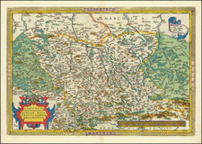
Alain Manesson Mallet's Cercle de Haute Saxe, published in Frankfurt in 1686, is a miniature map presenting a thorough rendering of the region known as the Upper Saxon Circle. This area, a significant administrative division within the Holy Roman Empire, boasts a rich historical and cultural context.
It outlines political boundaries, designates principal towns and cities, and indicates significant geographic features. The compact scale of the map does not detract from its informational value, but instead highlights the precision and dedication inherent to Mallet's cartographic approach.
With Cercle de Haute Saxe, Alain Manesson Mallet offers an intricate cartographic portrayal that extends beyond mere geographical representation, capturing the intricate political landscape of the Upper Saxon Circle during a notable period of historical transformation. It serves as a testament to Mallet's precise cartographic style and his contribution to the geographic understanding of the Holy Roman Empire.
Alain Mannesson Mallet (1630-1706) was a French mapmaker and engineer who served in the armies of Louis XIV. After rising through the ranks, Mallet was appointed as Inspector of Fortifications, a job which also required mathematical skills and which made him a competent military engineer. Eventually, he joined the court of Louis XIV at Versailles, where he taught math and focused on writing.
Mallet is best known for his Description de L’Univers, first published in 1683, in five volumes. A wide-ranging geographical work, the Description included textual descriptions of the countries of the world, as well as maps of the celestial sky and the ancient and modern worlds. The Description continued to be published until the early eighteenth century. He also published a work in three volumes on warfare (1684) and a primer on geometry (1702).
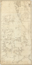
![[ Mecklenburg-Vorpommern, Rugen, Bornholm, Lubeck, Sonnderborg,Svendborg, Zealand ] Beschrijvinghe vant zuijder deel vande Belt, en hoemen de Custen van Mekeleborch Pomeren, met de Lande daer tegen over tusschen emeren en Bornholm geleghe besijlen en alle Reve en Sanden daer ontrent Shouwen Sal.](https://storage.googleapis.com/raremaps/img/small/61988.jpg)
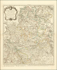
![Turingiae Noviss Descript. Per Iohannem Mellinger Halens [with] Misniae et Lustaiae Tabula Descripta a. M Bartholomeao Sculteto Gorlit.](https://storage.googleapis.com/raremaps/img/small/61448.jpg)