
This item has been sold, but you can enter your email address to be notified if another example becomes available.


|
||

|

|
|

|
Stock# 95413
Description
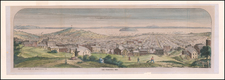
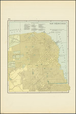
Fine vintage map of the central portion of San Francisco Bay, issued by NOAA, and showing downtown San Francisco in detail.
This is the 26th edition of the map, published in 1957, and showing the bay in extremely accurate navigable detail. The map stretches from Marin in the north to Colma in the south, and also shows Oakland, Berkeley, and Richmond. Numerous additional details, scattered throughout the map, add to its usefulness for navigation.
Condition Description
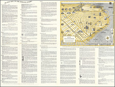
Shoal depths pasted over map. Small amount of lingering smoke smell, but mostly dissipated and will continue to do so.
![[San Mateo, California] St. Matthews Hall, Church & Rectory, San Mateo, California, Rev. A.L. Brewer, Rector](https://storage.googleapis.com/raremaps/img/small/88381.jpg)