|
||

|

|
|

|
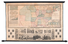
Second Recorded Copy; The Only One in America.
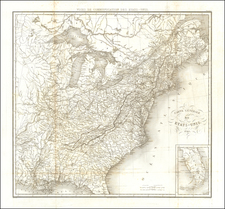
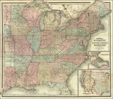
J.N. Taylor's New Rail Road Map of the United States and Canadas, published in 1864, provides an extensive and detailed view of the railway networks across the United States and Canada, during a pivotal period in North American transportation history. Featuring insets of key urban vicinities and an image of "Union Depot Indianapolis," this hand-colored lithographed wall map, dissected and mounted on linen, extends from Minnesota in the northwest to Louisiana in the southwest, and to northern Florida and southern Maine in the east. It captures the burgeoning railway infrastructure and reflects the ambition and dynamism of the era.
In the mid-19th century, railroads were transforming the landscape of North America, revolutionizing transportation, industry, and urbanization. Taylor's map documents this transformation by illustrating the extensive railway system, including key routes to gold mines and the Pacific. The inset titled "Map of the United States West of the Mississippi" highlights proposed railroads, overland mail, telegraph, stage, wagon, and emigrant routes, showcasing the multifaceted nature of transportation and communication networks of the time.
The map's additional insets focusing on the vicinities of major cities such as Boston, New York, Philadelphia, Baltimore, Washington, Indianapolis, Louisville, Cincinnati, Pittsburgh, Chicago, and St. Louis further demonstrate the urban interconnectedness facilitated by rail. The inclusion of an image of "Union Depot Indianapolis," emphasizing the fifty-two trains arriving and departing daily, serves as a vivid representation of the hustle and bustle of the railway age, particularly as commerce and population shifted westward.
As a cartographic document, Taylor's map offers more than mere geographical information. It provides a snapshot of the technological and economic advancements of the era. The railroad's impact on the development of cities, industry, commerce, and the opening of the western frontier is encapsulated in this map, illustrating the vital role railroads played in shaping the modern nation. The comprehensive nature of the map, coupled with the artistic and technical skills employed in its creation, makes it an invaluable historical artifact, bearing witness to an age of rapid expansion and innovation.
Rarity
Very rare. OCLC locates a single example, at the British Library. Not in Rumsey. Not in Modelski 1975 nor 1984. Not in RBH nor OldMaps.com.
![(U.S. Civil War) Panorama des Kriegsschauplatzes [Bird's-Eye View of the Theater of War Showing Virginia, Maryland, Deleware & Columbia]](https://storage.googleapis.com/raremaps/img/small/99760.jpg)