|
||

|

|
|

|
Stock# 65178op
Description
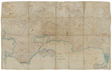
Highly detailed map of Bordeaux, published in Bordeaux in 1874.
The map is oriented with east at the top, and includes a detailed index on either side of the map.
The map illustrates the major buildings and squares, along with the town lay out along the west side of the Garonne River. Includes train lines, bridges, etc.
Condition Description
Dissected and laid on linen.
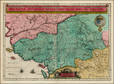
![[ Salses-le-Château, France ] Salces en Roussillon.](https://storage.googleapis.com/raremaps/img/small/37766.jpg)