
This item has been sold, but you can enter your email address to be notified if another example becomes available.


|
||

|

|
|

|
Stock# 59205
Description
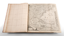
Wonderful early coast to coast map of the United States from Woodbridge's Geography.
Shows a large and rare early appearance of Oregon Territory, massive Missouri Territory and Great American Desert.
The Northwest Territory, Michigan Territory, Arkansas Territory and other early configurations are shown.
Texas is listed as Spanish Province of Texas. Inset of the Northern States.
Condition Description
Some soiling and foxing. Laid on Library linen, with stamps on front and back from the Rochester Historical Society.
![[ English Plantations in North America ] A New Map of the most Considerable Plantations of the English In America Dedicated to His Highness William Duke of Glocester.](https://storage.googleapis.com/raremaps/img/small/98233.jpg)


![[ British Colonies in North America ] Carte Nouvelle de L'Amerique Angloise contenant tout ce que les Anglois possedent sur le Continent de L'Amerique Septentrionale . . .](https://storage.googleapis.com/raremaps/img/small/100143.jpg)
![Louisiana [Large-Paper Example]](https://storage.googleapis.com/raremaps/img/small/83278.jpg)