The item illustrated and described below is sold, but we
have another example in stock. To view the example which
is currently being offered for sale, click the
"View Details" button below.
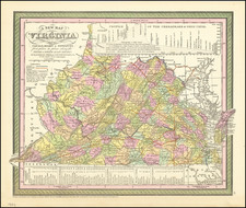
1854 Thomas, Cowperthwait & Co.
$ 245.00


|
||

|

|
|

|
Stock# 55161

![(American Revolution - Virginia Privateering) Manuscript Document Concerning the American Privateer Grand Turk, Captured Near Scotland's Fair Isle by Michael Griff [The Capt. of the Privateer Michael Griff declares as follows ...]](https://storage.googleapis.com/raremaps/img/small/82328.jpg)