|
||

|

|
|

|
Japanese Map on Mercator's Projection Showing the Sea of Joseon (Korea)
Interesting 1852 (Kaei 6) Japanese world map by Suido Nakajima, likely influenced by Commodore Perry's arrival in Japan.
Presented on a Mercator projection, this map marks a significant advancement in Japanese world cartography and a far more sophisticated adaptation of western cartographic standards than is evidenced in most earlier Japanese world maps. No longer reliant on 17th century Dutch maps acquired via the Dutch East India Company's (VOC) trade concession in Nagasaki, the Japanese have here abandoned many of the antiquated cartographic notions, such as the island of California, which were common in Japanese maps of the previous decades. Japanese cartographers may have been motivated to update their traditional world view in the light of the explosion of cartographic ideas associated with the arrival in Edo Harbor of the American Commodore Matthew Perry in the same year this map was published.
As a whole this map offers a sophisticated cartographic presentation of the world embracing the most up to date cartographic knowledge available in the mid-19th century. Though adapted to the Japanese printing style, this map presents a generally accurate world view. British Claims to Washington and British Columbia are noted in North America, Australia and the Pacific are accurately rendered, as are the discoveries of Vitus Bering and James Cook in the Arctic, and Africa is clearly pre-Speke.
The disputed Sea of Korea / Sea of Japan / East Sea is here labeled as the Sea of Joseon (Korea), which some scholars have suggested as demonstrating Japanese acceptance of the 'Sea of Korea' convention.
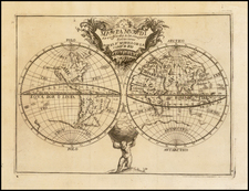
Four hemispheres appear in the lower left quadrant, from left, the southern, northern, eastern, and western. All are on a stereographic projection. The map is printed on woodblock and hand colored in vivid, blues, greens, oranges, and yellows.
A fine example of the redefined Japanese cartography style of the later Tokugawa period.
Description provided by Kevin Brown of Geographicus Rare Antique Maps.
![[ Ancient World ] Aevi Veteris, Typus Geographicus](https://storage.googleapis.com/raremaps/img/small/85526.jpg)
![[Spectacular Set of Wall Maps of the Continents Dedicated to King Charles II of England, &c.]](https://storage.googleapis.com/raremaps/img/small/93614.jpg)