This item has been sold, but you can enter your email address to be notified if another example becomes available.


|
||

|

|
|

|
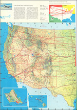
Stock# 3438
Description
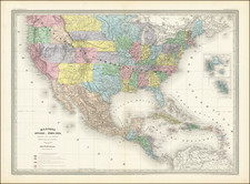
Excellent map of the US on the eve of the Civil War. The treatment of the western states and territories is particularly noteworthy. Oregon & Washington extend to the Rocky Mountains. New Miexico is above Arizona (Baylor Line). Nevada is shown west of Utah, but the delineation is the western shore of the Great Salt Lake, off by several degrees at the time although foreshadowing the ultimate eastern push of this line by Congress in the early 1860s. Kansas extends into modern Colorado. Massive Nebraska Territory includes all of Wyoming, Montana and part of the Dacotas. Classic small Dacota Territory is just appearing.