|
||

|

|
|

|
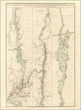
Extraordinary map of the mining regions in the Southern District of West Kootenay, British Columbia, prepared by Charles E. Perry and drawn by T.P. O'Farrell.
The map consists of a main map of the entire "Southern District," and inset maps of the major mining regions, including Trail Creek Mining Camp; Ainsworth Mining camp; Kaslo-Slocan Mining Camp; Nelson mining camp; and "Our position on the planet." The focal point of the map is the various mining regions, with the smaller maps presenting a detailed topographical look at the relevant regions, with a kely identifying the claims itne Slocan area. The map shows roads, trails, railways, telegraph lines, towns, mining camps, claims, steamship lines, etc.;
The map is one of the earliest obtainable printed maps to focus on the Kootenay mining regions. OCLC notes only two town plans (Nelson and a portion of Salmo) which pre-date this map. The Streeter Sale did not include any maps of the Kootenay region and we were not able to find a single auction records for a map focused on the Kootenay region. The most recent offering for a Kootenay related map which we could locate was a map offered in 1964 by Edward Eberstadt (Catalog 164), offering a copy of Charles A. Perry's Map of the Cariboo, Yale, Kootenay gold and silver districts; the largest and richest of silver-lead ore in the world. . . published in 1895 for $125.00.
The first gold strike in the Kootenay region occured in 1863, at the confluence of the Wild Horse and Kootenay Rivers in the East Kootenay region, which resulted in the Wild Horse Gold Rush, which resulted in the region's first gold rush town, Fisherville, B.C. When it was discovered that the original town site was on a rich deposit, it was moved and the new town's site was officially named Kootenai (though still known as Fisherville). Galbraith's Ferry was established across the Kootenay near Fort Steele to facilitate crossing by the incoming rush of prospectors and merchants. Most of the gold was mined out by 1864.
Other gold rushes on the Moyie and Goat Rivers, tributaries of the Kootenay, were followed by the discovery of silver and galena mines in the Kootenay Lake and Slocan Valley areas (Silvery Slocan), leading rapidly to the settlement of the region and the creation of various "silver city" boomtowns, notably Nelson, at the outlet of Kootenay Lake, Kaslo, midway up its north arm, New Denver, Silverton, Slocan City and Sandon in the 1880s and 1890s. By 1889, a smelter had been constructed close to the mouth of the Kootenay, near Revelstoke, to process ore from the mines. Serving the mines and settlers, steamer companies plied the Kootenai River from Bonner's Ferry, Idaho to Nelson and to the Lardeau or "Lardo" district at the north end of Kootenay Lake, and also on the upper Kootenay River between the Cranbrook-Fort Steele area and points in Montana.
OCLC lists one example (University of British Columbia). We also note a copy in the Vancouver Public Library.
![[Vancouver] Fraser River and Burrard Inlet](https://storage.googleapis.com/raremaps/img/small/68029.jpg)
![[ New France - Pierre Biard's Letter ] Missio Canadensis [in] Annuæ Litteræ Societatis Jesu Anni MDC.XI.](https://storage.googleapis.com/raremaps/img/small/84352.jpg)