|
||

|

|
|

|
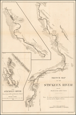
Detailed map of the region explored by Captain Richard N. Back, documenting his Arctic exploration in 1833 and 1834.
The present map, which appeared in Volume the Sixth, 1836, Part 1 of The Journal of the Royal Geographical Society of London, meticulously records the geographical findings and route of the expedition aimed at charting previously unexplored parts of the Canadian Arctic.
Admiral Sir George Back (6 November 1796 – 23 June 1878), the leader of this expedition, had a notable naval and exploration career starting from his early service in the HMS Arethusa in 1808. After various naval engagements and after being held prisoner in France, Back participated in Arctic expeditions with John Franklin before leading his own.
The 1833-1834 expedition, detailed in this map, was initiated to locate the missing Arctic explorer John Ross and explore uncharted territories. Departing England in February 1833, Back reached Great Slave Lake in August and established winter quarters at Fort Reliance. He discovered and mapped the Back River, known from Indigenous reports but unseen by Europeans, in late August 1833.
In June 1834, Back departed from Fort Reliance, navigating through areas such as Artillery Lake and Clinton-Colden Lake, and meticulously charting the course along the Back River. His journey continued through territories marked by numerous rapids until reaching Chantrey Inlet on 23 July, where he confirmed the sighting of King William Island before returning.
The map illustrates significant geographical and hydrographical features identified during the expedition, including lakes, rivers, rapids, and coastal lines, with detailed annotations of the route taken by Back and his team. The expedition concluded with Back’s return to Fort Reliance on September 27, 1834, and eventually to England on September 8,1835.
The Arrowsmiths were a cartographic dynasty which operated from the late-eighteenth century to the mid-nineteenth. The family business was founded by Aaron Arrowsmith (1750-1823), who was renowned for carefully prepared and meticulously updated maps, globes, and charts. He created many maps that covered multiple sheets and which were massive in total size. His spare yet exacting style was recognized around the world and mapmakers from other countries, especially the young country of the United States, sought his maps and charts as exemplars for their own work.
Aaron Arrowsmith was born in County Durham in 1750. He came to London for work around 1770, where he found employment as a surveyor for the city’s mapmakers. By 1790, he had set up his own shop which specialized in general charts. Arrowsmith had five premises in his career, most of which were located on or near Soho Square, a neighborhood the led him to rub shoulders with the likes of Joseph Banks, the naturalist, and Matthew Flinders, the hydrographer.
Through his business ties and employment at the Hydrographic Office, Arrowsmith made other important relationships with Alexander Dalrymple, the Hudson’s Bay Company, and others entities. In 1810 he became Hydrographer to the Prince of Wales and, in 1820, Hydrographer to the King.
Aaron Arrowsmith died in 1823, whereby the business and title of Hydrographer to the King passed to his sons, Aaron and Samuel, and, later, his nephew, John. Aaron Jr. (1802-1854) was a founder member of the Royal Geographical Society (RGS) and left the family business in 1832; instead, he enrolled at Oxford to study to become a minister. Samuel (1805-1839) joined Aaron as a partner in the business and they traded together until Aaron left for the ministry. Samuel died at age 34 in 1839; his brother presided over his funeral. The remaining stock and copper plates were bought at auction by John Arrowsmith, their cousin.
John (1790-1873) operated his own independent business after his uncle, Aaron Arrowsmith Sr., died. After 1839, John moved into the Soho premises of his uncle and cousins. John enjoyed considerable recognition in the geography and exploration community. Like Aaron Jr., John was a founder member of the RGS and would serve as its unofficial cartographer for 43 years. Several geographical features in Australia and Canada are named after him. He carried the title Hydrographer to Queen Victoria. He died in 1873 and the majority of his stock was eventually bought by Edward Stanford, who co-founded Stanford’s map shop, which is still open in Covent Garden, London today.
![Carta rappresentante una parte della Baja Hudson, e le Regioni a Maestro dell'America Settentrle. [Map representing a part of Hudson Bay, and the regions to the northwest of North America.]](https://storage.googleapis.com/raremaps/img/small/95989.jpg)
![[Whaling Operations] Pesca della Balena | Pesca del Pesce Sega](https://storage.googleapis.com/raremaps/img/small/78472.jpg)