
Search
Place/Date:
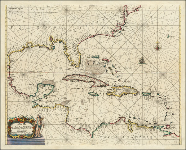
Amsterdam / 1659
Size:
21.5 x 17 inches
Condition:
VG
Stock#:
81198
Place/Date:
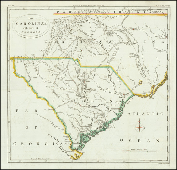
London / 1788
Size:
14 x 14.5 inches
Condition:
VG
Stock#:
79723
Place/Date:
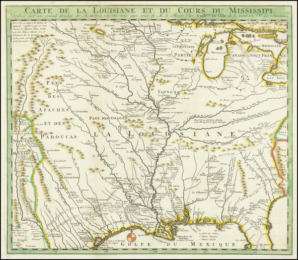
Amsterdam / 1720
Size:
16 x 14 inches
Condition:
VG
Stock#:
79683
Place/Date:
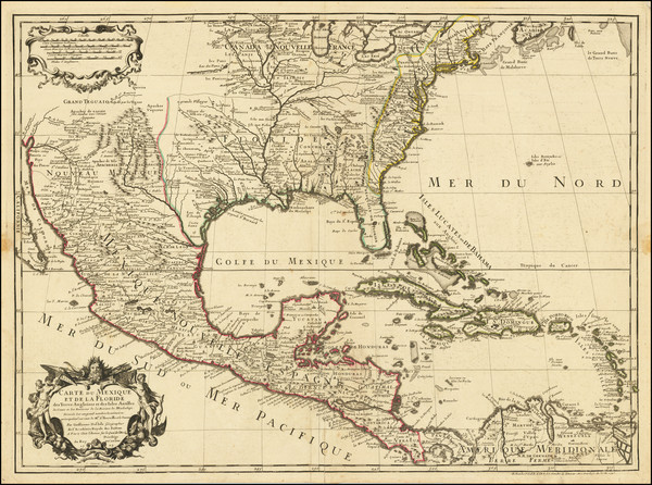
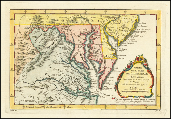
Paris / 1745
Size:
25.5 x 19 inches
Condition:
VG
Stock#:
76340
Antique map showing the Southeast by De L'Isle / Buache made in 1745.
Place/Date:
Paris / 1757
Size:
11.5 x 7.5 inches
Condition:
VG+
Stock#:
76325
Bellin's 1757 rare map showing the Southeast.
Place/Date:
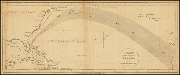
London / 1804
Size:
15.5 x 6.5 inches
Condition:
VG
Stock#:
78209
Place/Date:
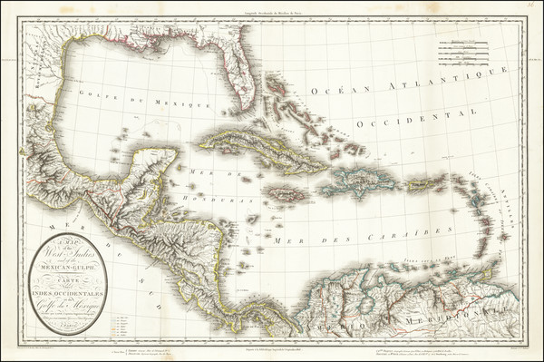
Paris / 1806
Size:
29 x 19 inches
Condition:
VG
Stock#:
68056

Place/Date:
Washington / 1863
Size:
27 x 23.5 inches
Condition:
VG
Stock#:
47081
Original map showing the Southeast by United States Coast Survey made in 1863.
Place/Date:
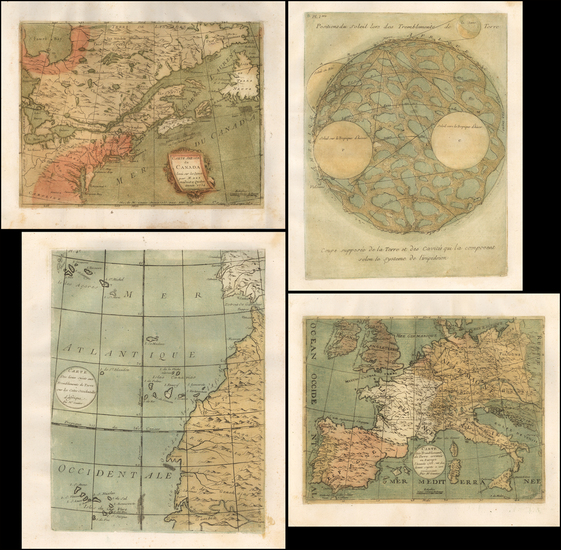
Paris / 1756
Size:
13.5 x 11 inches ( Whole Sheet)
Condition:
VG
Stock#:
52293op
Gautier d'Agoty's 1756 antique map showing the Southeast.

Place/Date:
Livorno / 1763
Size:
7 x 10 inches
Condition:
VG+
Stock#:
69299
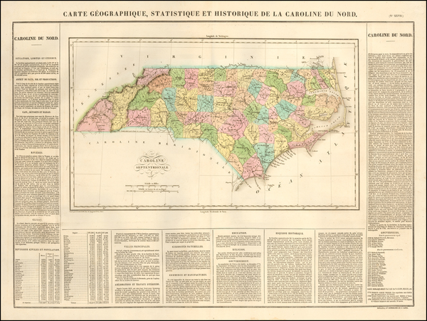
Place/Date:
Paris / 1825
Size:
18 x 11 inches
Condition:
VG+
Stock#:
57603
Rare map showing the Southeast by Buchon made in 1825.
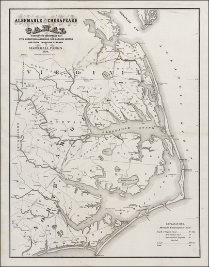
Place/Date:
New York / 1874
Size:
29 x 22.5 inches
Condition:
VG
Stock#:
50523
Antique map showing the Southeast by Hosford & Sons, 1874.

Place/Date:
Washington / 1856
Size:
30 x 24.5 inches
Condition:
VG
Stock#:
36619mb
United States Coast Survey's 1856 antique map showing the Southeast.
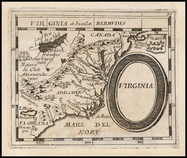
Place/Date:
Nuremberg / 1681
Size:
5 x 4 inches
Condition:
VG
Stock#:
44123
Du Val / Hoffmann's 1681 rare map showing the Southeast.
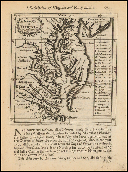
Place/Date:
London / 1688 (1693)
Size:
5 x 5 inches
Condition:
VG+
Stock#:
43053
Morden's 1688 antique map showing the Southeast.

Place/Date:
Washington, DC / 1871 circa
Size:
28.5 x 8 inches
Condition:
VG
Stock#:
38475mb
U.S. Army Corps of Engineers's 1871 antique map showing the Southeast.