
Search
Place/Date:
Vienna / 1789
Size:
11.5 x 9.5 inches
Condition:
VG+
Stock#:
103252
Place/Date:
Vienna / 1789
Size:
11.5 x 9.5 inches
Condition:
VG+
Stock#:
101757
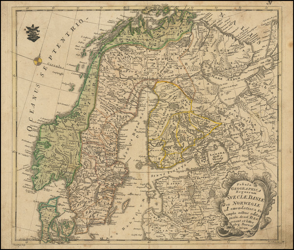
Rare map showing the Baltic Countries by von Reilly made in 1789.
Place/Date:
Vienna / 1794
Size:
11.5 x 9.5 inches
Condition:
VG+
Stock#:
101485
Place/Date:
Vienna / 1794
Size:
11.5 x 9.5 inches
Condition:
VG+
Stock#:
89311
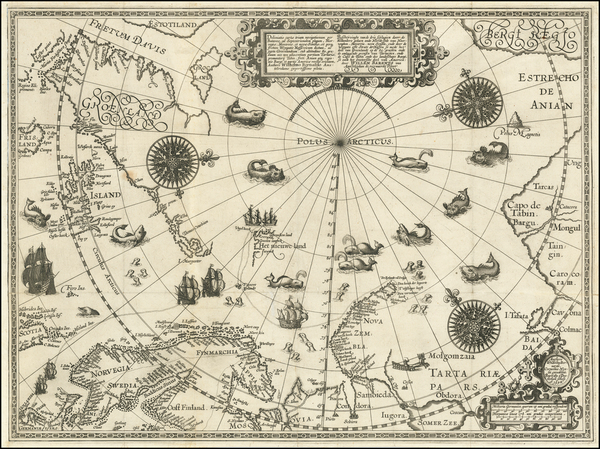
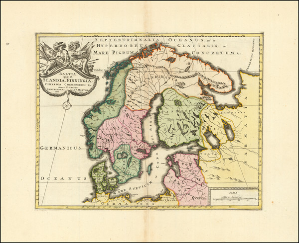
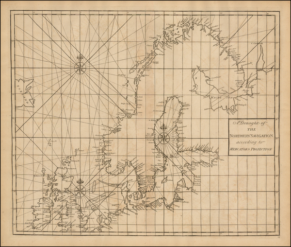
Place/Date:
Amsterdam / 1598
Size:
22 x 16.5 inches
Condition:
VG
Stock#:
62203
16th Century Antique Map /Sea Chart of Polar Regions / Northeast Passage
Place/Date:
Basle / 1560
Size:
6 x 5.5 inches
Condition:
VG
Stock#:
101319
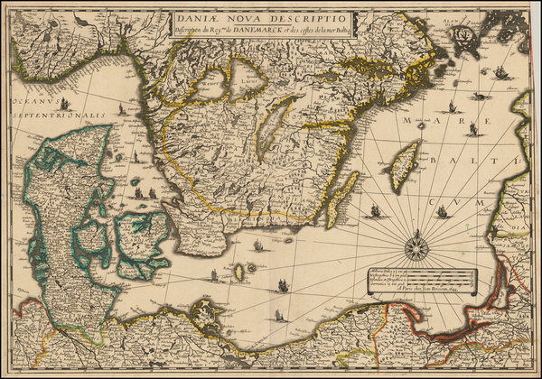
Place/Date:
Paris / 1644
Size:
21 x 15 inches
Condition:
VG
Stock#:
48927
1644 antique Boisseau map showing the Baltic Countries.
Place/Date:
Vienna / 1831
Size:
24 x 19.5 inches
Condition:
VG
Stock#:
98958

Place/Date:
Edinburgh / 1817
Size:
24 x 19 inches
Condition:
VG
Stock#:
72115
Place/Date:
Paris / 1783
Size:
17.5 x 12 inches
Condition:
VG
Stock#:
43982
Original map showing the Baltic Countries by Rizzi-Zannoni made in 1783.
Place/Date:
Paris / 1834
Size:
13.5 x 11 inches
Condition:
VG+
Stock#:
71718
Place/Date:
Paris / 1831
Size:
25.3 x 18 inches
Condition:
Good
Stock#:
99166
Place/Date:
Paris / 1745
Size:
24 x 18 inches (each sheet)
Condition:
VG
Stock#:
30758
Original map showing the Baltic Countries by Buache, 1745.

Place/Date:
Paris / 1764
Size:
11 x 9 inches
Condition:
VG+
Stock#:
77402

Place/Date:
Amsterdam / 1700 circa
Size:
16.5 x 13 inches
Condition:
VG
Stock#:
89456
Mortier's 1700 antique map showing the Baltic Countries.

Place/Date:
Paris / 1703
Size:
13 x 13 inches
Condition:
VG+
Stock#:
82029
Place/Date:
Vienna / 1799
Size:
19.5 x 13.5 inches
Condition:
VG+
Stock#:
39700
1799 original von Reilly map showing the Baltic Countries.
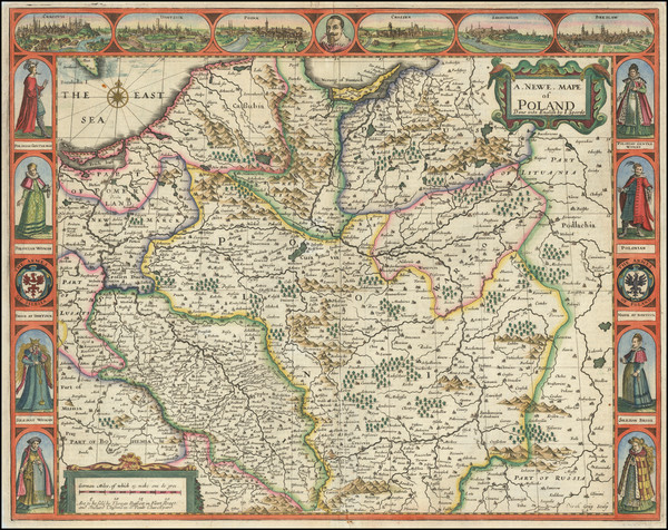
Place/Date:
London / 1676
Size:
20 x 15 inches
Condition:
VG+
Stock#:
87239

Place/Date:
London / 1799
Size:
20.5 x 18 inches
Condition:
VG+
Stock#:
91881
Place/Date:
London / 1799
Size:
20.5 x 18 inches
Condition:
VG+
Stock#:
97604
Place/Date:
London / 1730 circa
Size:
24 x 20 inches
Condition:
Good
Stock#:
79933
Place/Date:
London / 1794
Size:
11.5 x 9 inches
Condition:
VG+
Stock#:
55830
Original map showing the Baltic Countries by Wilkinson made in 1794.

Place/Date:
London / 1808
Size:
11.5 x 9 inches
Condition:
VG
Stock#:
70529
Place/Date:
London / 1799
Size:
20.5 x 18 inches
Condition:
VG+
Stock#:
97270
Place/Date:
Oxford / 1704
Size:
20 x 14.5 inches
Condition:
Good
Stock#:
90595
Place/Date:
London / 1799
Size:
22 x 24 inches
Condition:
VG
Stock#:
103017
Place/Date:
London / 1667
Size:
16 x 11 inches
Condition:
VG
Stock#:
85532
Place/Date:
London / 1728
Size:
20 x 23 inches
Condition:
VG
Stock#:
47459
Rare map showing the Baltic Countries by Senex / Halley / Cutler, 1728.

Place/Date:
London / 1671
Size:
21.3 x 9.5 inches
Condition:
VG
Stock#:
69660
Place/Date:
Venice / 1568
Size:
19.5 x 30 inches (if joined)
Condition:
VG
Stock#:
75089
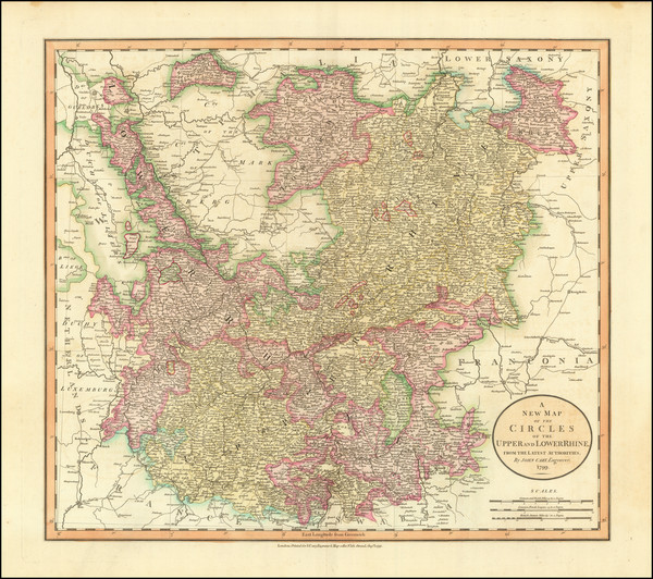
Place/Date:
London / 1853
Size:
25.5 x 19.5 inches
Condition:
VG
Stock#:
43365
Antique map showing the Baltic Countries by British Admiralty, 1853.
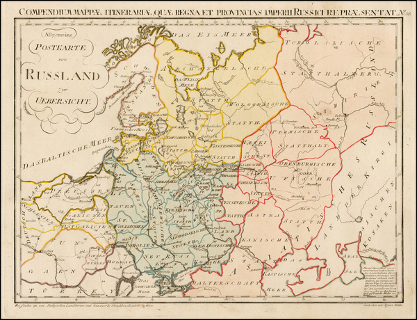
Place/Date:
Berlin / 1791
Size:
28 x 19 inches
Condition:
VG+
Stock#:
69148

Place/Date:
Nuremberg / 1795 circa
Size:
20.5 x 17.5 inches
Condition:
VG+
Stock#:
60050
Homann Heirs's 1795 antique map showing the Baltic Countries.
Place/Date:
Cologne / 1584
Size:
17 x 13.5 inches
Condition:
VG+
Stock#:
89171
Place/Date:
Augsburg / 1730
Size:
22.5 x 19.5 inches
Condition:
VG+
Stock#:
63449
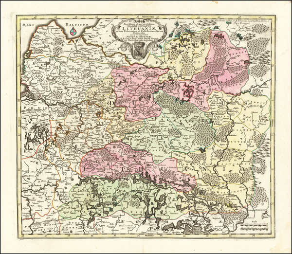
18th Century Antique Map of Lithuania
Place/Date:
Amsterdam / 1620 circa
Size:
18.5 x 14.5 inches
Condition:
VG
Stock#:
69198
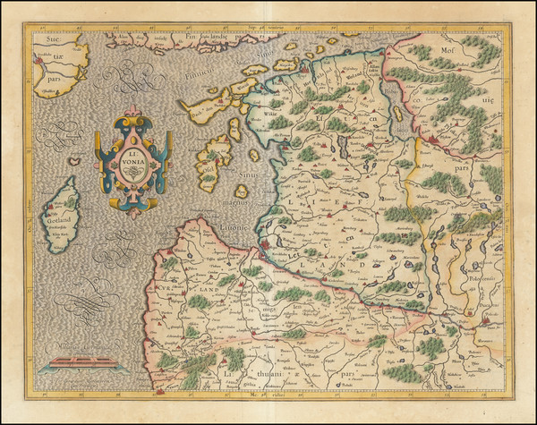
Antique Map of Estonia , Latvia and northern Lithuania
Place/Date:
Amsterdam / 1623
Size:
14 x 10.25 inches
Condition:
VG
Stock#:
75573

Place/Date:
Amsterdam / 1669
Size:
21.5 x 17.5 inches
Condition:
VG+
Stock#:
83731
Place/Date:
Amsterdam / 1623
Size:
14 x 10.25 inches
Condition:
VG
Stock#:
75076
Place/Date:
Leiden / 1713 circa
Size:
14 x 11.5 inches
Condition:
VG
Stock#:
88602
Place/Date:
Augsburg / 1720
Size:
9.1 x 6.3 inches
Condition:
VG+
Stock#:
60087
Original map showing the Baltic Countries by Bodenehr, 1720.
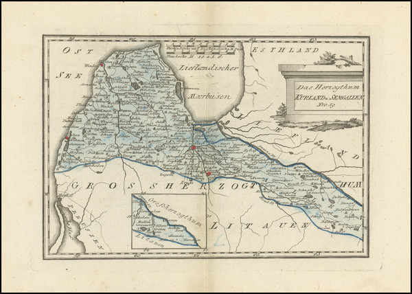
Place/Date:
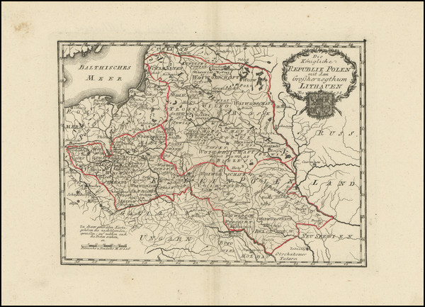
Vienna / 1789
Size:
12.5 x 8.5 inches
Condition:
VG
Stock#:
101643
Place/Date:
Berlin / 1752
Size:
14.25 x 12.5 inches
Condition:
VG
Stock#:
102797
1752 rare Von Euler map showing the Baltic Countries.
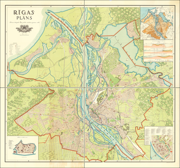
Place/Date:
Riga / 1937
Size:
39.5 x 41 inches (Each Sheet)
Condition:
VG
Stock#:
63953

Place/Date:
Rome / 1740 circa
Size:
13.5 x 11 inches
Condition:
VG+
Stock#:
69618
Place/Date:
Amsterdam / 1638 circa
Size:
20 x 15.3 inches
Condition:
VG
Stock#:
67711
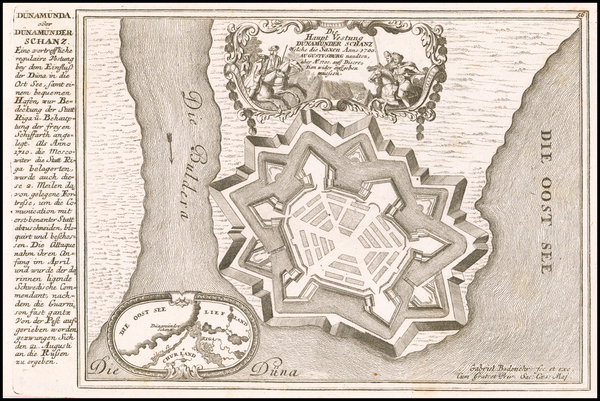
Place/Date:
Vienna / 1790
Size:
11 x 8 inches
Condition:
VG+
Stock#:
102639
Place/Date:
n.p. / 1700 circa
Size:
18 x 14 inches
Condition:
VG
Stock#:
28095
Rare map showing the Baltic Countries by Wolf made in 1700.
Place/Date:
Vienna / 1790 circa
Size:
10.75 x 8 inches
Condition:
VG+
Stock#:
101749