
Search
Archived
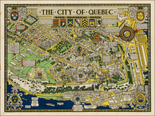
Place/Date:
Quebec / 1932 circa
Size:
33 x 25 inches
Condition:
VG+
Stock#:
33516
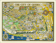
Place/Date:
Quebec / 1932
Size:
33 x 25 inches
Condition:
VG+
Stock#:
62951

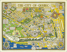
Place/Date:
Quebec / 1932
Size:
33 x 25 inches
Condition:
VG+
Stock#:
65962
Place/Date:
Quebec / 1932
Size:
32.75 x 25 inches
Condition:
VG+
Stock#:
81323