|
||

|

|
|

|
Stock# 99957
Description
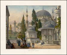
Environs of Istanbul Including Summer Palaces and European Embassies
Rare map of the Bosphorus Strait and contiguous parts of the Europe and Asia Minor, published in Berlin.
The map is highly detailed, with an unusual and quite effective use of color to differentiate terrain and topographical features. The text boxes are quite informative and detailed. The first notes:
- The “Die bezifferten Linien im Meere” refers to numbered lines in the sea on the map, indicating depths in "fathoms" and heights in "Parisian feet," a unit of measure used widely in Europe before the adoption of the metric system.
- The “In Bogüldere” refers to the summer palaces of European embassies along the Bosphorus strait, with the letters corresponding to different countries' embassies, such as:
- “O. der Österreichischen” indicating the Austrian,
- “R. Russischen” for the Russian,
- And others including Danish, Spanish, Portuguese, and Dutch.
The second notes:
- The “Erklärung der Ziffern im Stadtplane” section gives explanations of numbers in the city plan, listing prominent structures and areas in Constantinople. It includes significant buildings and locations such as:
- “Sultan Ahmed Moschee und Platz Atmeidan,” referring to the Sultan Ahmed Mosque and the Atmeidan (Hippodrome of Constantinople) square.
- “Pascha-kapussi (Hohe Pforte),” likely referring to the High Gate or the Sublime Porte, the central government of the Ottoman Empire.
- “Wasserleitung des K. Valens,” which is the Aqueduct of Valens, a major water-providing structure of the city.
Condition Description
Segmented and laid on linen.
![(First state!) [Greece & Turkey] Tabula Europae X](https://storage.googleapis.com/raremaps/img/small/94618.jpg)