|
||

|

|
|

|
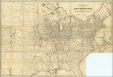
Fine example of this attractive and detailed map of the United States & Canada, extending nearly to the Rocky Mountains.
Texas is shown as part of Mexico, shortly before it declared its independence in 1836. The region west of the Missouri River is dominated by the Mandan, Osage and Ozark Districts, with a small region called Territoire Des Indiens Du Nord Du Mexique.
In the midwest, the future Iowa Territory is "District des Sioux," which extends to Canada. Oversized Nord-Oest Territory is shown, wich will soon become Terr. de Norde-Ouest ou Ouisconsin" in the next state of the map.
The map delineates a number of other Indian Regions in Georgia, Alabama, Misssissippi, and other parts. Many forts and Indian Tribes located, along with roads.
Insets of Florida and Newfoundland. Several interesting annotations in the body of the map. The legend describes Liberia as being a US Colony. The note at the bottom left translates as follows:
This second edition is an extract from our map of these regions, published in 1832, on a very large sheet recently revised and enlarged! To give, here, as much scope as possible to the best known and most populated Regions, we have omitted, to the West, part of the Mandan District and that of Oregon, for which we must consult our general map of North America, No. 57, from our Universal Atlas.
The numbers written inside this map express the absolute elevation, in toises, of principal points above the level of the Ocean.
First issued in 1832, the map would be reissued, dated 1836 and 1843.
Andre Hubert Brué was a French geographer and cartographer. Born in Paris, he served in the French Navy, joining the Baudin expedition to the Pacific (1800-1804). After his sea service, Brué applied his navigation and charting skills to creating finely-crafted maps, which were renowned for their crisp engraving and accuracy. He drew directly on the copper of the plate, creating what he called encyprotypes. He is best known for the Atlas universal de géographie physique, politique, ancienne et moderne.
![[The Russian Question] Die Russische Frage. Ein Schauspiel von K. Simonow](https://storage.googleapis.com/raremaps/img/small/83978.jpg)

![[Los Angeles Olympic] O Limp Hicks Loose Anglaise Calif. 1932](https://storage.googleapis.com/raremaps/img/small/90509.jpg)