|
||

|

|
|

|
The Most Important Series of Maps of the West Coast of North America to Have Appeared on the Market in Modern Times.
A Complete Set of Ten Original Manuscript Maps From the Hezeta-Bodega y Quadra Survey of California to Alaska.
"The earliest cartography of northern California and the northwest coast" - Wagner
Including the First Map of the Mouth of the Columbia River, the First Map of a European Landing between California and Alaska, and others.
This spectacular set of ten original manuscript maps, charting previously unexplored regions of the West Coast of North America, extends the coverage on Miguel de Costansó's foundational 1770 "Carta Reducida del Occeano Asiatico ó Mar del Sur..." with the discoveries of the famed Hezeta-Bodega y Quadra Expedition of 1775. These maps, a blend of ambition and precision, embody the spirit of the Enlightenment, extending European geographical knowledge and asserting Spain's navigational prowess across a vast stretch of the eastern Pacific.
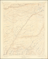
The collection is remarkable, both for its scope and detail, encompassing a vast section of the West Coast from California's Carmel River to beyond Mount Edgecumbe near Sitka, Alaska. This group comprises a very large (i.e., over 52-inch-tall) general chart of the West Coast between the California and Alaska; a general chart of the West Coast between the Carmel River and near Cape Flattery, Washington, as recorded by Hezeta; a further, but revised, general chart of the West Coast by Hezeta, stretching from just south of the Carmel River to around Cape Flattery, Washington; a further, but revised, general chart by Bodega y Quadra and Mourelle of the West Coast from the Carmel River to Salisbury Sound, Alaska; the first map of Bodega Bay, California; the first map of Trinidad Bay, California; the first map of the entrance of the Columbia River; the first map of Point Grenville, Washington, where the first landing of Europeans on the American coast between California and Alaska occurred; the first map Bucareli Bay, Alaska; and the first map of Sea Lion Bay, Alaska, the northernmost point yet reached by a Spaniard in the Pacific.
The Expedition
The 1775 expedition led by Bruno de Hezeta and Juan Francisco de la Bodega y Quadra was part of Spain's broader strategy to reassert its navigational and territorial dominance in the Pacific Northwest. It was intended to address both the strategic need to delineate the extent of feared Russian advances in the area and the ambition to claim these lands for Spain. Prior to this, expeditions such as the 1774 voyage commanded by Juan Pérez had already begun the process of exploration along the coast but had not accomplished anything like the success that awaited the following voyage.
Two vessels took part in this expedition, which undertook the first mapping of the Pacific coast north of Monterey. They were the frigate Santiago commanded by Hezeta, and the smaller schooner Sonora (actually Felicidad) commanded by Bodega y Quadra. The latter ship was originally to be under the command of Juan de Ayala, but he was transferred to the San Carlos, which was to transport supplies to California and make a reconnaissance of San Francisco Bay. The expedition was under the supervision of the Viceroy, Antonio Bucareli y Ursua, and his instructions to Hezeta were to sail north to lațitude 65, then proceed southward along the coast, exploring and charting. The vessels set sail March 16, 1775, and separated on August 1 at a latitude of about 47". Hezeta went on to Vancouver Island before turning south, with many of his men sick with scurvy. Bodega y Quadra, together with his pilot Mourelle, went up about as far as 58° before turning. The two ships were reunited at Monterey in October 1775.
Though the expedition was nominally led by Hezeta, it was the personal enterprise and daring of Bodega y Quadra and Mourelle that made it a success. The latter two faced considerable adversity almost as soon as they set out from San Blas on March 16, 1775. Bodega y Quadra was a 32- year-old Peruvian-born Creole who had been passed over for leadership. Mourelle was only 25 years old. Their vessel, the Sonora, was a 36-foot-long schooner intended for short trips to Baja from the mainland, not fighting the vicious swells of the Pacific north of Point Conception. The expedition met with almost immediate peril when the first captain of the Sonora lost his mind and was relieved of command.
The expedition performed four official acts of possession, at Port of the Remedies, Bucareli Sound, Bucareli Anchorage (Martyrs' Point), and Trinidad Bay.
The achievements of the [1775 Hezeta - Bodega y Quadra] expedition were considerable: Spanish knowledge of the coasts, harbors, and anchorages north of Monterey was substantially increased; formal possession was taken for Spain at four places; something had been learned about the native inhabitants; and although the expedition did not include anyone with expertise in natural history, notes were made of flora and fauna of the regions - Hill Catalogue 242 (entry on an English translation of the journal of Miguel de la Campa).
The Viceroy's concerns about Russian encroachments were also put to rest, allowing Bucareli to push ahead with plans for an orderly northward expansion of settlement in Spain's far-flung Pacific empire. Recall this had been an important impetus adding to the urgency of the 1775 expedition: "Russophobic alarms were rife in Madrid at the highest levels of the government. Julian de Arreaga, minister of the Indies, had pointedly reminded Bucareli 'of the King's order to take appropriate measures to find out if these Russians explorations were going forward." - Herbert K. Beals, The 1775 Journal of Juan Francisco de la Bodega y Quadra, page 55.
The 1775 Hezeta-Bodega y Quadra Expedition in Context
The 1760s and '70s saw the resurrection of Spain's efforts to explore, survey, and colonize the West Coast of North America, this time aided by the new developments in navigational science that unfolded in the second half of the 18th century. The era was characterized by a renewed vigor in maritime exploration, driven by the desire to expand territorial claims, secure trade routes, and spread Christianity, with expeditions equipped with advanced navigational tools like the marine chronometer, which allowed for the precise determination of longitude at sea.
In 1775, the joint expedition led by Bruno de Hezeta (often Heceta or Ezeta) and Juan Francisco de la Bodega y Quadra became one of the most significant undertakings of this period. Their voyage aimed to assert Spanish claims to the Pacific Northwest and to gauge the extent of Russian expansion in the area. Hezeta and Bodega y Quadra's exploration marked the first European entry into what is now Washington State, with Hezeta's encounter at the mouth of the Columbia River, a pivotal moment that underscored the strategic importance of the region for future trade and settlement.
While these explorations were undoubtedly propelled by territorial ambitions, they were also imbued with the Enlightenment's spirit of scientific inquiry. The expeditions contributed to a better understanding of the Pacific Northwest's geography and the diverse cultures of its Indigenous peoples. The interactions between the Spanish explorers and Indigenous communities were complex, involving trade, cultural exchanges, and sometimes conflict, which would shape the region's subsequent European interactions.
Spain's efforts during these decades significantly shaped the history and development of the region, leaving a lasting legacy that is evident in the cultural and geographic landscape of the American West today. Indeed, the expeditions by Hezeta and Bodega y Quadra, along with others in this period, laid the groundwork for future settlements and missions along the coast, marking the beginnings of Spanish influence that would extend into the 19th century. This legacy survives to this day in dozens of Spanish placenames in California and the Pacific coast. Settlements such as San Diego, San Francisco, and Los Angeles owe their origins to this era of exploration and colonization. The missions established were part of Spain's broader strategy to convert Indigenous peoples to Christianity, assimilate them into Spanish culture, and secure its territorial claims against foreign encroachments.
In sum, the latter decades of the 18th-century were clearly a transformative period which saw Spain revitalizing its colonial ambitions on the West Coast of North America, very much supported by the era's scientific advancements, and strongly driven by geopolitical, religious, and economic motives.
Enumeration of the Maps and Rarity
The maps are listed below. The eight smaller items all have hand coloring in shades of green and yellow, and all maps are in fine condition apart from minor strengthening at the folds in a few places on the large folding map, A.
Although the large map is very similar to Wagner 641, there are some differences. The high mountain identified as San Jacinto (present-day Mount Edgecumbe) is shown more than half a degree lower on our map at just below 57; there is a chain of small mountains running between Ensenada del Susto and Ensenada del Principe on Wagner 641 which is not present on our map; and there are differences in the rhumb lines, as well as slight deviations in the routes.
A. Bodega y Quadra and Maurelle. Carta reducida de las Costas y Mares Septentrionales de la California... Very large uncolored folded map (1335 x 840 mm.) showing the Pacific coast from 36° to 58° 30', with the southernmost point identified as "R. del Carmelo" and the northernmost as "Pto de los Remedios." A very fine and meticulously executed map. Similar to Wagner 641 ("This and that of Hezeta are the earliest maps to show the Spanish discoveries north of San Francisco"); Lowery 572.
Rarity: Wagner traces one other example, at the Archivo General de Indias, Sevilla (AGI) (No. 309 of Torres Lanzas, Carpeta de Mapas No. 21)
B. Hezeta. Carta Reducida de las Costas y Mares Septentrionales de la California construida por las observaciones y demarcaciones de... Bruno Ezeta... Map with the coastline in color (420 x 295 mm.). Depicts the coast from "Ro. del Carmelo" to two degrees north of "Los Frailes" and "I. de Dolores" (Destruction Island) just south of Cape Flattery, Washington. Wagner 645: Palou, IV, pl. facing p.48; Lowery 573.
Rarity: Wagner traces one other example, at the AGI (No. 307 of Torres Lanzas, Carpeta de Mapas No. 15)
C. Hezeta. Carta Reducida de las Costas y Mares Septentrionales de la California... Uncolored folded map (710 x 485 mm.), with Hezeta's name only in the title, no date. Depicts the coast from 365 to 50° 58', and is similar to B. except that "C. Blanco" is substituted for "Co. de S. Sebastian", and "Pta. de Pinos (Cypress Point) and Pto. de Sn. Francisco" (Angel Island?) are added. Indicates the mouth of the Columbia River, but without the usual designation of "Entrada de Ezeta." Wagner 646: Lowery 571
Rarity: Wagner traces one other example, at the AGI (No. 308 of Torres Lanzas, Carpeta de Mapas No. 7)
D. Bodega and Maurelle. Carta reducida de las Costas, y Mares Septentrionales de California... Colored map, (407 x 245 m.). Depicts the coast from 36° 30' to 57°50', from "Carmelo" to "Pto. de Nra. Sa. de los Remedios" and "Ia. de Lovos" (Sea Lion Islands), Alaska. Similar to map B, with "Las Tres Marias" moved south from 45° 30' to 44. and "Ro. de S. Fraco." added. Not in Lowery or Wagner.
Rarity: No other examples located.
E. Bodega and Maurelle. Plano del Puerto del Capitan Bodega... Colored chart, (275 x 385 mm.). Shows Bodega Bay, California, discovered on October 3, 1775. Wagner 643.
Rarity: Wagner traces several examples, at the Archivo Historico Nacional; and at the Museo Naval (four copies - 7305.7, 7306.7, 7308.7, 7310.7)
F. Hezeta. Plano del Puerto de la Trinidad... Colored chart, (285 x 390 mm.). Shows Trinidad Bay, California, discovered by Hezeta on June 10, 1775. Wagner 647; Palou, IV, pl. facing p.16.
Rarity: AGI (MP-MEXICO,582); Wagner mentions the Bancroft as well, but we are unable to confirm this with a search of their catalog. At the Bancroft, OCLC only locates 20th-century tracing based on this map.
G. Hezeta. Plano de la Bahia de la Asumpcion o entrada de Ezeta... Colored chart (270 x 382 mm.). Shows the entrance to the Columbia River, discovered by Hezeta on August 17, 1775. Wagner 648; Lowery 570.
Rarity: Wagner traces one other example, at the AGI (Carpeta de Mapas 17)
H. Hezeta. Plano de la Rada de Bucareli... Colored chart (367) x 270 mm.). Shows Point Grenville, discovered by Hezeta on July 13, 1775, and includes "Punta de los Martires" where seven of the Sonora's crew were massacred by natives. This was the first European landing on the coast between California and Alaska. Not in Lowery or Wagner. Chapman 2802 (describes a different map: Plano de la entrada o Puerto de Bucareli situado bajo el Latitude Norte de 55 gs. 17 ms. y en la Longitud Occl. de S. Blas 32 gs. 9 mins. descubierto y levantado por el Teniente de Fragata Dn. Juan Franco de la Bodega y Quadra y el Piloto Dn. Franco Maurelle).
Rarity: Wagner traces one other example, at the AGI (MP-MEXICO,532)
I. Bodega and Maurelle. Plano de la entrada o Puerto de Bucareli... Colored chart (390 x 278 mm.). Depicts Bucareli Bay, Alaska, discovered by Bodega y Quadra on August 24, 1775. Wagner 642. Chapman 2802 (describing example at AGI, dimensions: 35.4 x 46.5 cm).
Rarity: Wagner traces one other example, at the AHN. Bolton, p.141 (describing a colored map of the Puerto de Bucareli, 24 x 18 inches, at the AHN (Mexico City), accompanying a diary of Mourelle's later 1779 voyage).
J. Bodega and Maurelle. Plano del Puerto de los Remedios... Colored chart (280 x 383 mm.). Depicts Sea Lion Bay, south of Salisbury Sound, Alaska, discovered by Bodega on August 18, 1775. Shows the "Islas de Lobos." Colored. Wagner 644. Chapman 2803 (describing example at AGI, dimensions: 46.7 x 36.2 cm).
Rarity: Wagner traces one other example, at the AHN.
Six accounts of the expedition are extant: those of Hezeta, Juan Perez (second in command to Hezeta and commander of the 1774 expedition), Bodega y Quadra, Mourelle, and the two Franciscans: Fr. Campa Cos and Fr. Benito de la Sierra. None of the maps was published at the time, but one was made up from Mourelle's (his name appears on the maps as Maurelle) account for the London Magazine of December 1780.
A Comment on Rarity
As is well known, the Spanish colonial bureaucracy required that a handful of extra copies be made of official documents - one for the Archivo General de Indias at Seville, another for the use of viceregal officials in Mexico City, and a limited number of additional copies as required for immediate personal and/or administrative use of high echelon political or military leaders. While hand-drawn maps of important exploring expeditions were also made in a few extra copies, these were necessarily of a far more restricted number, given the extra care and expense required for their making. Indeed, the Spanish reluctance to publish the results of such expeditions, for fear that their imperial rivals might derive advantage from them, dictated that only a minimal number of copies of maps be produced. Such highly sensitive geographic information, undoubtedly made in only a tiny few extra copies, would have stayed within the direct personal orbit of the viceroy, in this case, Bucareli, or perhaps a trusted advisor to the king himself, someone of the level and caliber of Julián de Arriaga y Rivera, long-serving Minister of the Indies, though not necessarily him.
Provenance
H.P. Kraus, as "Collection of 10 manuscript charts and maps depicting the west coast of north America from Monterey, California to just north of Salisbury Sound, Alaska. c. 1775"
Kraus probably first cataloged the set before the late-1960s but no earlier than the late-1940s (the letterhead of his description still bears the "212 Murray Hill 7-4808" phone number).
Private American Collection.
A Note on H.P. Kraus and Other Bodega y Quadra Materials
In 1950, Kraus purchased from the Palacio Revilla in Madrid the 37-volume papers of the Viceroy of New Spain, Juan Vicente de Güemes Padilla Horcasitas y Aguayo, 2nd Count of Revillagigedo (served, 1789-1794). This event is recounted as Chapter 21 in A Rare Book Saga. Included among the papers were ten volumes of explorers' monographs, including many maps and drawings related to the West Coast of North America. The papers were subsequently sold to Irving W. Robbins, Jr., of Palo Alto. In 1957, Robbins left the papers on long-term loan with the Bancroft Library, where they received much attention. In 1973, Robbins asked the Bancroft for $40,000 for the papers, later revised down to $35,000. The two parties were unable to reach a deal, so the papers were removed from Berkeley and returned to Robbins in 1974. As Kraus relates in A Rare Book Saga, he repurchased the papers from Robbins and had them in his possession in the mid-to-late 1970s when he wrote the book. Around that time, he decided to break up the collection, and some of the material from the set formed the basis for his 1976 Catalogue 144, The American West Coast and Alaska: Original Drawings and Maps from the Expedition to Nootka Sound of Juan Francisco de la Bodega y Quadra, 1792.
We entertained the prospect that these maps came from that set as well. However, two facts militate against this. One, the maps relate to the Expedition of 1775, which occurred under the administration of Viceroy Bucareli, almost 15 years before Revillagigedo took office. Two, Kraus's cataloging for the present set seems to have been written years before he repurchased and broke up the Revillagigedo papers.
Further complicating matters, the maps appear as item 168 in Kraus's 1981 Catalogue 160 Americana with a price of $65,000. Many items from the Revillagigedo papers appear in this catalog, too, though under the headings "From the Revilla-Gigedo Papers." It is probably from this catalog that these maps were purchased by the collector who last owned them. It should be noted that, like most dealers, Kraus would recycle items through multiple catalogs, lists, bulletins, etc. until they sold, and it therefore cannot be said that this was the first time the maps were offered in the market. Indeed, it seems very unlikely that this was the case.
A review of Kraus's Catalogue 144, The American West Coast and Alaska, shows that the maps were not included in that dispersal from the Revillagigedo Papers.
Juan Francisco de la Bodega y Quadra was a notable figure in late 18th-century maritime exploration. Born in Lima, Peru, in 1744 to a Spanish naval family, he joined the Spanish Navy in 1760 and quickly distinguished himself as a skilled navigator and cartographer.
Bodega y Quadra's most significant contributions were in the exploration of the Pacific Northwest coast of North America. In 1775, he participated in expeditions that reached as far north as Alaska. He is perhaps best known for his explorations in 1779, where he charted the coastline of California, including the discovery of Bodega Bay, named in his honor.
In 1790, during the Nootka Controversy between Spain and Britain over territorial claims in the Pacific Northwest, Bodega y Quadra was appointed Spanish commissioner. He was tasked with negotiating with British Captain George Vancouver to resolve territorial disputes on Vancouver Island and the surrounding areas. His diplomatic skills were instrumental in the peaceful resolution of these tensions, leading to the Nootka Convention, which eased hostilities and outlined respective territorial rights.
Bodega y Quadra's legacy extends beyond his exploration achievements. He was known for his fair treatment of indigenous peoples and his efforts to understand and document their cultures. His detailed maps and navigational charts were invaluable to future explorers and remain a testament to his skill and dedication.
He passed away in 1794 in Mexico, leaving behind a legacy as one of the most important figures in the Spanish exploration of the Pacific Northwest. His contributions to navigation, diplomacy, and intercultural relations were significant in shaping the history of the region.
![[Bering Land Bridge, Alaska] Teller-Kougarok Area Compliments of Lomen Commercial Company Nome, Alaska](https://storage.googleapis.com/raremaps/img/small/45000jc.jpg)