|
||

|

|
|

|
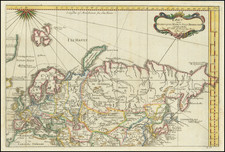
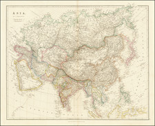
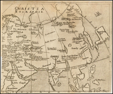
Early English Map of the Continent of Asia
This early map of Asia appeared in the 1652 edition of Dr. Peter Heylyn's Cosmographie . . . , published in 1652.
Engraved by John Goddard for Henry Seile, the map provides a comprehensive view of Asia, ranging from the northern Mare Tartaricum to Adu Island near the Maldives in the south. It spans from the western areas of Candia to the eastern territories near Japan. The map includes regions such as Japan, Formosa, the Ryukyu Islands (positioned south of Formosa), the Philippines, Indonesia, Sumatra, the Malayan Peninsula, Indo-China, Siam, Burma, China, Tibet, Mongolia, Korea, and parts of Central and South Asia. It also touches on areas like Persia, the Arabian Peninsula, certain parts of Africa, the Holy Lands, and some sections of Europe, Russia, and the Crimea.
The map is detailed, marking rivers, mountain ranges, cities, and other geographical features, offering a depiction of the Asian continent that would have been considered accurate for its time. The treatment of Korea as a long narrow peninsula is based upon a configuration popularized by Linschoten.