|
||

|

|
|

|
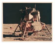
This detailed terrain map provides an intricate representation of specific equatorial areas on the Moon. Edited by Alan Filice, the map's design integrates a rich combination of color-coded units, descriptive labels, and symbols, enabling an observer to grasp the various geological features of the lunar surface. It offers a unique insight into our understanding of the Moon, built over years of observation and analysis.
The legend categorizes different terrains based on their geological characteristics and appearance. For instance, "Rayed maria" corresponds to the Kepler region, displaying radiant patterns often formed by relatively young craters. Similarly, the "Dark rough deposits" in the Bode area, located 250 km southeast of Eratosthenes, and the "Regional maria" of the Oceanus Procellarum, provide insights into areas with dark, basaltic plains formed by ancient volcanic eruptions.
Highland terrains, depicted in varied shades of brown, represent the Moon's rugged landscapes. The "Highland basins" in the Lade area, east of Hipparchus, and the "Rough highlands" on the flanks of Ptolemaeus, showcase the Moon's elevated terrains, distinguished by their roughness and complexity. This map even delves into the specific details of "Young craters," such as Copernicus, and their surrounding ejecta blankets, evidencing the dynamic processes still shaping the lunar surface.
Beyond the terrain categories, this map is further adorned with a set of symbols that denote specific lunar features. From "Wrinkle ridges" to "Domes with superimposed crater chains," these symbols offer a refined understanding of the structural intricacies of the Moon's landscape.
![[Important Early Geology Maps] Tableau du Climat et du Sol des Etats-Unis D'Amérique. Suivi d'éclaircissemens sur la Floride, sur la colonie Française au Scioto, sur quelques Canadiennes et sur les Sauvag . . .](https://storage.googleapis.com/raremaps/img/small/69358.jpg)
![[Run of 6 Volumes] Report Upon Geographical Surveys West of the 100th Meridian](https://storage.googleapis.com/raremaps/img/small/74064.jpg)