|
||

|

|
|

|
This is Braun & Hogenberg's second bird's-eye view of Hamburg, which reflects the city's evolution from a pastoral community to a bustling hub of commerce during the second half of the 16th Century.
This view of Hamburg offers a detailed representation of the city, likely informed by the work of David Frese and Heinrich von Rantzau. Hamburg is depicted at the meeting point of the Elbe and Alster Rivers, its security ensured by an array of canals and defensive walls. The initial core of the city is identifiable around the Domplatz, situated near the center-right of the engraving and adjacent to St. Peter's Cathedral. The image captures the Altstadt, or Old Town, as it appeared before the turn of the 17th century, densely populated and interlaced with narrow canals known as 'Fleeten,' lined by the storage buildings essential for trade.
By the end of the 16th century, the prominence of Hamburg in commerce is evident from the numerous vessels docked at its busy port. The engraving is also adorned with figures of what appear to be wealthy inhabitants in the foreground, adding a human element to the scene.
Hamburg shows the city's growth, spurred by Emperor Frederick I Barbarossa's grant of port rights in 1189, which exempted it from taxes on trade along the Lower Elbe. This advantage propelled Hamburg to become a significant trade center, known for supplying beer to the Hanseatic League.
Civitates Orbis Terrarum: The Greatest City Book
Georg Braun and Frans Hogenberg began the process of creating a comprehensive atlas of the cities of the world in 1572. Their book, Civitates Orbis Terrarum, was originally intended as a companion to Abraham Ortelius's Theatrum Orbis Terrarum, the first true atlas.
The great atlas was edited by Georg Braun, with Franz Hogenberg engraving many of the views. When the project was finished, the series would contain over 546 views (sometimes with multiple views on a single plate).
Civitates Orbis Terrarum includes the work of over 100 artists and topographers, perhaps most notable among them was the superlative talent of Joris Hoefnagel (1542-1600). He provided original drawings of Spanish and Italian towns, as well as reworking and improving the town drawings of other artists. After Joris's death, his son Jakob continued the project.
The Civitates provides an incredibly comprehensive view of urban life in the late 16th century. Many of the views in these volumes are the earliest of their respective towns -- either absolutely, or they are predated only by impossible rarities, as in the case of London. Cities portrayed range from the great capitals of Europe, Asia, Africa, and the Americas to small Swiss hamlets and other tiny villages. As such, this singular and indispensable source for understanding the early modern world.
The work was published in six volumes, each of which contained approximately sixty plates. The subject matter of each plate varied widely, it could provide a single view of a city, two views of the same city, or views of up to nine different cities. The range of designs is extensive, and it is interesting to compare the variety between views of the same city by two different authors.
Georg Braun (1541-1622) was born and died in Cologne. His primary vocation was as Catholic cleric; he spent thirty-seven years as canon and dean at the church St. Maria ad Gradus, in Cologne. Braun was the chief editor of the Civitates orbis terrarum, the greatest book of town views ever published. His job entailed hiring artists, acquiring source material for the maps and views, and writing the text. In this role, he was assisted by Abraham Ortelius. Braun lived into his 80s, and he was the only member of the original team to witness the publication of the sixth volume in 1617.
Frans Hogenberg (ca. 1540-ca. 1590) was a Flemish and German engraver and mapmaker who also painted. He was born in Mechelen, south of Antwerp, the son of wood engraver and etcher Nicolas Hogenberg. Together with his father, brother (Remigius), uncle, and cousins, Frans was one member of a prominent artistic family in the Netherlands.
During the 1550s, Frans worked in Antwerp with the famous mapmaker Abraham Ortelius. There, he engraved the maps for Ortelius’ groundbreaking first atlas, published in Antwerp in 1570, along with Johannes van Deotecum and Ambrosius and Ferdinand Arsenius. It is suspected he engraved the title page as well. Later, Ortelius supported Hogenberg with information for a different project, the Civitates orbis terrarium (edited by Georg Braun, engraved by Hogenberg, published in six volumes, Cologne, 1572-1617). Hogenberg engraved the majority of the work’s 546 prospects and views.
It is possible that Frans spent some time in England while fleeing from religious persecution, but he was living and working in Cologne by 1580. That is the city where he died around 1590. In addition to his maps, he is known for his historical allegories and portraits. His brother, Remigius, also went on to some fame as an engraver, and he died around the same time as his brother.
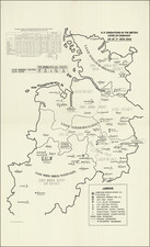
![(Second World War - NVKD SMERSH) Übersicht der Verkehrsverbindungen mit Sonntagsrückfahrkarte von Berlin. Gültig während des Winterfahrplans 1938/39 [Overview of the Transport Links with Sunday return ticket from Berlin. Valid During the Winter Timetable 1938/39]](https://storage.googleapis.com/raremaps/img/small/69563.jpg)