


|
||

|

|
|

|
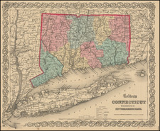
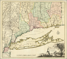
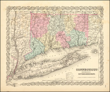
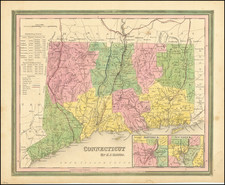
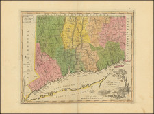
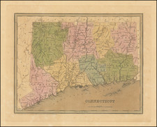
Connecticut by Thomas Gamaliel Bradford, published in Boston in 1846, is a fine example of cartographic work from that era. Hand-colored by counties, the map provides a detailed depiction of early canals, towns, rivers, and other geographical features in Connecticut.
Bradford's atlas stands out from its contemporaries as it deviates from the traditional style of atlases at the time. Alongside his counterpart H.S. Tanner, Bradford produced an elegant and well-engraved large format atlas on high-quality paper. The 1830s marked a transitional period in the United States, and Bradford's work reflects this changing landscape, both in terms of cartography and domestic publishing.
The map's engraving was skillfully executed by G.W. Boynton. The attention to detail and the quality of the engravings contribute to the overall excellence of the map.
Thomas Gamaliel Bradford (1802-1887) was an American geographic publisher. He hailed from Bradford, Massachusetts and began his publishing career by working for the America Encyclopedia. Then, he edited and republished the Atlas Designed to Illustrate the Abridgement of Universal Geography, Modern & Ancient, which had originally been offered in French by Adrian Balbi. In 1835, he published another atlas, A Comprehensive Atlas: Geographical, Historical & Commercial, and, in 1838, An Illustrated Atlas Geographical, Statistical and Historical of the United States and Adjacent Countries. His interests were primarily in educational publishing and he was one of the first mapmakers to show Texas as an independent country.