|
||

|

|
|

|
Stock# 90307
Description
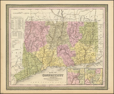
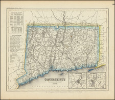
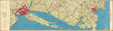
A detailed and attractive map of Connecticut, with inset plans of Hartford and New Haven.
The map is hand colored by county, showing roads, canals, towns, steamship routes and other interesting details. Includes early railroads, Courthouses, Churches, Taverns, etc.
A chart shows the County populations and other details.
![[ Early Handwritten Annotations ] Connecticut From the best Authorities](https://storage.googleapis.com/raremaps/img/small/100909.jpg)