|
||

|

|
|

|
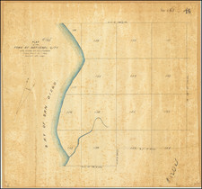
A shipmaster's essential tool, the NOAA sea chart of San Diego Bay, first published in 1918, carries a wealth of historical and navigational detail, its most recent update dating back to 1975. The chart is as much an artistic testament as it is a pragmatic guide, outlining sailing directions, meticulous soundings, and marking the intricate topographical features, significant landmarks, and intricate street plans of the neighboring communities.
On the chart, one could trace the lifelines of San Diego's maritime tradition, the yacht harbors, and the numerous piers - notably the B Street Pier, Customs House Broadway Pier, Navy Pier, G Street Pier, and the 10th Avenue Marine Terminal. These serve as silent testament to the region's extensive shipyards and the Naval Repair Base, each dot and line echoing a century of seafaring legacy.
The southern edge of the chart is a fascinating narrative of shipwrecks and repair yards of National City, each marking a memory and a lesson in maritime history. A keen eye could follow the intricate pathways across the bay, unveiling the subtle details of Coronado Cay, extending all the way to the mesmerizing beauty of Imperial Beach.
Further, the chart demarcates a series of numbered Boat Lanes off the ocean side of the strand, a systematic organization from 1 to 14. Concurrently, it points out the environmentally-sensitive areas, detailing prohibited dumping grounds, a clear reminder of the sea's sanctity.
An intriguing aspect of the chart is the marked Submarine Transit Lane Sierra Zeuss, with portions labeled as Restricted Areas. The chart reflects a harmonious balance between nature and man-made maritime infrastructure, like the pipeline off the coast south of the Point Loma, and the 800-foot wide channel into the harbor.
Of particular note is the area labeled "breakers" off Cabrillo point. A siren call for the brave-hearted surfers who dare to undertake the remote journey to conquer these waves. Simultaneously, the chart also details several man-made and military structures such as the lookout tower, tank, Naval Fuel Annex, Radio Telescope, and several towers on Point Loma, each testament to the strategic importance of this region.
North Island, intriguingly, is conspicuously devoid of any infrastructure details, despite the chart's accuracy elsewhere. This is likely due to its long history as a military zone, housing the North Island Naval Air Station. Outlining sensitive military installations would contradict the chart's primary use, hence the selective omission. However, the docks, Jetty Berths, and Marginal Wharf Berths are carefully marked.
In essence, the NOAA sea chart of San Diego Bay is a comprehensive guide, carrying the nautical history and nuances of San Diego Bay within its meticulously marked points, lines, and contours. This chart, an artifact of time, remains a quintessential navigational tool, and a testament to the region's rich maritime tradition and geographical wonders.
![[Eastern San Diego County] Cuyamaca Quadrangle](https://storage.googleapis.com/raremaps/img/small/83422.jpg)