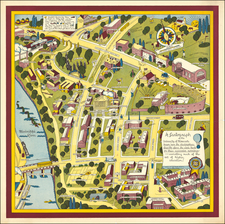
|
||

|

|
|

|
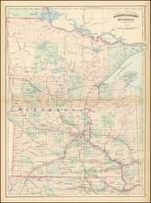
Gorgeous large format railroad map of Minnesota, hand colored by counties.
Shows railroads, towns, rivers, lakes, mountains, township surveys, forts, Indian Reservations, etc.
The map shows a number of large oversized counties in the north, predating the formation of Cook County (1874), reshaping of Beltrami and Itasca Counties (1876), the renaming of Pembina County to Kittson County (1878), the formation of Marshall County (1879), and creation of Hubbard County (1883) over the next decade.
Asher & Adams Atlas was conceived as a Railroad Atlas, but is probably most notable for its relatively unique style and excellent large format treatment of the states west of the Mississippi.
Asher & Adams was a New York publishing firm known for their atlases. Notably, their maps were some of the first to prominently exhibit railroad lines, even if this meant a slight reduction in topographical detail. They specialized especially in state and county maps of the United States.
Asher & Adams was a New York publishing firm known for their atlases. Notably, their maps were some of the first to prominently exhibit railroad lines, even if this meant a slight reduction in topographical detail. They specialized especially in state and county maps of the United States.

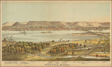
![Bancroft Freeborn Co. MT [Minnesota Territory]](https://storage.googleapis.com/raremaps/img/small/82401.jpg)