|
||

|

|
|

|
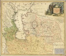
Created by the Military Topographic Department of the Caucasus and published in Tbilisi in 1903, this large color-lithographed, linen-mounted, folding map, "Дорожная карта Кавказского края" or "Road Map of the Caucasus Region," provides an invaluable snapshot of the ethno-cultural mosaic of the Caucasus at the dawn of the 20th century.
This period was marked by significant geopolitical shifts and the intensifying churn of empires, making the Caucasus a focal point of European, Ottoman, and Russian interests. Each force sought to understand and leverage the region's complex ethnography in their expansionist strategies, turning ethnographic maps into critical instruments of knowledge and power. This map, with its detailed "Ethnographic Key," represents one such instrument, dividing the region's diverse populations into distinct categories - a reflection of the contemporary racial theories and socio-political classifications.
The map's "Ethnographic Key" categorizes the population by racial groupings and corresponding subgroups, such as the "Indo-European (Aryan) family" with its "Slavic," "Germanic," "Roman," "Pelagic," "Iranian," and "Armenian" generations (i.e., lineages or ethnic groups), and the "Semitic family" with its Jewish and Assyrian populations. Intriguingly, it also includes a "Properly Caucasian" category, reflecting the region's distinct ethno-linguistic groups. The "Mongolian Race" is also represented, further testifying to the region's cultural and racial diversity.
The rich detail in this map extends beyond ethnic delineations. Notations encompass military fortresses, postal and telegraph stations, lighthouses, railway stations, factories, and border controls, offering a glimpse into the infrastructural realities of the region in the early 20th century. This map, therefore, not only portrays the intricate patchwork of ethnic groups in the Caucasus but also illuminates the socio-political and economic landscapes that were part of the imperial tug-of-war in this highly contested region.
In essence, this map from 1903, with its myriad of ethnic, geographical, and infrastructural details, serves as an informative and engaging record of the Caucasus at a critical point in its history. It offers a rich tableau for understanding the complex interplay of cultures, empires, and geopolitical strategies at the turn of the century.
Ethnographic Key
А. СРЕДИЗЕМНАЯ РАСА [MEDITERRANEAN RACE]
I. Индо-европейское (арійское) семейство [Indo-European (Aryan) Family]
1. Славянское поколѣніе [Slavic Ethnic Group]
2. Германское поколѣніе [Germanic Ethnic Group]
3. Романское поколѣніе [Romance Ethnic Group]
4. Пеласгийское поколѣніе [Pelasgian Ethnic Group]
5. Иранское поколѣніе [Iranian Ethnic Group]
6. Армяне [Armenian]
II. Семитическое семейство [Semitic Family]
Евреи [Jews]
Айсоры [Assyrians]
III. Собственно кавказскіе народы [Properly Caucasian Peoples]
1. Картвельская группа [Kartvelian Group]
2. Западно-горская группа [Western Mountain Group]
3. Восточно-горская группа [Eastern Mountain Group]
Б. МОНГОЛЬСКАЯ PACA [MONGOLIAN RACE]
1. Тюркское поколѣніе [Turkic Ethnic Group]
2. Монгольское покомъніе [Mongolic Ethnic Group]
3. Финское поколе [Finnish Ethnic Group]
![[Iran & Iraq] Quinta Asie Tabula](https://storage.googleapis.com/raremaps/img/small/75299.jpg)