|
||

|

|
|

|
Previously Unknown Proof State
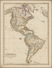
Rare separately published map of America, published by Louis Delarochette.
Published shortly after the end of the Seven Years War (French & Indian War), the map retains the claims of the French in America (in bright Yellow), but includes a red line which approximates the subsequent Treaty of Paris in 1763. Notably, the map pre-dates the numerous text clauses added in the second state of the map.
An interesting explanation is given for why California was thought to be an island:
the Californian Isthmus being covered in the Spring Tides made Imagine at first that California was an Island.
Addressing the question of the Northwest Passage, the map notes at the top:
all the Bays & Inlets on the West side of Hudson's Bay have been visited without appearence of Success in the several attempts made for the Discovery of a North West passage.
The discoveries of Juan de Fuca (1592), Martin d'Aguilar (1603), Francis Drake (1542 and 1578) are shown.
In the area of the Upper Mississippi and Upper Missouri Rivers, a number of the great river legends and myths are delineated.
An interesting feature of the map is the illustration and identification of the "Line of Demarcation between the Spaniards & the Portuguese fixed By the Pope Alexander VI in the Year 1500.
Rarity
The map is very rare. We are aware of a single example at auction and only one example in AMPR (PJ Radford, 1984).
![[Unusual Italian Immigrant Communities shown!] America Settentrionale, Centrale e Meridionale -- Carta Dimostrativa Delle Ambasciate, Legazioni, Consolati (Con Le Risettive Circoscrizioni Territoriali), Camere Di Commercio, Agenzie Commerciali, Stazion Enotecniche, Uffici Postali, Ospedali, Scuole Governative e Sussidiate All'Estero](https://storage.googleapis.com/raremaps/img/small/86098.jpg)
![America [Manuscript Map Showing the Sea of the West!]](https://storage.googleapis.com/raremaps/img/small/41297dm.jpg)