


|
||

|

|
|

|
This exquisite steel engraving of the United States Capitol, rendered with precision by C.E. Loven, offers an evocative glimpse into the past. The image is based on a photograph of architectural drawings by Thomas Ustick Walter, the fourth Architect of the Capitol, who played a significant role in shaping the Capitol’s iconic dome. This image was produced by A.J. Johnson in 1866.
In the forefront, numerous figures in Victorian attire animate the scene. These individuals, seemingly engaged in various activities, lend an air of everyday life to the grandeur of the architectural backdrop. The hustle and bustle around the Capitol paint a vivid picture of the era's societal norms and fashion, highlighting the intersection of public life and political power.
The imposing structure of the Capitol itself is beautifully portrayed, with intricate details that speak to the grandeur and architectural prowess of the period. The iconic dome, a signature element of the Capitol’s design, is prominently depicted, showcasing the neoclassical style that was popular during the 19th century. The architectural elements reflect not only the physical characteristics of the building but also symbolize the democratic principles upon which the nation was founded.
Hovering above the stately Capitol are dramatic clouds, which add a striking atmospheric quality to the scene. They infuse the engraving with an emotional resonance, perhaps serving as a visual metaphor for the tumult and change inherent in the political process housed within the Capitol's grand chambers.
Overall, this steel engraving serves as more than just a depiction of the United States Capitol; it is a rich visual narrative that intertwines architecture, fashion, politics, and weather to create a comprehensive tableau of American life in the Victorian era. The artist’s attention to detail, and the blend of different elements, create an intriguing snapshot of a particular moment in the nation's history.
Alvin Jewett Johnson (1827 - 1884) was an American map publisher. Born in Wallingford, Vermont, he received only a basic public education, but he still served as a school teacher for several years before moving to Richmond, Virginia and, in 1857, New York City. Johnson also worked as a book canvasser for the map publisher J.H. Colton.
Johnson's name first appears on maps published with Samuel N. Gaston and D. Griffing Johnson (no clear relation) in the mid-1850s, and his name (along with Ross Browning) appeared on Colton's atlas maps of 1859 and 1860. Although map historian Water Ristow speculates that Colton sold his copyrights to Johnson and his business partner, fellow Vermonter Browning, a more likely theory is that Johnson and Browning financially bailed out the Colton firm in exchange for the right to use Colton’s existing copyrighted map plates. The first Johnson maps were mostly reissues of earlier Colton maps. Indeed, Johnson's earliest works described his firm as the “Successors to J. H. Colton and Company”. Johnson converted the original Colton steel plate engravings to lithographic stones, allowing his firm to produce more maps at a lower price point.
In 1860, the Johnson firm published its first significant work, the Johnson’s New Illustrated (Steel Plate) Family Atlas. The first edition of the Atlas bears imprints in both New York and Richmond, VA. In 1861, however, following the outbreak of the American Civil War, the Johnson & Browning firm abandoned their Richmond location. Browning seems to have remained in Virginia to pursue other ventures and, in 1861, Browning’s portion of the firm was purchased by Benjamin P. Ward. The 1863 issue of the Atlas was one of the most unusual, it being a compilation of older Johnson and Browning maps, updated 1862 Johnson and Ward maps, and newer 1863 maps with a revised border design.
The 1864 issue of the Atlas is the first true Johnson and Ward atlas. Johnson published one more edition in partnership with Ward in 1865, after which Johnson becomes the sole publisher. The next issue of the Atlas, 1866, is the first purely Johnson atlas with all new map plates, updated imprints, and copyrights. Johnson maps include a unique border style, which changed over the years, but was not copied by other makers. These include a “strapwork border” from 1860 to 1863, a “fretwork border” from 1863 to 1869 and a “spirograph border” in 1870.
In addition to the Family Atlas, Johnson issued numerous wall maps, pocket maps, and, in the 1880s, the Cyclopedia. Johnson frequently updated his western atlas maps and on occasion, more than one update appeared in a single year. Johnson continued to publish the Family Atlas until 1887. In 1879, Johnson brought his son into the business, and their publications have the imprint “A.J. Johnson and Son” and, later, “A.J. Johnson and Co.” Johnson’s son continued the business until it shuttered in 1887.
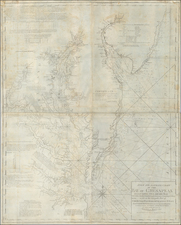

![[Revolutionary War Plans of New York, Boston, Charleston, Delaware River to Philadelphia & Havana] Various Plans and Draughts of Cities, Towns, Harbours &c . . .](https://storage.googleapis.com/raremaps/img/small/83450.jpg)

![Carte Particuliere de Virginie, Maryland, Pennsilvanie, La Nouvelle Jarsey. Orient et Occidentale [Heighten in Gold!]](https://storage.googleapis.com/raremaps/img/small/61392mp2.jpg)