|
||

|

|
|

|
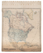
Rare example of the first edition of Brue's map of map of North America, described at length by Wheat in his seminal book on the Mapping of the Transmississippi West (Wheat 335).
The map is a marvelous post-Lewis & Clark production, combining excellent detail from the expedition in the Northwest with information from Pike, Humboldt, and others. The "Phillipe ou Rio del Colorado" flows from Monterey to both Lake Teguayo and Timpanago and then onward even further toward the Rocky Mountains.
The map includes remarkable Indian details. The missions of Upper California are named. The Rocky Mountains are shown as a single Cordillera, as described by Humboldt. Excellent detail in western Canada and Russian America.
Texas is named, but pre-dating the arrival of Moses Austin and with only a few early Spanish settlements shown.
The map would be revised and updated for at least the next 12 years.
Rarity
The first edition of this map (1821--unknown to Wheat) is rare on the market, with no example being offered in a dealer catalog in over 20 years.
Andre Hubert Brué was a French geographer and cartographer. Born in Paris, he served in the French Navy, joining the Baudin expedition to the Pacific (1800-1804). After his sea service, Brué applied his navigation and charting skills to creating finely-crafted maps, which were renowned for their crisp engraving and accuracy. He drew directly on the copper of the plate, creating what he called encyprotypes. He is best known for the Atlas universal de géographie physique, politique, ancienne et moderne.
![[French America and the Triangular Trade] L'Amérique Françoise Où son Décrites La France Nouvelle, La France Insulaire, La France Equinoctiale, et autre pais Par P. Du Val d'Abbeville Geographe du Roy . . .](https://storage.googleapis.com/raremaps/img/small/91968.jpg)
![Tabula Terre Nove [The Admiral's Map]](https://storage.googleapis.com/raremaps/img/small/81714.jpg)
![[Fruit Crate Label Advertising Map] Panama Brand (North America & Panama Canal)](https://storage.googleapis.com/raremaps/img/small/48860.jpg)