|
||

|

|
|

|
Promoting West Portland Park
Colorful chromolithographic promotional tract map, promoting West Portland Park, surveyed by C.W. Brown and offered by Shorey & Hall of Portland, Oregon.
The map is topped by a decorative vignette showing a view of the Willamette River and Mount Hood, with a train in the foreground, along with a lake and boat.
Thomas Alexander Wood formed the Portland City Real Estate Association to buy and develop land for sub-dividing. He purchased 538 acres in the southwest area that he named West Portland. He also purchased another 480 acres that would become the first addition to West Portland Park. As an incentive to get people to buy his lots, he stated that when he sold 600 lots he would bring a railroad out to West Portland to give his buyers easy access to Portland.
Wood and partners laid out West Portland Park, and on April 4, 1889, filed articles of Incorporation for the railroad, the City and West Portland Park Motor Company, to connect the development with Portland. The plan was to clear the land of trees, selling the wood in Portland, and selling the cleared lots for residential development.
The Oregonian’s Handbook of the Pacific Northwest, published in 1894, describes the railroad. as follows:
The City & West Portland Park Motor Company was incorporated in April, 1889, with a capital of $100,000. This company operates a motor line seven miles in length, running from Hamilton street, in South Portland, through the attractive additions of Bertha, Hillsdale and South Portland Park, to the beautiful tract of land known as West Portland Park. This lies on the uplands back of Oswego. This line is equipped with two steam-motors, two coaches and 11 freight cars. The total cost of construction and equipping this road was $150,000.'"
An advertisement placed in the Omaha Bee (spreading a wide net) of 1890 by Shorey & Hall, the sales agents, lured buyers by stating: "You can double your money in six months by buying one of those choice lots in West Portland Park." The Multnomah Historical Association notes that "The railway operated sporadically, and shut down completely by 1900."
The plat depicted on the promotional broadside poster runs from First Street at the west to Eleventh Street in the east, and from Montsylvania Avenue in the south to Dickinson Avenue in the north, all names that are no longer on the grid. Arnold Street, Buddington Street and Dickinson Street still exist. The park shown is now in the area of Loli Wildwood Natural Area.
Noted on the map is the surveyor, C. W. Brown, C.E. and the scale of 185 Feet to an Inch."
Rarity
OCLC locates 2 copies: Yale and Oregon Historical Society.
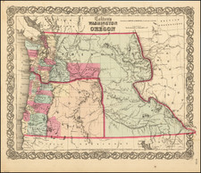
![(Nothern Half) [Bancroft's Map of the Pacific States]](https://storage.googleapis.com/raremaps/img/small/54924.jpg)