|
||

|

|
|

|
A detailed 1788, Madrid-published chart of the southern part of South America, with a particular focus on the Straits of Magellan, based on the findings of the de Córdoba expedition from 1785 to 1789, including inset plans of various bays and ports.
The map was published in Madrid as part of José de Vargas Ponce's work, Relación del último viaje al Estrecho de Magallanes, which documented the de Córdoba expedition's exploration of the region. The expedition aimed to gather new navigational knowledge of the Straits of Magellan, a strategically important passage between the Atlantic and Pacific Oceans, when European powers sought to expand their global reach and control.
This is a meticulously detailed chart featuring soundings and geographical information vital for navigators of the time. The inset plans showcase "Plano del Puerto de Año-Nuevo," "Plano de la Bahia de la Soledad," and "Plano de la Bahia de Buen-Suceso," highlighting key locations in the region. The engraving was skillfully executed by Fernando Selma, a notable Spanish cartographer and engraver.
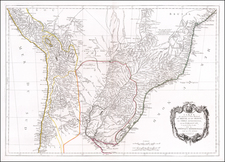
![[ Argentina & Uruguay ] La Plata](https://storage.googleapis.com/raremaps/img/small/97143.jpg)

![[Eastern End of the Strait of Magellan - Previously Unknown French Reconnaissance Chart]](https://storage.googleapis.com/raremaps/img/small/93919.jpg)