|
||

|

|
|

|
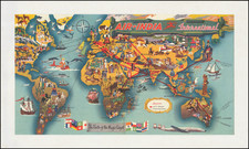
The 1958 map titled "Bombay – The Gateway of India" is a fascinating promotional work for orienting western visitors in the bustling city of Bombay, now known as Mumbai. This map, a product of the Directorate of Advertising and Visual Publicity under the Ministry of Information and Broadcasting, was designed to cater to the needs of tourists and western expatriates alike.
The choice of English for the map's language indicates its intended audience. While English was the language of India's colonisers, it was, and remains, one of India's official languages, understood by a broad swathe of its populace and, crucially, by western visitors.
The map's legend is comprehensive, including symbols for hotels, travel agencies, and money exchangers, emphasizing its focus on tourist-friendly facilities. This level of detail suggests that the map was intended to help visitors navigate the city independently, making it as convenient as possible for tourists to find their way around.
However, the inclusion of the "Government of India, Tax Office", and several shipping and air companies suggests the map was not only designed for tourists. It was also a practical tool for western expatriates and business visitors, indicating places of commercial and official interest.
The map offers insights into the way the Indian Government of the time wanted to portray Bombay to a western audience. The careful selection of what to highlight reflects the city's colonial legacy, its business opportunities, and a semblance of orderliness amidst the bustling cityscape. The map, in essence, encapsulates Bombay's identity as it was in the late 1950s: a city straddling two worlds, a city with a rich colonial past and a promising future, a city positioning itself as the "Gateway of India".