


|
||

|

|
|

|
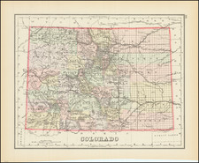
Rare Colorado Improvements Map
Rare map of Colorado, overprinted to show the location of expenditures made by the State of Colorado from its Internal Improvement funds between 1886 and 1908.
The map shows the type of improvements (Res. = Reservoir, BR = Bridge, RD = Road, Art W. = Artesian Well, etc.), the date and location of the improvements, etc. A table at the bottom right shows the various State Engineers from 1881 to 1909 and a key locating Reservoirs, Wagon Roads, Flumes, Artesian Wells, Canals, Bridges, etc.
The map is overprinted on a black and white image of a General Land Office map.
Rarity
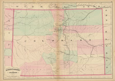
The map appeared in the Fourteenth biennial report of the State Engineer to the Governor of Colorado for the years 1907 and 1908. Part 2. Maps and bridge drawings : [Colorado water districts and divisions].
OCLC locates 2 copies of the report with maps (University of Colorado, Boulder and Colorado Mesa University).
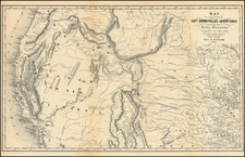

![[Montana, Wyoming, Colorado, Dakotas, etc] Reconnaissances in the Dacota Country By G.K. Warren](https://storage.googleapis.com/raremaps/img/small/82655.jpg)