


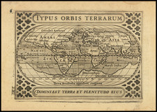
|
||

|

|
|

|
Rare map constructed on a Polar Azimuthal Equidistant Projection. The map shows distances from London to 27 major cities, noting that:
on this projection a straight line from London to any part of the world is a great circle track and can be measured by means of the scales. The bearing to any place, measured at London is the initial great circle bearing. Bearings and distances between places other than London cannot be measured.
The Air Age Map of the World — Centered on London, was published in 1947 by the British Overseas Airways Corporation (BOAC). The map encapsulates a pivotal moment in global travel and cartographic design, offering a London-centric perspective during the dawn of the air travel era.
Produced shortly after World War II, the map reflects a significant shift in perception and the necessity of aviation-focused cartography, as traditional maps based on the Mercator projection no longer met the demands of the increasingly connected world by air. The map is distinguished by its azimuthal equidistant projection, which allowed aviators and planners alike to envisage the shortest air routes from London to any point on the globe, an invaluable tool during a period where Britain sought to maintain and extend its global reach and influence.
Aesthetically, the map is as much a visual treat as it is a practical instrument. It is illuminated by a palette of muted pastels, each continent a distinct hue, with vivid routes emanating from London, radiating outwards like spokes on a wheel, punctuating the strategic importance of Britain in this new age. The cartographic detailing and annotations provide insights into the routes of the time, which are both a testament to the aviation technology of the era and a foreteller of the international routes that have since become commonplace.
Accompanying the map is an insightful commentary, explaining the limitations of the Mercator projection for air navigation and the advantages of the azimuthal equidistant projection in plotting "great circle" air routes. These textual elucidations are invaluable in understanding the technical evolution and the rationale behind the design choices that governed the creation of this map.
Rarity
The map is quite rare on the market.
We note examples at the University of Wisconsin-Milwaukee (AGS Collection) and National Maritime Museum (Greenwich). OCLC also locates and example in the Northwestern University Library.
![[Pictorial World Map Gameboard]](https://storage.googleapis.com/raremaps/img/small/88775.jpg)
![[ Janet Taylor -- Pioneer English Astronomer and Naval Navigation Expert ] Chart to Accompany R. Russel's Diagram of Great Circles / R. Russel's Diagram of Great Circles](https://storage.googleapis.com/raremaps/img/small/98801.jpg)