This item has been sold, but you can enter your email address to be notified if another example becomes available.


|
||

|

|
|

|
Stock# 84361
Description
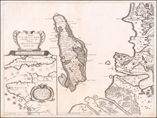
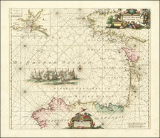
Nice oiriginal antique map of the region in southern France near Perpignan, published by Valk and Schenk in Amsterdam in the 17th century.
The map shows the portion of the French riviera bounded by the Gulf of Lyon, the Languedoc Region, and the present-day Spanish border. Detail is beautiful and extensive - many towns, cities, rivers, and other features are shown. This heavily mountaineous Pyreneean country is represented by pictorial hills that grow in size to the south and west of the map.
This map shows the region known today as the "Pays Catalan" in French, the northward extension of Sanish Catalonia. Detail extends slightly into Spanish Catalonia, with the Bay of Roses shown in the far southeast of the map.
Condition Description
Nice wide margins. Minor ink stain in far-right margins.
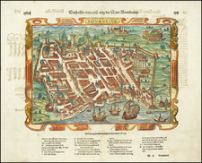
![[ Salses-le-Château, France ] Salces en Roussillon.](https://storage.googleapis.com/raremaps/img/small/37766.jpg)